In 2020 I had a long-awaited leave of absence to hike the Arizona Trail. I made it 200 miles and no more before the coronavirus pushed me off. Here is the story of the first quarter of the AzT, roughly 200 miles, in the weeks just before everything changed.
Feb. 26, 2020
The joy of forecasting…

I wouldn’t say I have been obsessively checking the weather forecast for Miller Peak, but I am sure Elliott would say I have been obsessively checking the weather forecast for Miller Peak.
If this forecast holds out, I will consider myself extremely lucky. In past days the forecast has included as many as 8 inches of snow and winds up to 60 miles per hour. While I will not be camping at this elevation, I won’t be significantly lower my first night on the trail. Long-term, I have no major concerns. It’s just that first day.
Worst case scenario, I hole up in my cheap motel room and lose some money on a shuttle. It’s not the end of the world.
March 1, 2020
The day before
There’s always something especially hellish about the day before start dates.
It could just be that the day started far too early at 5:30, when my wonderful mother drove me to the shuttle. (Thanks Ma.) Despite an unethically long line to check my bag, the airport was a mostly uneventful experience, as was my flight to Tucson. I even got to watch Frozen 2 (hashtag don’t judge).
I was relieved to have the shuttle guy waiting for me at the airport, even though this was a more expensive luxury than I had anticipated. When I booked in November, I just figured that with so many hikers starting around this time, I would find someone to share the shuttle with and then split the cost. That didn’t happen, but I was grateful to not have to deal with figuring out a bus network or putting strain on a trail angel.
The last couple weeks have put a strain on me in pretty much every category of my life so I’m looking forward to getting on the trail and sleeping well.
The forecast looks a lot better than it had looked. I should be able to get up and over Miller Peak before the snow starts. My second day on trail will have snow (2 inches or so) or rain depending on the freezing elevation, but after that it will be lovely.
I’m immensely grateful to be here, and as exhausted as I am grateful.
Day 1: March 2, 2020 – The Up and Over Day

6AM Update:
Well, I am so grateful that I didn’t delay my hike by a day. I won’t claim that today will be pleasant, but I should be able to get up and over Miller before any weather blows in.
I’m hoping to camp tonight around 6000 feet and tomorrow I should be even lower. That’s good and bad; I would rather deal with snow than rain usually, but it doesn’t look like it will get too dramatic and I have enough layers to be safe whatever happens.
10PM Turn of events:
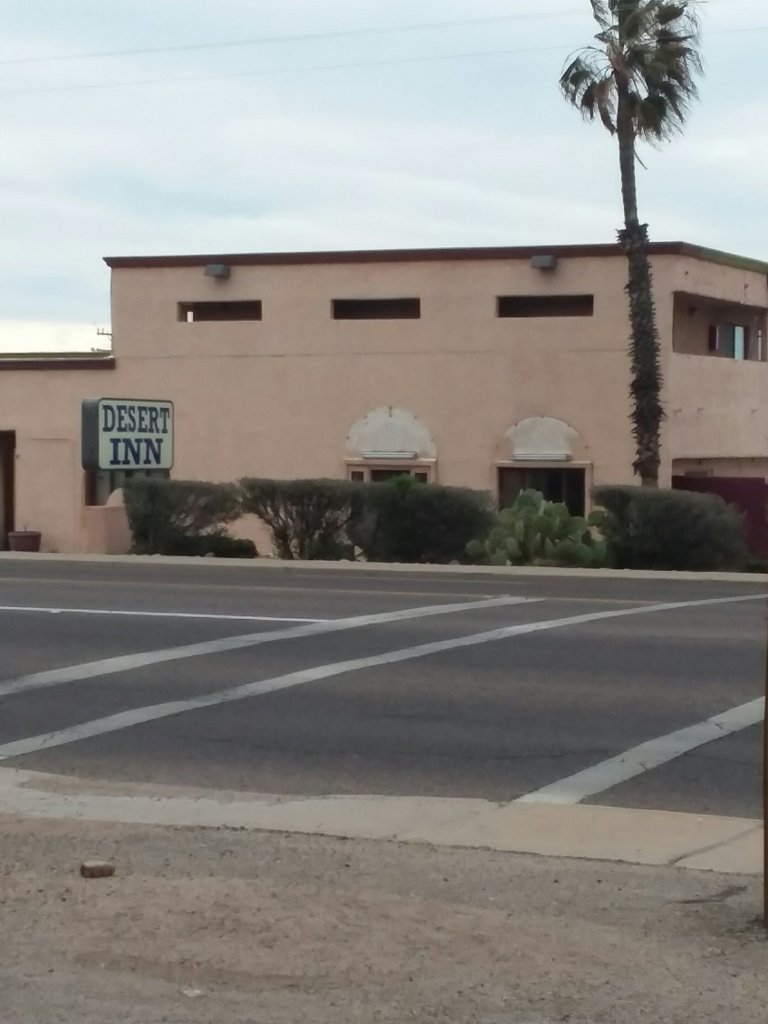
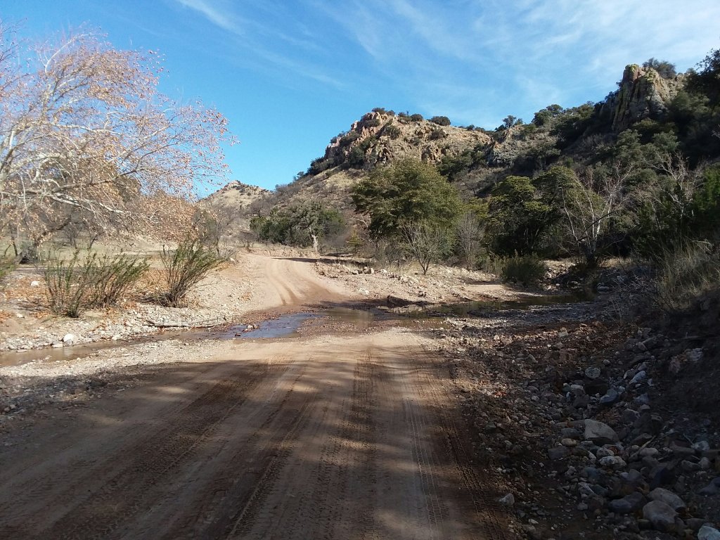
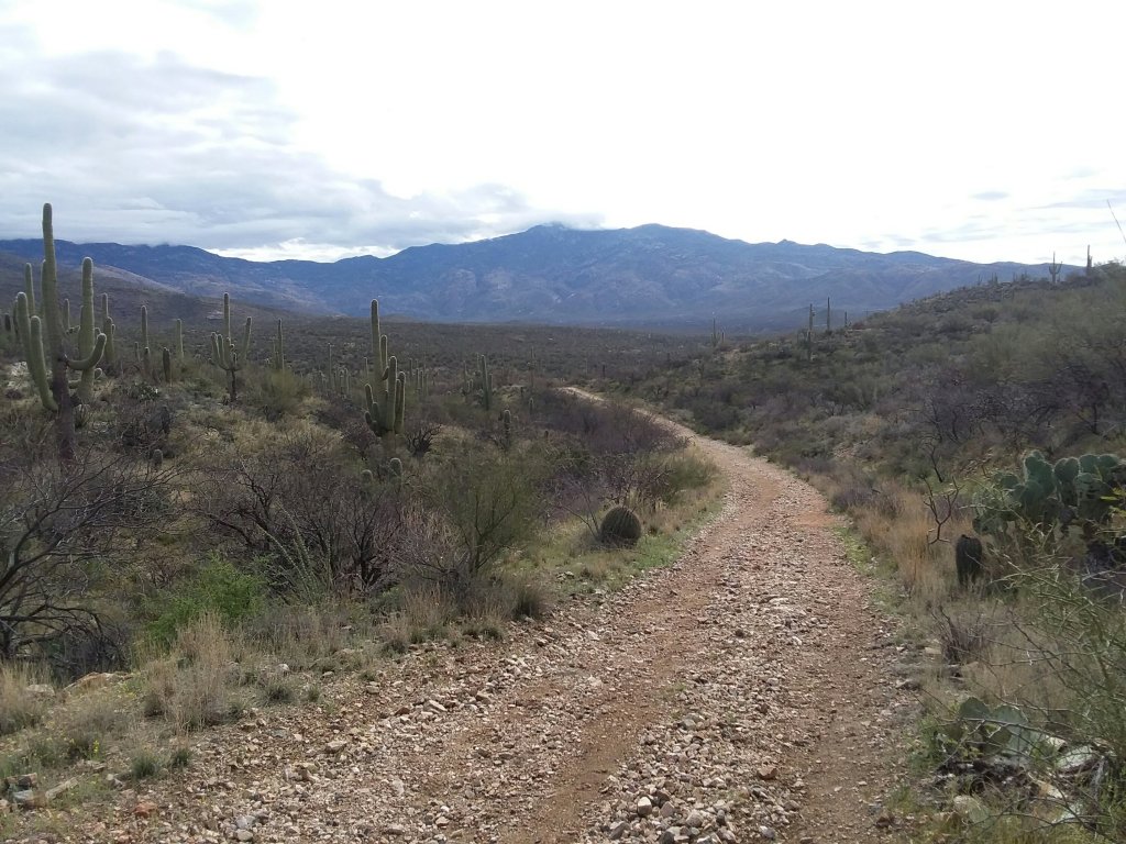
I got a shuttle from Sierra Vista to Coronado National Monument and easily hitched up Montezuma Pass. Because the Arizona Trail begins at the border I hiked south 1.9 miles to Monument 102.
It was really bright, okay, and hard to see.
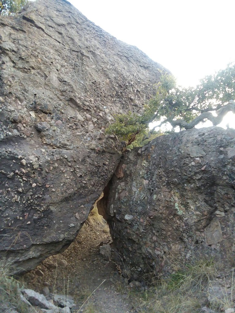
From there began my 3500 foot climb up Miller Peak and into the Miller Peak Wilderness Area. It went about as well as you’d expect for someone from the flatlands who hasn’t been able to move much due to ice.
So long story short I soon realized that I wouldn’t make it as far down Miller Peak as I’d like. At least I made it past the existing icy sheet of death.
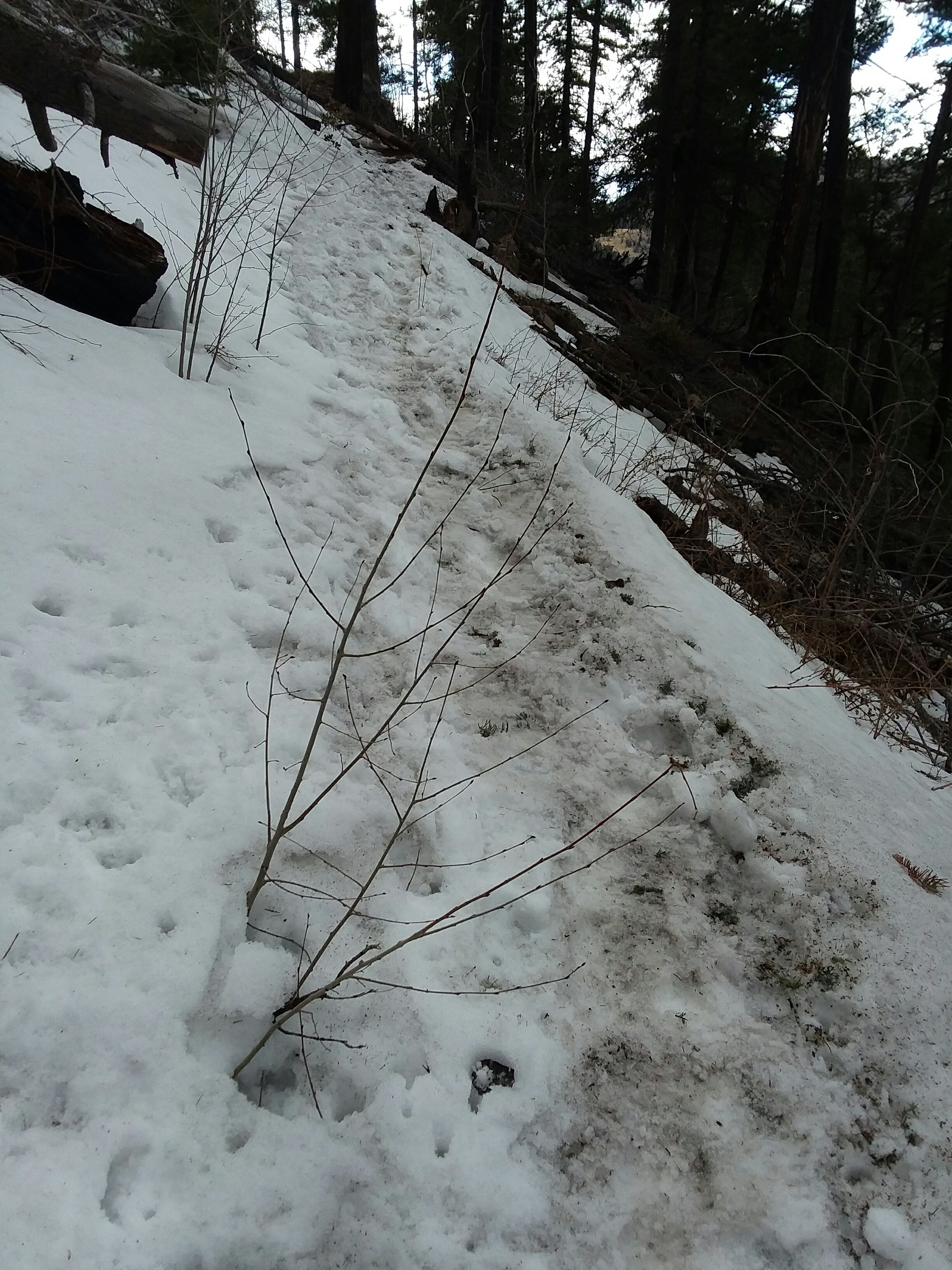
It was on a stretch like this where a rock I stepped on gave way. The saturated soil slid down a fairly steep incline. And so did I.
I would like to point out that it’s been 3 years since I’ve slid uncontrollably down a mountain. If it happens only once every 3 years, I’m good with that. I scuffed up my hand, put a dent in my knee, crawled up, and kept going.
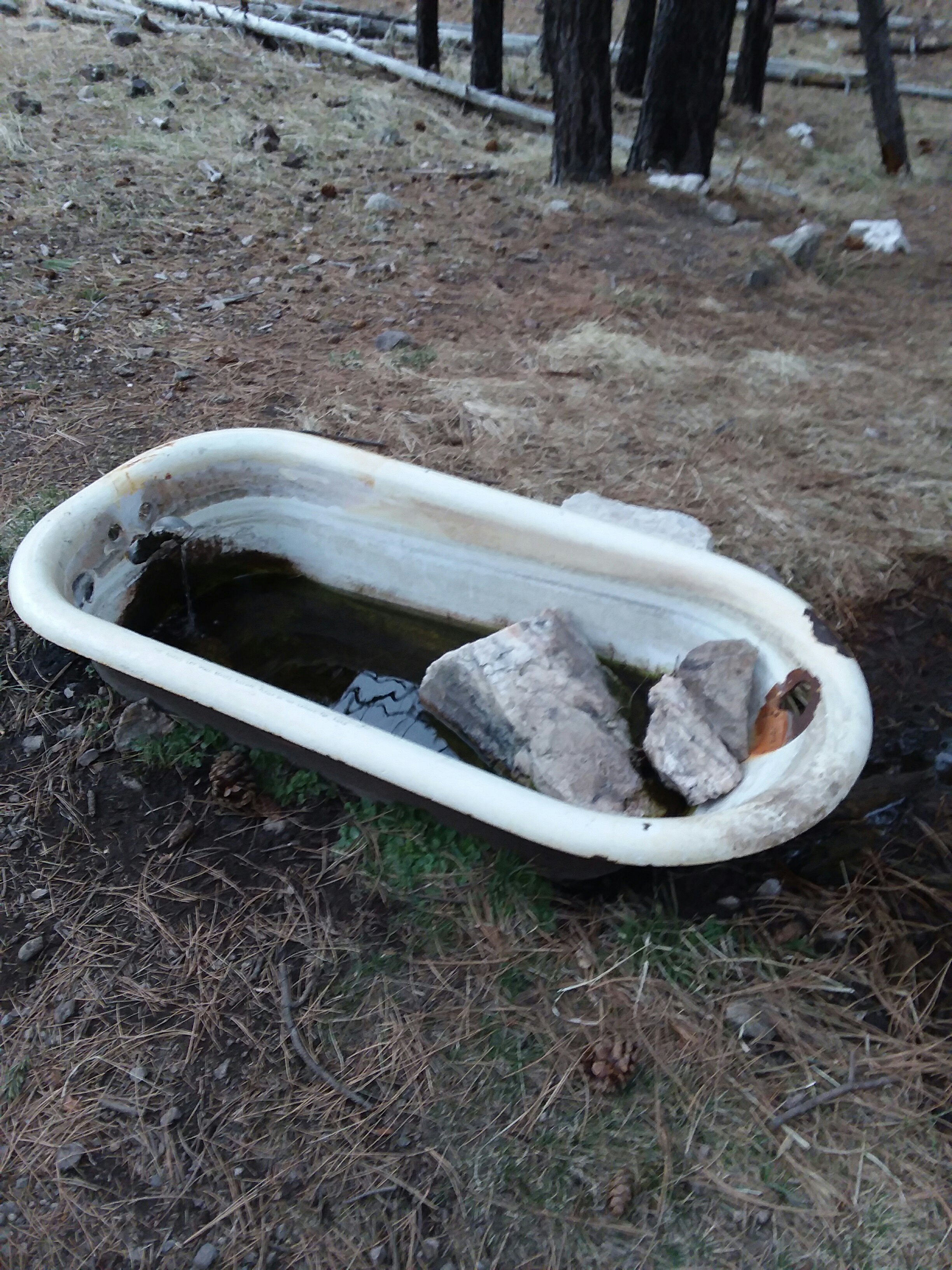
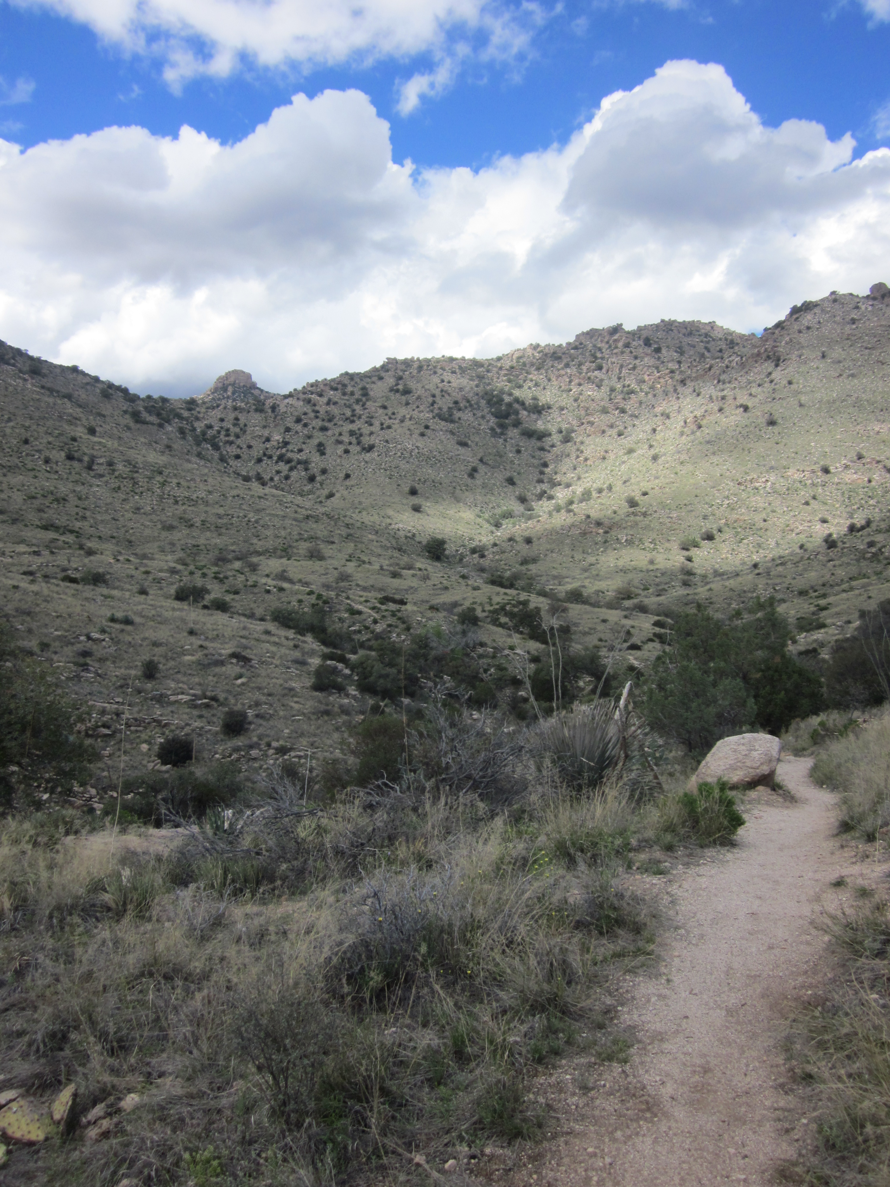
Bathtub Spring is only 8.1 miles from the border but it was a 10 mile day including the hike down to the terminus.
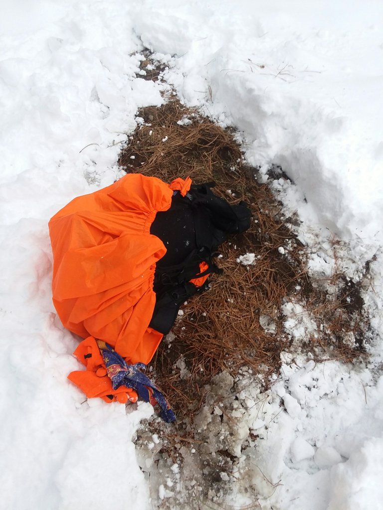
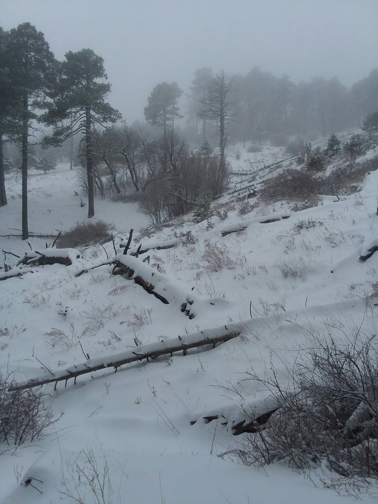
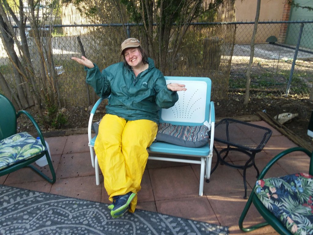
I considered hiking farther that night with Moonie and Ponykeg but I was wiped and it was beginning to snow. By the time my tent was set up, it was dark but coming down white.
For the next 2 hours I tried to sleep but mostly watched in dismay as my tent got more and more buried. At some point in the snow, someone joined me, but I could not see who they were.
Day 2: March 3, 2020 – Just, yikes…
All night I’d wake up, hit my tent walls, and make sure I still had air pockets so I wouldn’t die. Whatever the snow equivalent of raining cats and dogs is, that’s what it was doing. If the Miller Peak Wilderness Area had school, it totally would have been cancelled.
I wanted to zero. I wanted to stay in my tent and do nothing. The last thing I wanted to do was move. But the forecast said more snow. The only way out was through.
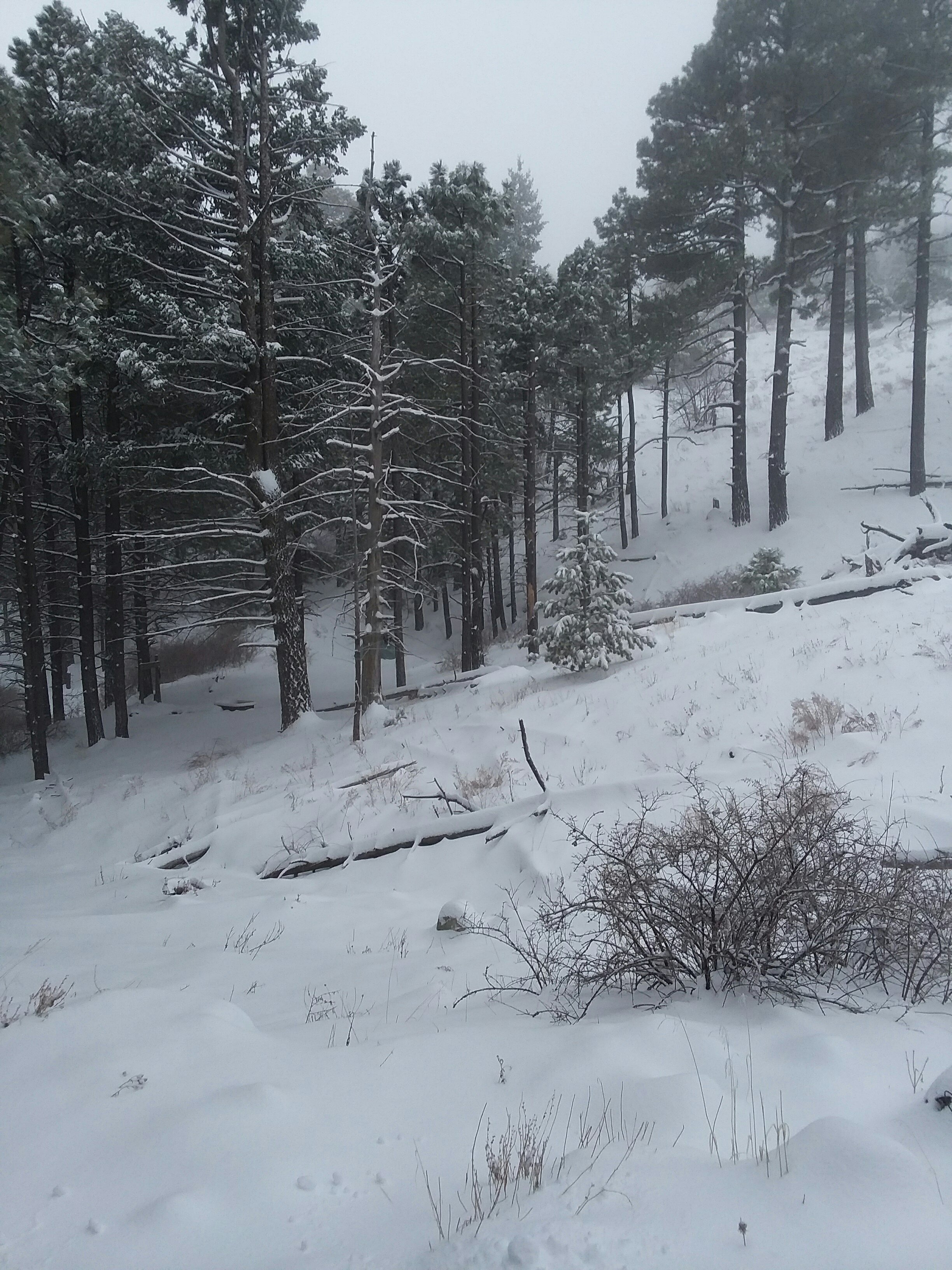
It was still snowing but I bundled up and began breaking trail. Uphill through ankle + deep snow (a few patches of knee deep, but not many). The snow was so thick and heavy that at times I could go only 25 steps before taking a break.
There was a delightful (sarcasm) stretch along a ridge that I butt-scooted across because, NOPE. I had to just not think about where I was sometimes. Big cheers to my dad for his great job patching my FrogTogs, and also to Gayle C from whom I inherited the Yak Trax that made the whole endeavor possible.
It was pretty dramatic. And when I was feeling super low, along came a woman moving quickly who passed me and said “We’ll make it.” It was exactly what I needed.
The psychological benefit of following someone’s footsteps was even greater than the physical benefit. That woman was who I needed, when I needed her. I have no idea who she was.
It’ll be fun, they said.
Finally I crested the last peak and began the slog downhill. As I descended, giant balls of snow fell from the trees. It was as if the trees were having a snowball fight and I was the bad guy. When I reached the canyon at the bottom, a cold rain had started and kept up the rest of the day.
I made it out of passage 1 and into passage 2 and I shivered for 2 hours before I was warm.
Day 3: March 4, 2020 – The pendulum swings
I awoke to a silent world.
No rain. No snow. Sunshine. So although my best hiking hours are before 9am, I let everything dry out first and didn’t get on trail until 8:30.
The day felt long and rollercoastery. I got reception atop a saddle and called home. I needed to cool down: it was so damn hot.
The rest of the day was kind of sloggy. Even without elevation change, miles are hard and hot and rocky and mostly unpleasant. So were my water sources.

I was too focused on getting to passage 3 to take many photos. I was also kind of crabby.
TBH not gonna miss you. xoxo
I set up my tent and realized I hadn’t seen another human since I was passed in the snow by my trail breaking angel. But I did hear them: all night long planes flew back and forth in a grid looking for migrants I guess and I heard a whistled language of those they sought.
Oh also there are blimps along the border. Yeah. Cuz that’s not creepy.
Day 4: March 5, 2020 – The heat, the food, and the rebound
Ever since I started hiking, I’ve barely been able to eat. It was so alarming that I even began writing everything down so I could track just how few calories I was consuming.
In the cold, stopping to eat didn’t feel like an option. In the heat, my body just wants nothing to do with foods. The thought of food makes me nauseous. I can’t even choke down chocolate.
But I’m doing great at staying hydrated. Lots of sources for the first half of today.
Today I decided to push a little and get to Patagonia. It was so hot today I could feel my skin burn and no matter how much water I drank I was always thirsty. The final push to town was flat on the elevation map but was actually a series of many many many oh my god many little climbs and descents. And it was so hot.
You know, I didn’t cry once during the snow madness or the rainy aftermath, but this section made me cry a little. I’m exhausted and only 50 miles in. Meanwhile the world appears to be falling apart, Elliott might cancel his trip to visit me due to travel concerns, and I missed his grandmother’s funeral. It’s a lot.
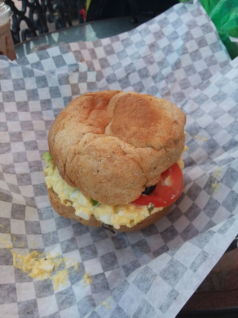
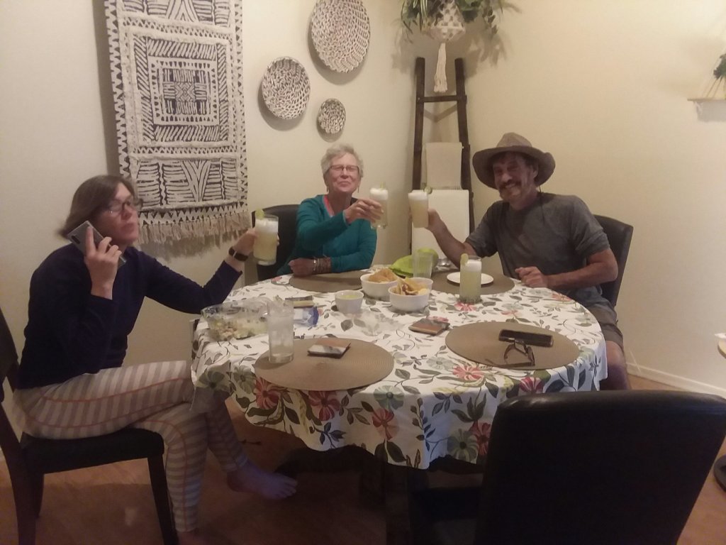
But Patagonia! This town changed my apocalyptic worldview, if only for a night.
This is the best little trail town, thanks to Carrie who is letting me camp in her yard.
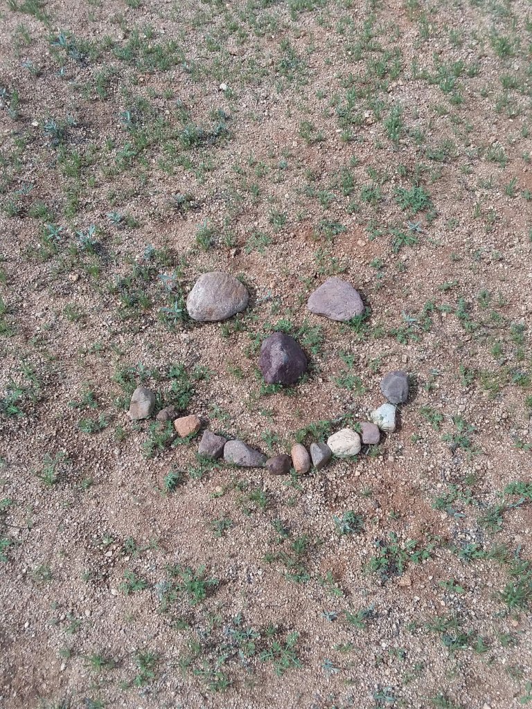
There are 4 hikers here, 3 who began a day after me and had to bail out of Bathtub Spring due to intense weather, and Eeyore with whom I shared this:

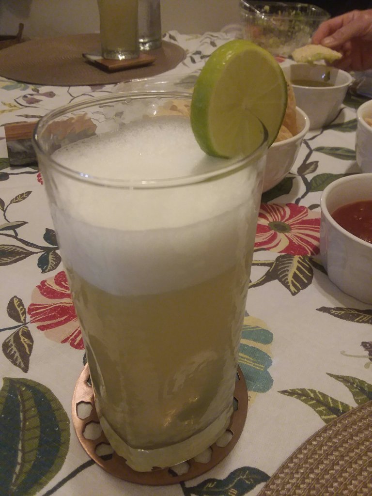
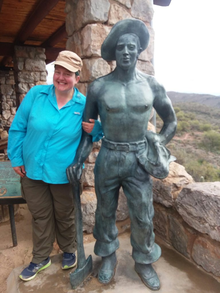
Thanks to Carrie I got to shower and do laundry. Elliott is missing out on all this:
There are goats here and a dog named Etta and 2 cats. It will be hard to not zero tomorrow but more iffy weather is moving in on Sunday so strategically I should get a move on. After I resupply. And eat my pizza.
After getting some calories in, I no longer want to cry. But I’m still very very tired.
Next stop: Colossal Cave.
Day 5: March 6, 2020: The Wright way to spend a day
Carrie in Patagonia gave me a much needed pep talk as I went on my way. I am very very tired and don’t really feel ready to tackle the trail each morning when I wake up. Oh how I would have loved to zero.

The climb up out of Patagonia goes on and on but at least there was lots of water. And in some places, shade.
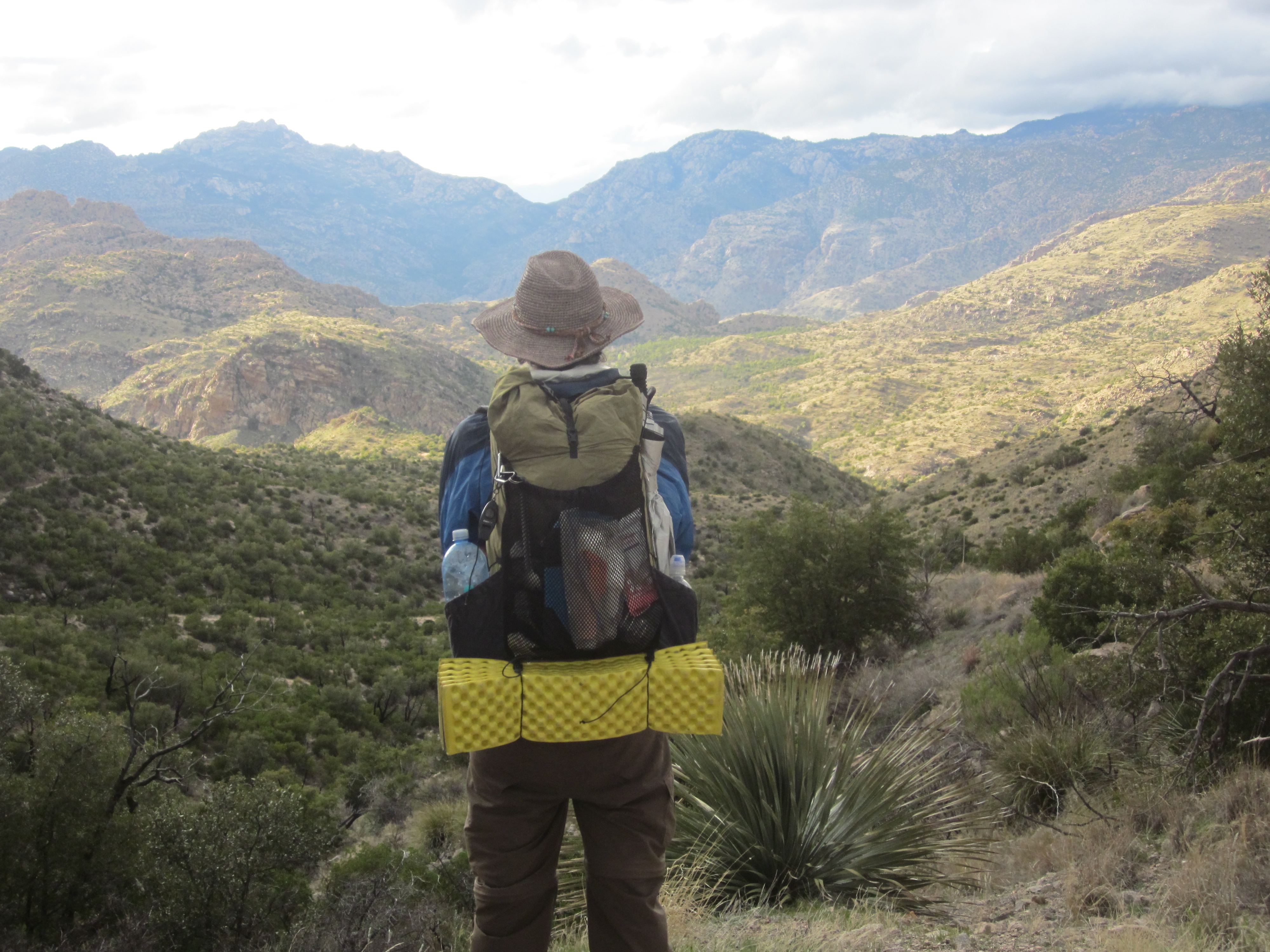
The trail kept getting closer and closer to Mount Wrightson. The trail does not summit the mountain but goes over a saddle right next to it.

And soon I entered the Mount Wrightson Wilderness, the second Wilderness Area of the trip so far.


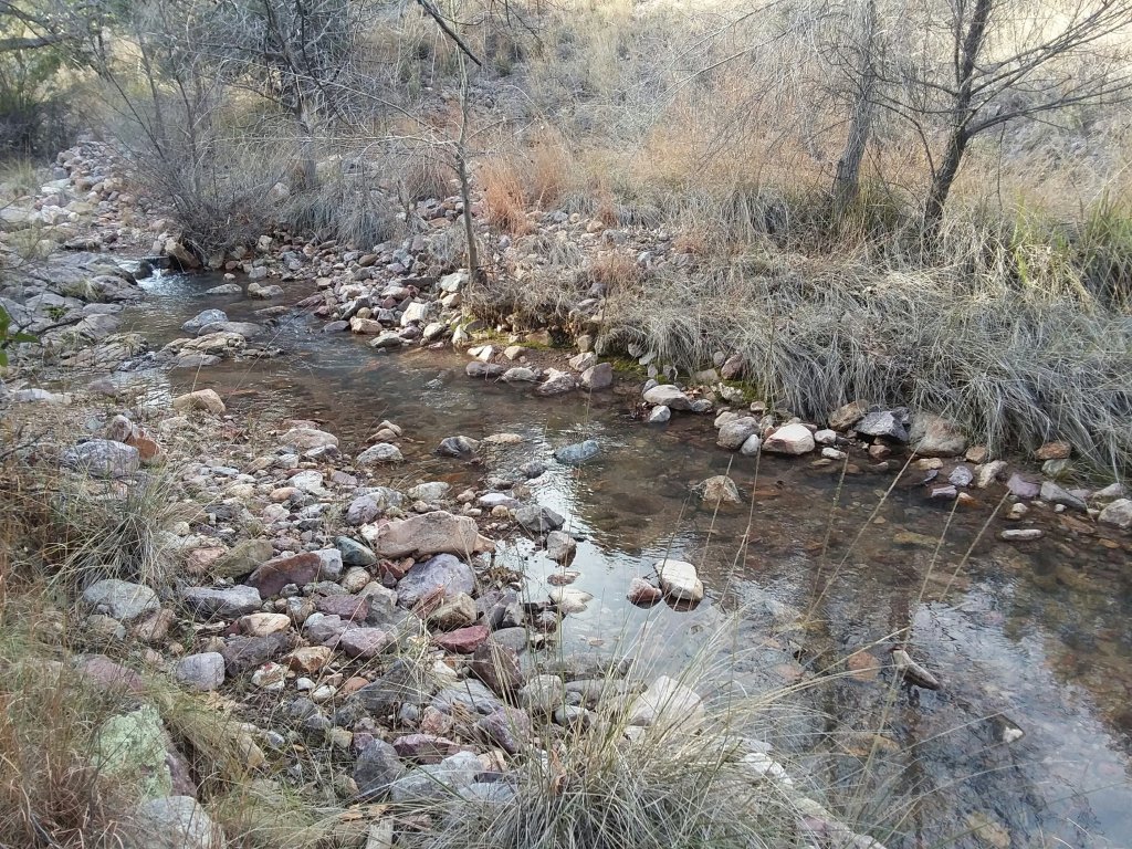
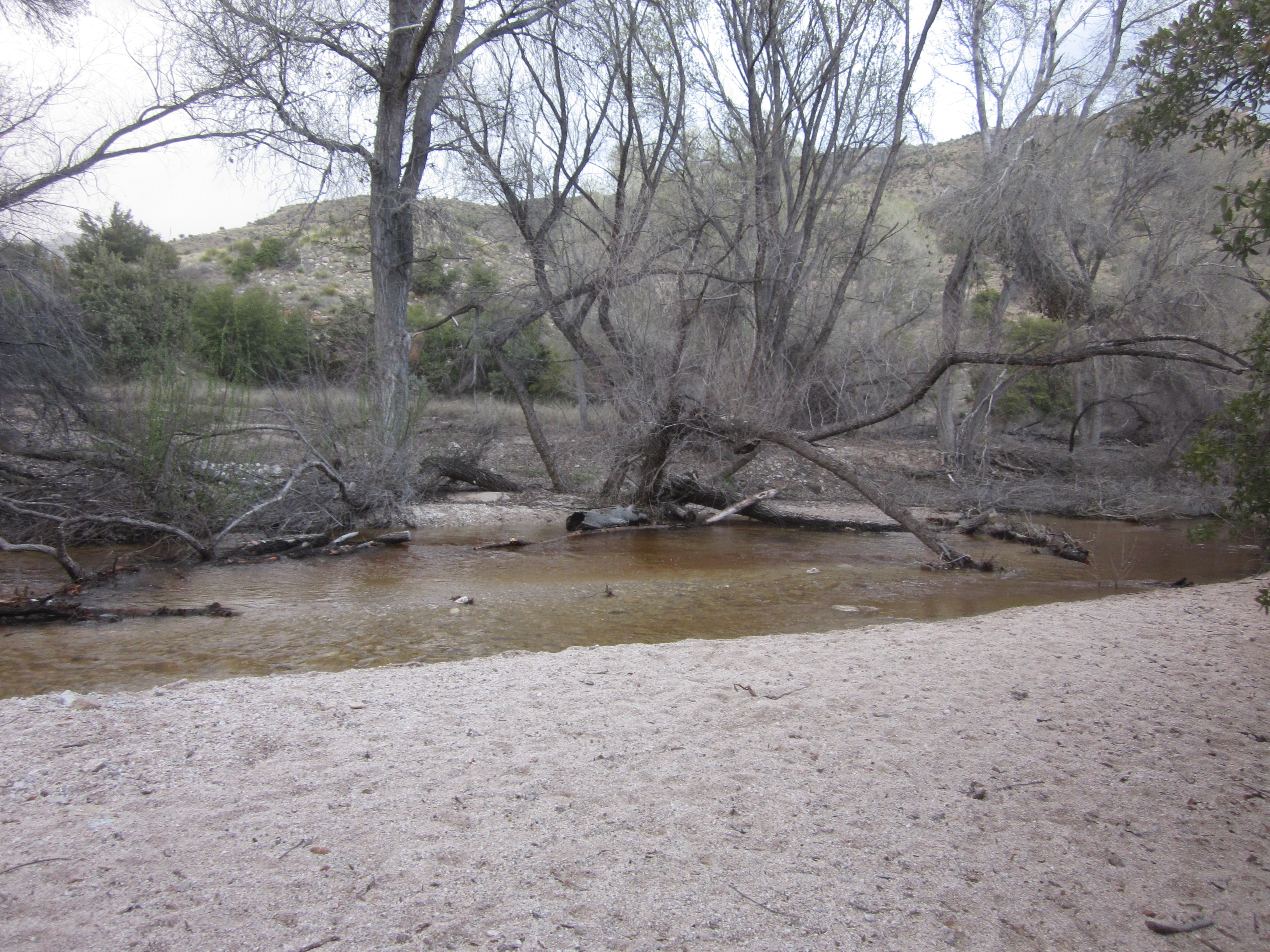
After getting over the saddle, it was a long downhill to get to my campsite. I pulled over at 4:30 which is too early usually, but I needed to take a break. I set up next to a little creek that seemed totally out of place in the desert.
Day 6: March 7, 2020 – Magic and miles
I had no intention of this being a long day. But I woke up to good weather and got several good miles in before the sun crested over the hills. I love morning hiking. I feel most hopeful and alive.
At the three mile mark, I ran into Trail Magic. I didn’t even know I needed pudding for breakfast but I did. I really did. Shout out to Mudhole, Matt, and Grandpa for their kindness.

It was at that moment when I met the first runner. Little did I know that I was about to become part of a major race. The Old Pueblo race was happening and every 1.5 minutes I was jumping to the side of the trail and cheering on another runner.
For the next half a day, runners were a major part of every hour. And because the course is some kind of loop, I was able to see some people multiple times. I’m pretty sure Jason Momoa even offered me water, twice.

I just kept walking.
I got too low on water because one of the water sources looked terrible and I couldn’t do it. So I just kept hiking.
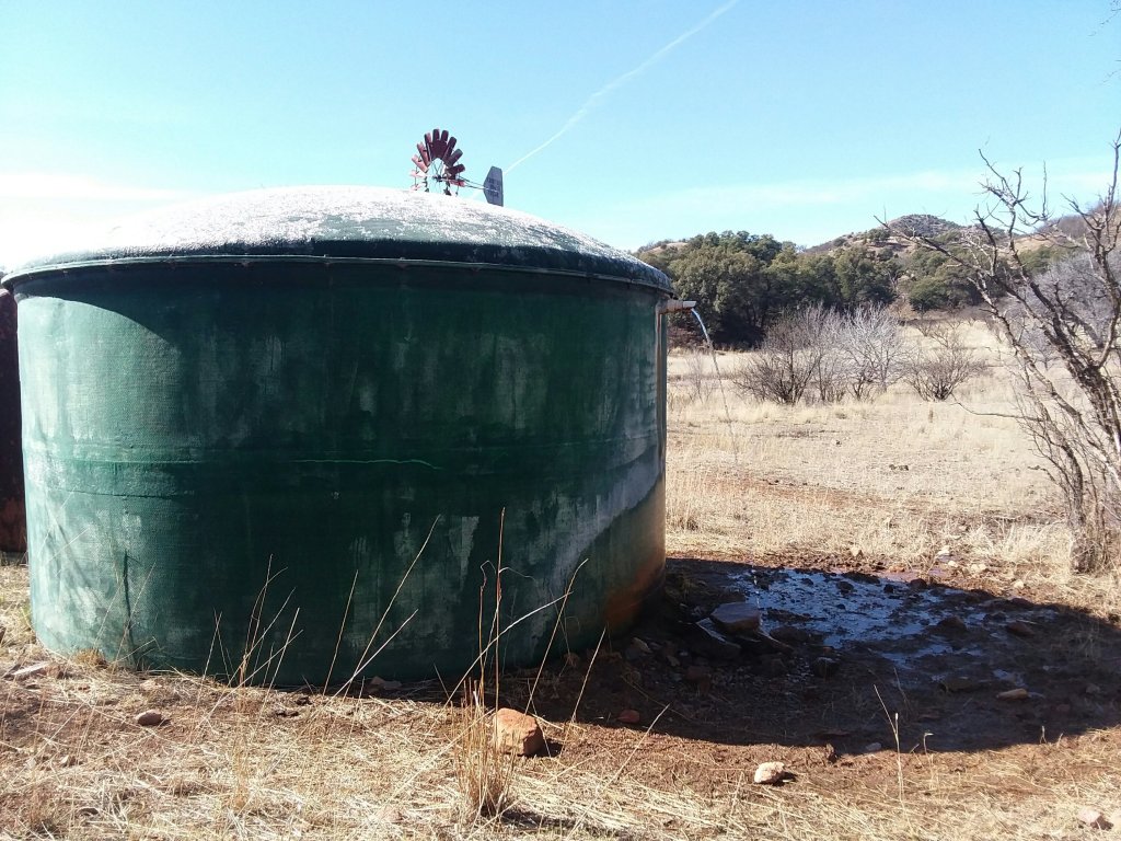
I eventually made it to a stock tank where I caught up with Mr. Clean and Thibaud. They warned me about intense winds coming so I took off a little farther and set up in a protected area.
This was a 20.9 mile day.
Although I was sheltered somewhat, the grass I was camping on was incredibly noisy and so it was hard to sleep. I know that sound ridiculous but I swear the grass was intensely loud.
It was a really lovely day.
Day 7: March 8 – The valley of the shadow of dehydration
My phone said I woke up at 6:30, but it was wrong or I was dreaming…
I poked my head out of my tent and discovered sunrise was still far away. I nighthiked until dawn. Hiking with a headlamp in the morning when you know dawn is coming is just fine.
I had a liter and a half of water from the stock tank the day before. I figured I could find some more along the way.
The first tank was empty. Not even damp.
Then it started to rain. At first it was nearly pleasant, but devolved into a downpour. Clay stuck to my shoes and I began shivering. I couldn’t stop hiking in those temperatures. You stop, you freeze.
Every wash I passed was dry. I found a puddle in one and managed to get a liter but knew I would only drink it in an emergency. It was kind of… green.
I wanted to go 13 or 14 miles. My body was tired after the 20 miler. Plus, 13 miles would get me to the 100 mile mark!
Also near the 100 mile mark: twin tanks, the most disgusting water source I’ve ever seen. They were my last water source of the day and when I saw their brown soup, I wailed a little at the unfairness of it all. To be sopping wet but so thirsty you’re in pain… what is that about?
I met a section hiker who informed me about a water cache 6.7 miles ahead. It seemed an impossible distance. But I had no choice.
It continued to rain and I contributed some tears to the earth too as I trudged along a passage that felt unnecessarily winding and unlovely.
I quite literally limped to the water cache, sat down in front of the big brown box, and opened it up. Unending gallons. Squirt. And fruit roll ups. The sun physically and metaphorically came out.
I camped by a cactus next to the water cache. I’d hiked over 19 miles.
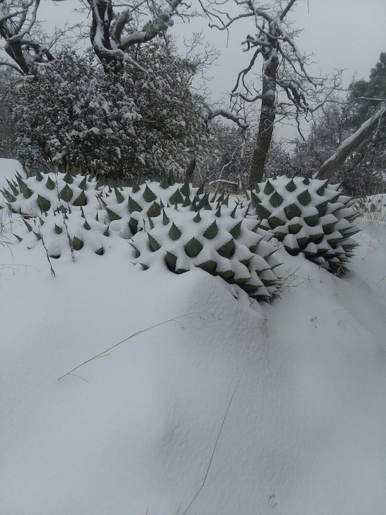
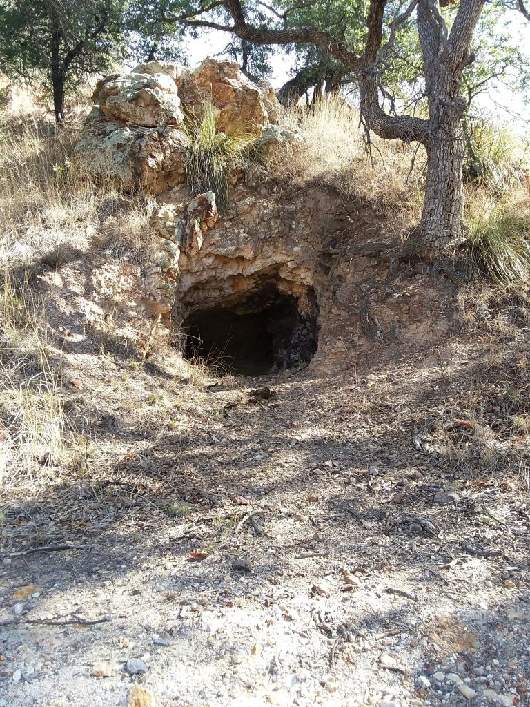
I took no photos that day because my phone was locked up out of the rain but here’s a cool cave from a couple days ago:
Day 8, March 9, 2020 – The cave of wonders
The world is better when you have water. So much better.
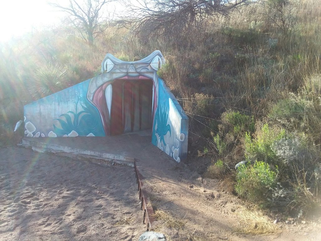
I got an early start headed to Colossal Cave where my package was being held. I carried all the water I needed for the day so I wouldn’t have to stop. Before 9, I’d already made it under I-10 through the snake tunnel. I saw no live snakes, only a dead rat.
My Guthook app quit working in the aftenoon. Luckily I knew where I was and I have the paper databook and map set to fall back on.
The trail was winding and long and it got hot but I was happy to be headed to civilization.
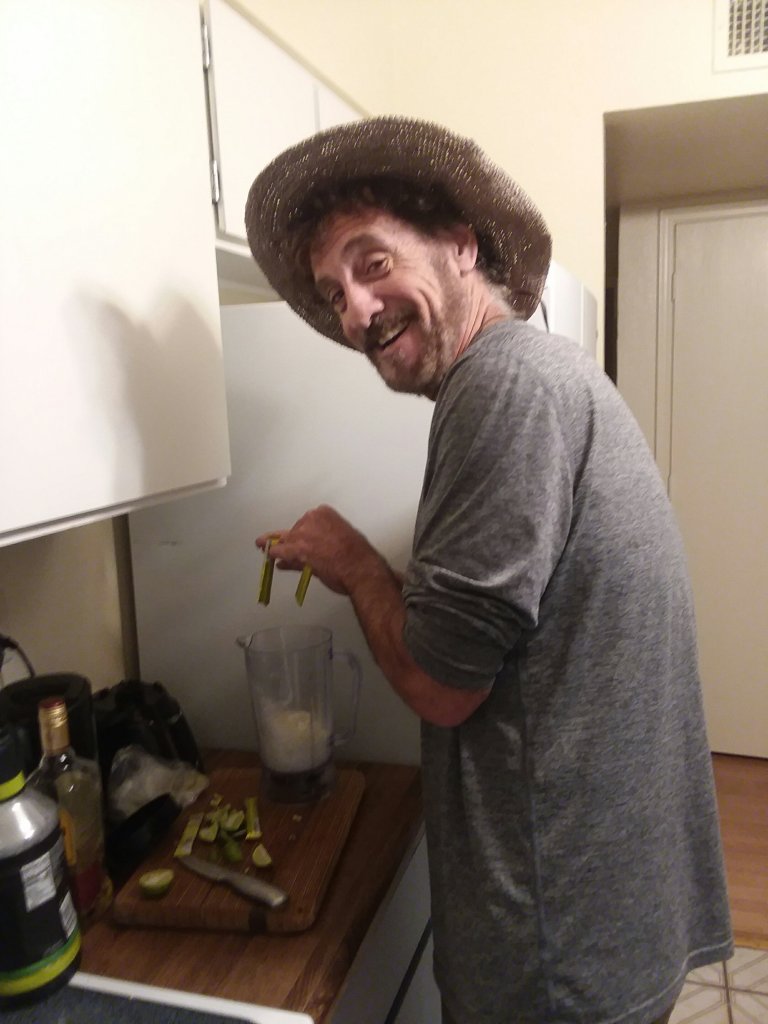
I made it to Colossal Cave a little after noon, got my box, and hung out waiting for Scratch, Bangles, and Tikimon who I met in Patagonia and who were a few miles behind me. You should check out Scratch’s videos here.
From there, the marvelous Barry gave us a ride to Safeway in Vail and we Lyfted to a motel near I-10. I did laundry in my bathtub like a good hiker trash does, and I ate an entire jar of beets. And a bag of salad. And pineapple. And another bag of salad. And some raviolis.
My first night inside since I started the journey! My first bed since Sierra Vista!
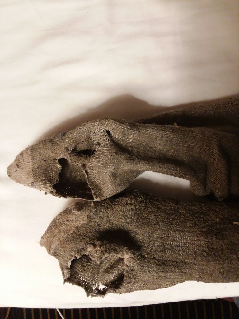
Turns out my leg tan wasn’t a tan. It was dirt. I also lanced my giant toe blister. Too much information?
I have photos. But I won’t share.
Day 9: March 10, 2020 – A zero, a zero, a zero!
There’s bad weather coming.
And honestly, it’s what I am expecting on this trail now. Except the weather coming is going to hit when I would be on one of the highest and most exposed peaks of the Arizona Trail: Mt. Mica in Saguaro National Park.
When I got into Patagonia, I declared that I was done with snow. It’s fine to play in but not when you are backpacking on a long trail with limited supplies and very few ways to get out. It’s going to get very unsafe.
We’ve been going back and forth on what to do. Saguaro National Park is very challenging because there are only two places to camp within the park. You need permits. Plus one of the places is very high so it is likely to be snow covered.
Scratch called a ranger and got inside information and the lower camp doesn’t seem like an option. There are no permits available anyway, but even if there were, it’s not an option. The higher camp isn’t an option either due to the forecast. So, Saguaro National Park isn’t feasible.
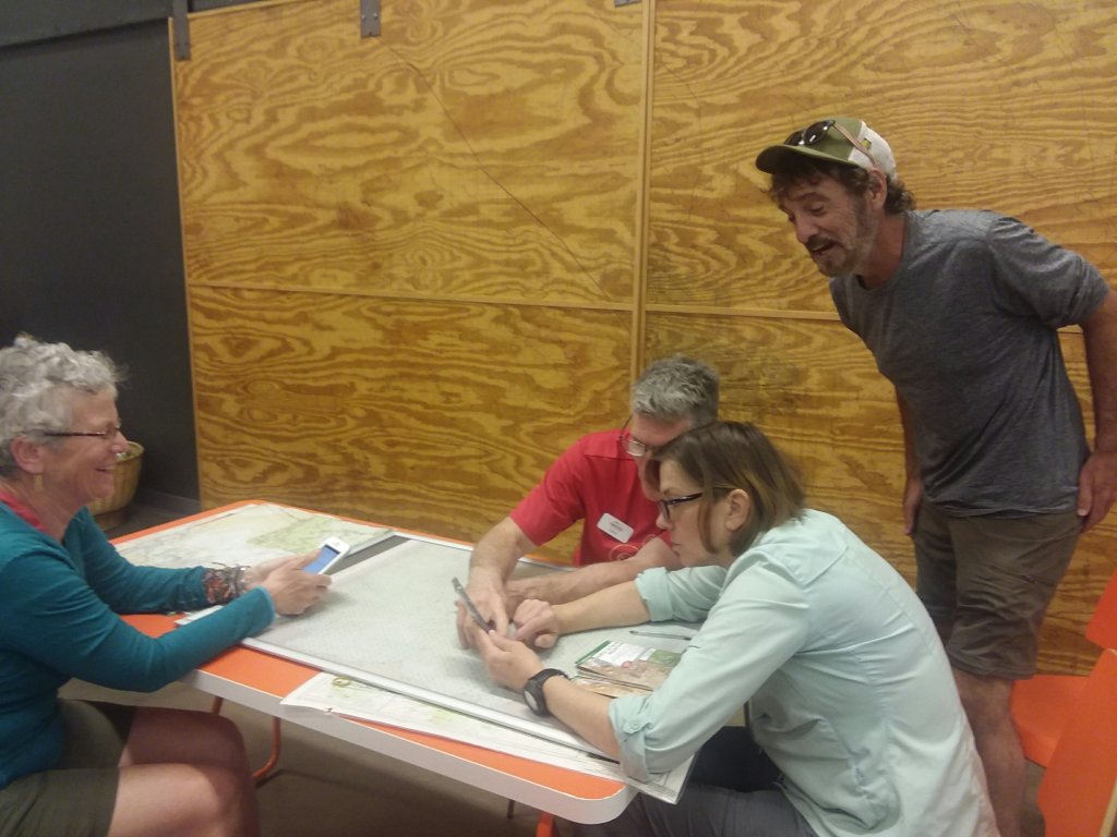
We packed everything up and went to Summit Hut, the best outfitter I have ever been to, ever in my life. Dave spent an hour with us trying to figure out a plan and we finally have some semblance of a plan.
We booked an Airbnb for 4 nights in Tucson. It’s amazing. Tomorrow we will slackpack into the park and come back here. Then we wait out the storm. Thank goodness for Bangles renting a car.
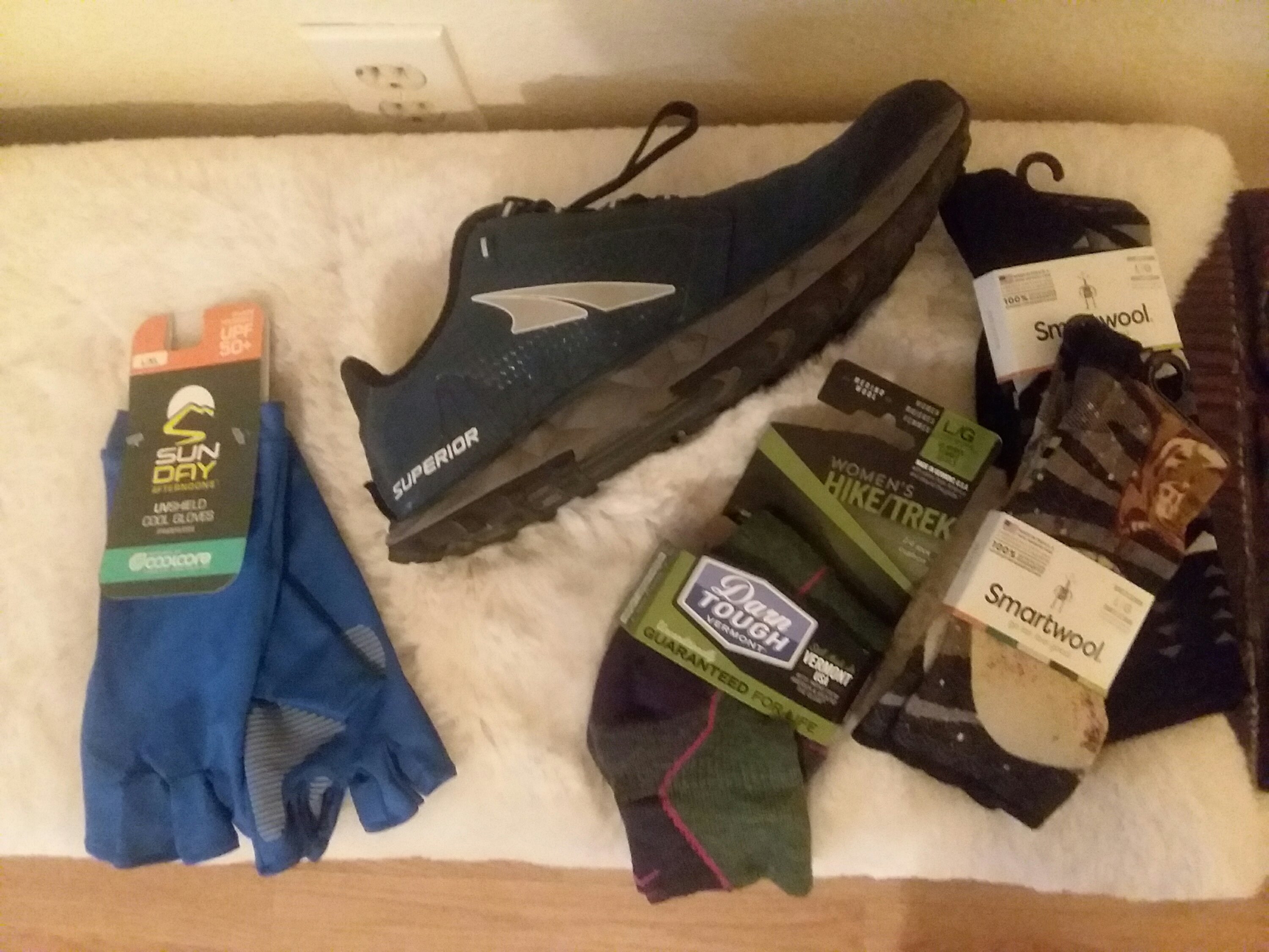
I got new shoes in town – an apt name, don’t you think? – new socks and sun gloves because my hands are getting totally fried.
I guess these investments mean I’m not quitting yet!
Day 10: March 11, 2020 – sobo hobos for a day
Staying in Tucson has been a dream. Friends and laundry and food and high spirits. Today we got up early and loaded into Bangles’ sweet rental car.

She drove us to a point where we could hike southbound back to Colossal Cave. We took off into Saguaro National Park and Wilderness.

It was a lovely day to be out.
We beat the rain by 5 minutes and when we were home it poured so heavily I thought the streets would flood. Tomorrow promises to be interesting weather. One more zero, then probably hitting the trail to Summerhaven on Friday.
This has been the most fun weather system I’ve ever waited out. Between shared meals, margaritas, and bemoaning the state of the world, it’s been really good.
Day 11: March 12, 2020 – Waiting out a storm by roughing it

Back on trail tomorrow to summit Mt. Lemmon on Saturday. Only a few days to Oracle where the southern section of the Arizona Trail ends. I’m really ready for the central section.
Much of this week has been corona virus stress. None of us are worried about contracting the virus, only the repercussions of a world gone mad.
Today I learned that Elliott won’t be visiting in a couple days as planned. I’m unsurprised but very sad. I didn’t say goodbye to him for 2 months; I said goodbye for 2 weeks. He and I have never traveled out of state together and I was so looking forward to it. I’m very grateful for the company of Scratch, Bangles, and Tikimon, without whom the blow would be much harder to bear.
I finished reading my 2nd book of the trip, Moominvalley in November. I’m reading all the Moomin books this year. I left Finn Family Moomintroll in a little free library in Patagonia.
Onward, despite the stress.
Day 12: March 13 – the push to Pusch

This morning Bangles dropped us off. It sprinkled off and on and the cloud patterns were intriguing. The trail was hilly and pleasant for the first many miles.
Tikimon, ten minutes ahead of me
As we walked, the wall of clouds around Saguaro National Park swirled. I was very sad to have bounced around (much of) Saguaro, but there were no permits available, and the 17-mile, 4000+foot up-and-over in bad weather just did not seem possible or safe. “Uninhabitable” was the word the ranger used to describe the mountain. I was so grateful to be hiking with Scratch and Tikimon, who had experienced Miller Peak in all its winter weather glory: they too were rightly leery of climbing into bad conditions. None of us were interested in “uninhabitable.”
Here’s my really long rant of the day (feel free to skip to the bottom of this where there are pictures):
The current system for hikers trying to get over Mica Mountain in Saguaro National Park is not a long-term solution and it’s not safe. Hikers used to make reservations by phone and could plead their case. Now it’s all online and the human element is gone, so there’s no flexibility.
Permit hoarders and inability to predict weather/timing 10 days out (heck, 2 days out) is going to create very unsafe situations where hikers force themselves to do a day that’s too hard by almost anyone’s standards, or hikers will force themselves to camp in the park during bad weather because it’s the only time they’ll be able to. Either way, hikers are going to end up getting hurt and thus, will put a strain on trail angels and park personnel. To say nothing of ruining a hike.
There are a few solutions:
1. There is a bike route around Saguaro National Park but it’s almost entirely on roads and is confusing – it isn’t in Guthook, making navigation a real pain. At a minimum, this route needs to go into Guthook and onto all AzT maps, making it a viable alternative, even if it’s sucky. Water and camping information needs to be collected for this route, as it is currently missing.
2. Saguaro National Park could reserve one campsite at the 2 campgrounds for AzT hikers in March and April (and whatever the sobo season is). Site capacity is 6, and the chances of there being more than 6 on any given night is minuscule. Saguaro National Park could charge AzT hikers double for the flexibility; we’d gladly pay it. This is a pain for Saguaro National Park but is it more of a pain than the inevitable upcoming issues?
3. AzT could change the route through Saguaro National Park to be a “choose your own adventure” situation. This would disperse hiker use on paths and in campgrounds, making it easier, though still not guaranteed, to get a reservation.
For early spring hikers, when most of us are out here, Saguaro National Park will always be hit or miss under the current system and people will put themselves into dumb situations under the current model.
Okay, rant over, let’s get some pictures:
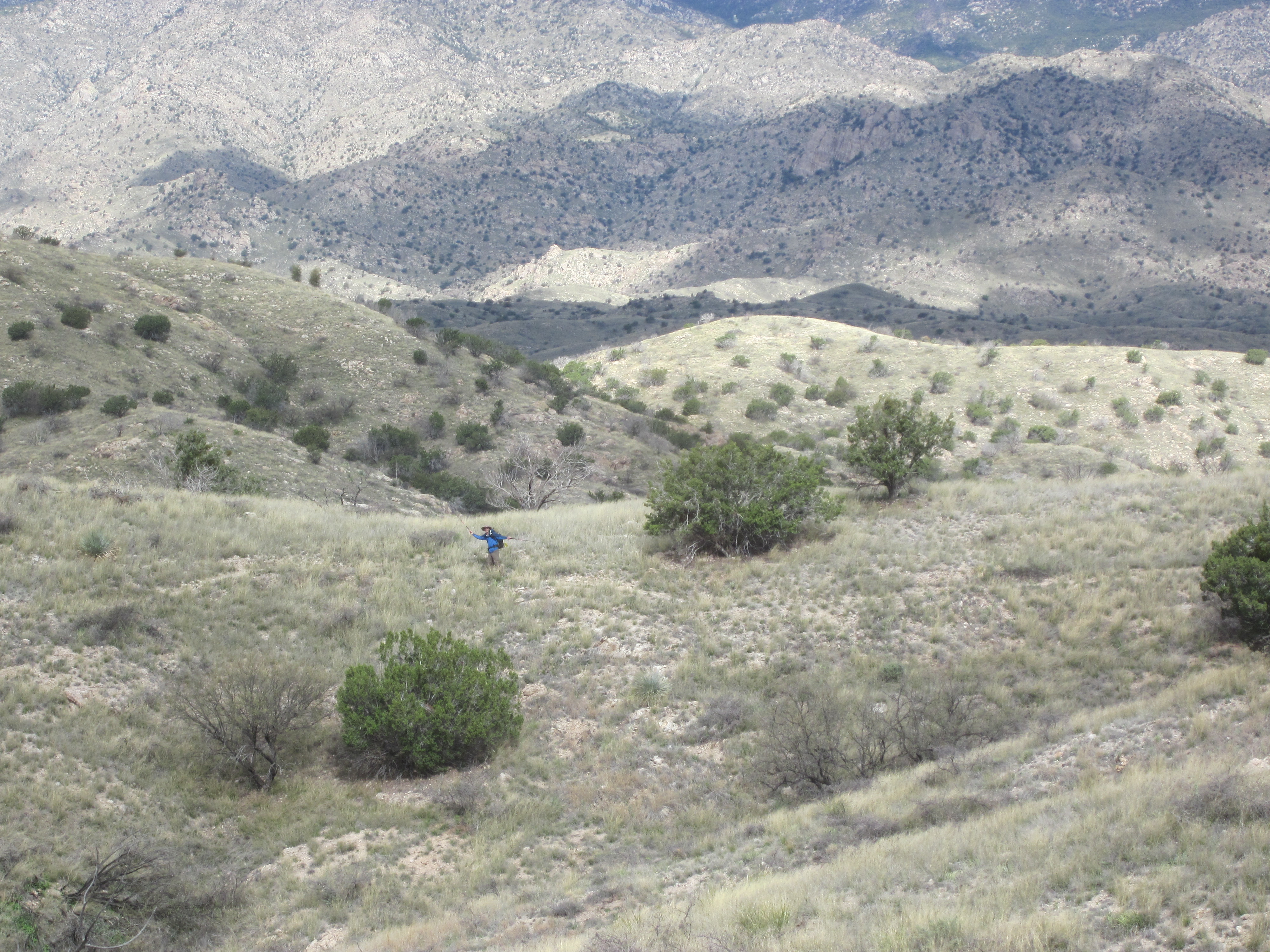
I hiked up to the saddle on the left side of the hump.
Did I mention the day was gorgeous?
We climbed up 800 feet to a saddle and down to Molino Campground where we regrouped. At this point I was feeling iffy about making it to Summerhaven on our current schedule. We had planned to meet up with Bangles there in a couple of days, but the trail was slower (but more pretty) than anticipated.
Near the end of a long day we finally crested a hill and looked into Pusch Ridge Wilderness Area.
We plummeted down to a lovely stream.
Rainbows and a colorful sunset painted the day. It was one of the most dramatic and rewarding AzT days I’ve had. I was happy to share it with Scratch and Tikimon. Pusch Ridge Wilderness is my new favorite part of the Arizona Trail.
Day 13, March 14, 2020 – The watershed moment
The day dawned so clearly and full of hope. I had no idea what the day would bring. This was going to be, unbeknownst to me, a watershed day in so many ways.

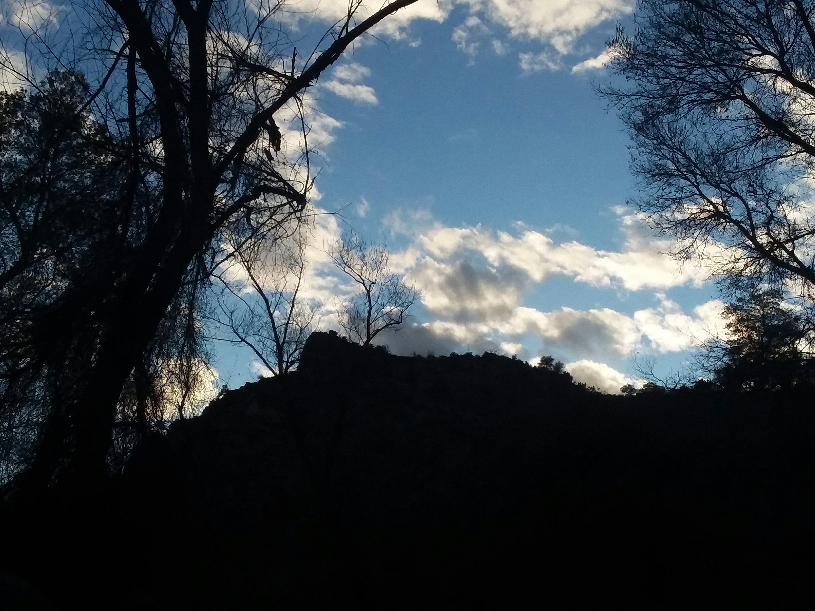
Sun hits the wilderness area
Our first order of business was to get an early start. We got up at 5:30 so we could be on trail at first light. We had a 16 mile, 4000 foot climb kind of day ahead of us. It was, to be honest, overly ambitious.

I really felt like I was hiking through “real” western mountains. It was spectacular.
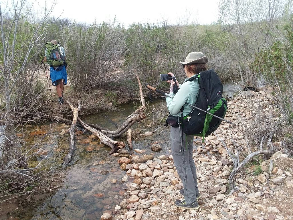
What I didn’t expect were all the fords. We came across two within the first mile or so. The first was easy. The second required getting decently wet after seeking a better crossing (and failing to find one). Fords take up lots of time.

Then things got even more interesting.
While Tikimon hiked ahead of us (Tiki=fast), Scratch and I took a wrong turn at a very confusing junction. The signage within Pusch Ridge Wilderness is kind of terrible. I don’t mind lack of signage in wilderness areas, but the problem is that the Pusch Ridge Wilderness has signage — and it’s unhelpful. You know it’s bad when someone graffitis the signs and you think “oh, good,” because the graffiti is better than the sign itself.
Alas, no one had graffitied the junction where we went wrong. Scratch and I hiked nearly half a mile uphill before I got the heebie-jeebies, checked Guthook, and realized we were off trail. We backtracked, found our mistake, found the trail, and came to a water crossing that was brown and fast.

There was no obvious way across. It totally made sense that it would be so bad: we’d waited out the storm, and now we were in the bottom of the canyon where all the rain and snow we’d waited out was congregating. Of course it was high, dangerous water.
We met two trail runners: one who couldn’t find a way across the water and bailed back to civilization via Sabino Canyon, and one who ran through the water and nearly got swept downstream. He claimed that it wasn’t the worst crossing he’d encountered. That did not inspire me.
The water was too brown and too fast. I didn’t want to cross it. I had flashbacks to the AT in ’09 when everything was dangerous and people got swept downstream. The irony of being stymied by water in the desert was not lost on me.

I made sure Scratch, who is DETERMINED and braver than I am, got across. I didn’t know I wouldn’t hike again with Scratch after that point. I would have given her a big hug.
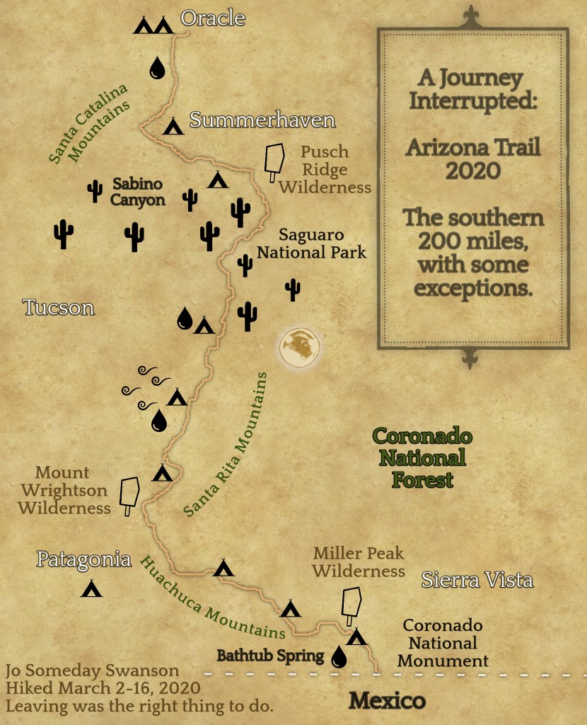
Then I returned to the wrong-way path we’d taken. I knew that trail led out through Sabino Canyon and to a place where I could meet up with Bangles on the edge of Tucson.

I didn’t know if I was making the right choice to hike out that way. But it was the only path forward I could see. All other trails would likely have similar water crossings.

At least the path forward was lovely and interesting.

I managed to get in touch with Bangles and arranged a pickup at Sabino Canyon. It was going to be pretty easy: the trail itself was only two or three miles, and then I was going to take a tram to the visitor center.

Near the tram stop, I was informed by another hiker that the tram wasn’t running today due to high water. So that added nearly four miles of walking onto the day, but it was an extremely pleasant walk through stunning terrain. I really enjoyed it.

And the high water over the hazardous bridges was at least easy to walk through.
It was the most enjoyable walk. Really. I’ve rarely had a more pleasant couple of hours.

Bangles, bless her heart, showed up to the meet-up point just 10 minutes after I arrived. It was pretty incredible timing. We roadtripped up to Summerhaven, which was fun but tinted with sadness, as I wanted to be out there, suffering all the way up that mountain. I wanted to climb it. I wanted to be outside.
Bangles and I hung out in Summerhaven and discussed life, the trail, and everything. Bangles had been planning on rejoining us at Oracle, but decided to go home in light of foot problems and the corona virus situation. She is from Washington, which is really suffering, and it’s hard to be away.
We waited at the trailhead for Scratch and Tikimon. It was dark when Tikimon arrived. Scratch, meanwhile, couldn’t find the trail at Lemmon Creek and decided to camp out. We were all glad she made the choice to hunker down at twilight, but sad that she couldn’t join us. Bangles didn’t get to say goodbye in real life, and that was hard. Those two had planned this trip together, so the departure of Bangles was a big deal. For all of us.
Tikimon and I got to the post office where the kind postmaster allows hikers to sleep (she even leaves the heater on for us!) and we said a sad goodbye to Bangles.

It felt like the end of an era for me, to have Bangles gone. I know I didn’t hang out with this trio for all that long, but bonds form quickly on trails, and seeing her leave was really sad. In retrospect, I know now that in a way, my Arizona Trail kind of ended when I chose to not ford that crossing with Scratch earlier in the day, but at the time, I still didn’t know it was almost over.
During this sadness, I met 800 Smiles. This amazing human being was camped out in the bathrooms and we invited him to the post office. Both places are okay for hikers to crash, but the post office is preferable due to there being a rug.

800 Smiles solved a huge mystery for me — it was this guy who joined me in the snowstorm at Bathtub Spring. I’ve been wondering for 2 weeks who the mystery hiker was who showed up at 9PM at Bathtub Spring, and it was him! How I managed to not run into him before now is a new mystery, but I’m so happy we finally connected. More than that: I’m happy he survived! That was a gnarly night.

Tikimon, 800 Smiles, and I had a great night in the post office.
Day 14: March 15, 2020 – We’ll cross that ridge when we come to it
We planned to wait for Scratch to show up this morning, but when it got close to 9AM, I knew I wasn’t going to make Oracle if I didn’t leave. Tikimon decided to stay and wait for her, and I continued hiking. I had a reservation at the 2nd most iconic place to sleep on the entire Arizona Trail: The Chalet. (The #1 most iconic place being the post office, of course.)

800 Smiles and I took off, for he too was staying in Oracle and needed to get there before dark. Our entire day was to be spent along Oracle Ridge.

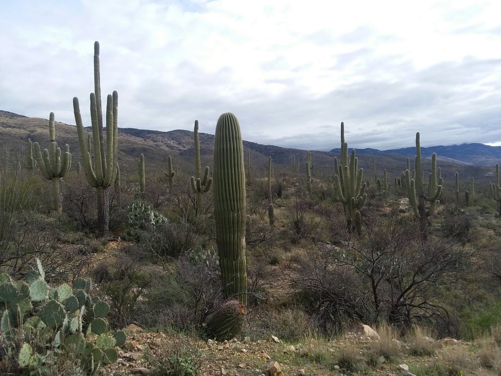
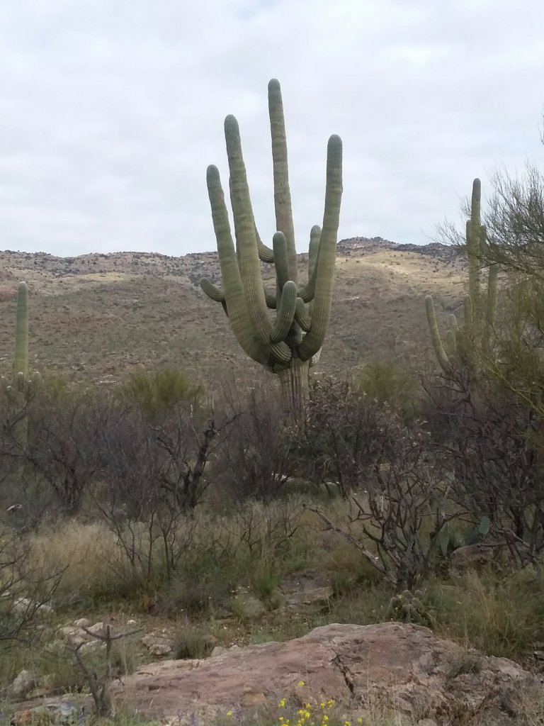
The views today were stunning: rock and scrubby tree and sky.

It was fun to see the snow up on the mountain, though that snow is what caused all the trouble yesterday.
The day was not as easy as anticipated. There was a steep climb that went on and on. I can only imagine what a slap in the face that would be to someone who had scrambled up the mountain a day earlier. Switchbacks on the AZT are often so steep as to be hardly worth it, and that was the case with these. But at least we had great views.
The trail was exceptionally rocky. It joined some rugged roads that were far too steep, with ankle-breaking rocks cluttering the road. I had to walk down some of the roads sideways because they were so steep I thought I’d just fall down if I tried to walk normally down them. It was such a relief to get back on singletrack.
Signage completely disappeared in the middle of the day. Without Guthook, I would have had some stressful hours. I imagine there are many “bonus miles” done on this section every year. I later learned Tikimon did some bonus miles here.
The trail was also very dry. Man, this trail does nothing subtly. It’s either way too much water or none at all! 800 Smiles and I hiked together for awhile. When we got to a water tank he climbed up and filled up our bottles!


The ladder kept us from having to drink green water out of a trough. I was happy about that. Green water is no one’s favorite. Way to go, 800 Smiles!
Shortly after the tank, we reached a stunning bit of trail through a rock garden and the soft tread was joy to our feet. It was a great descent to American Flag Trailhead!

Along the way, we passed the 200 mile mark. This was a cool moment. I was happy to share it with 800 Smiles.

Hashtag stylish
Day 15: March 16, 2020 – the end of the world as we know it
Getting to the Chalet last night was a dream come true. This is one of the most iconic places. Although the usual caretakers are out of town due to a family emergency, they have a wonderful woman taking care of the place. This kindness to hikers is incredible: it would be much easier to just close, but they wanted to make sure hikers are taken care of.


My little home
Last night, 800 Smiles and I each got a room, and within an hour Tikimon had hiked in too and he crashed with me because I had 3 beds. We were all so exhausted.
“Never quit on a bad day,” they say, and it’s the best piece of hiking advice I’ve ever heard. All day yesterday, even during painful parts of the hike, it was a pretty darn good day. I needed to sleep on my decision, though, and I woke up today knowing it was time to evacuate.
The Arizona Trail Association is a class act and released this statement. It’s worth a read. Although I made the decision to leave a day before they released this, the points they make were all things I was thinking about.
Bye, Tiki. Bye, AZT.
It’s not just about me and my desire to finish a thruhike.
It’s not just about me and my need to find adequate resupply.
It’s not just about me and my need to have a night inside now and then.
It’s not just about me.
It’s about my loved ones back in Minnesota.
It’s about the trail angels, exposing themselves to hikers.
It’s about the fellow hikers who, let’s be honest here, all have abysmal personal hygiene while hiking.
It’s about the mom and pop stores, the hotel workers, and everyone who lives in trail towns.
The world I left on March 1 is gone and this is not the world I anticipated living in, two weeks later. And it was time to get out.
I booked a plane ticket from Tucson and arranged a shuttle. Then I did my laundry and watched Tikimon pack his bag and hike on. It was incredibly hard to say goodbye.

It wasn’t just saying goodbye to a new friend; it was saying goodbye to my dream.
The only nice part was that I met two Canadians, Martin and Ian. They were thru-hiking the Grand Enchantment Trail – a trail which makes the AZT look, to be honest, a little wimpy. The Grand Enchantment Trail coaligns with the Arizona Trail for a few dozen miles and they had hitched into Oracle. Unfortunately, the Chalet was filled up. Fortunately, I had two extra beds in my room, so I made them move in with me.
The Canadians spent a lot of the evening speaking (in French) to their loved ones back home. Their travel insurance was going to be revoked due to corona virus, and from what I could gather, Canada was closing down international travel options. They wanted to keep going — they had permits for Avaraipa Canyon (Grand Enchantment Trail route, not an Arizona Trail feature) and were just getting their trail legs after two weeks on the trail — like me. Unlike me, they went to bed unsure what their next day would bring.

Day 16, March 17, 2020 – Does this day even count? The end of the world as we knew it, part 2
My last day in Arizona was gut-wrenching.
Four thousand virus cases. Or maybe it was four thousand new cases. At any rate, it was the deciding factor – the Canadians decided to join my shuttle to Tucson, planning to get a motel near the airport and think through their next move. Wonderful Saina from the Chalet drove us. It was amazing to drive around Oracle Ridge and see the mountains hiding Summerhaven. And it was also really hard.

Mass Coronavirus Exodus
The Tucson airport was quiet, but I couldn’t tell if it was coronavirus related or if the Tucson airport is always quiet. I checked my backpack and waited in line for security. I had two whole people ahead of me in the security line.
Everyone in the airport seemed on edge. Only a couple of people wore masks. Some people had wipes and wiped down everything they touched, including seats they sat on. I had found a Harry Potter book in the hiker box which I intended to read, but I couldn’t concentrate, not even on Harry Potter.

The only javelinas I saw the entire trip.
About an hour before my flight I was walking laps and ran into the Canadians! They had managed to book the last 2 seats on my flight to Minneapolis, where they could transfer to a flight to Montreal. It felt like a little gift from the trail gods to have a couple of familiar faces on my flight.

Accepting the adventure is over.
I don’t know much about air travel. I don’t know if this is normal. But I booked my flight from Tucson to Minneapolis about 30 hours before I left. When I booked, at least a third of the seats were open. I was able to get my precious window seat. And as I said, the Canadians were able to get the last seats on that flight. I was very surprised that it filled up. Maybe that level of last-minute travel is normal. I don’t know.

Goodbye, mountains and canyons.
On the plane, I wiped down every surface I would come into contact with. So did the woman I was sitting next to. Both of us tensed up whenever someone coughed. And yes, I watched Frozen II again because that was exactly the level of stressful programming I could handle.

Oh, I’m not ready for the squares of the midwest quite yet.
We landed 40 minutes early, I retrieved my backpack, and I waited an hour and a half for my shuttle’s departure. I was relieved to share the shuttle with only two other passengers, a couple from Duluth who tried to have a Vegas vacation in the midst of coronavirus casino shutdowns.

I’m struggling to allow myself to grieve. I have hardly allowed myself to feel sad about my hike, given the current world situation. Anytime I feel upset, I instantly remind myself how lucky I am, and I am — really really fortunate.
But it’s also not healthy to deny the fact that I lost a dream. My leave of absence isn’t something I can defer. Many Arizona Trail thru-hikers who had to leave or postpone will try again as a southbounder this fall, but I don’t get a second chance — not unless I want to uproot my entire life. And that’s something worth mourning. Even if it is a privileged first-world problem.
