On many long hikes, rail trails make up a tiny portion of total miles and those can be either a relief due to their gentle terrain, or a terror due to the monotony of that gentle terrain (and the blisters that monotony can cause). I never envisioned hiking a long rail trail – not on purpose.
And then 2022 happened. First I caught COVID and then I sprained my ankle, with one glorious, and thoroughly under-appreciated day of health in between those two events. The ankle was actually worse for me, mentally and physically, than COVID. It took longer to heal and took more out of me. All my fall plans had to be scrapped multiple times as I kept delaying my departure, tweaking my plans, etc. I had at least four versions of fall plans fall through.
I guess the good news is, I am all planned and ready for hikes I didn’t get to go on.
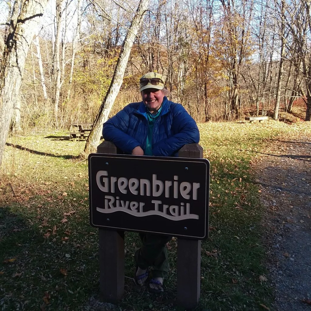
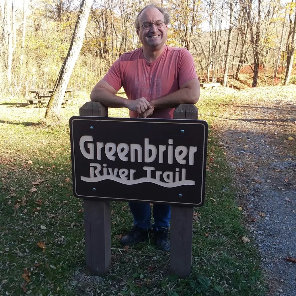
I was looking at wilderness areas in West Virginia, seeing if I could create my own route by linking some of them. That’s when I kept seeing a little trail on the maps – Greenbrier River Trail. Though it was only adjacent to two wilderness areas, it meant I wouldn’t have to plan my own route. Given how much planning I’d done, the thought of doing less planning was super appealing.
I downloaded maps for the wilderness areas I wanted to explore, printed a mileage guide someone created online, and I was ready to go. I really needed an easy win.
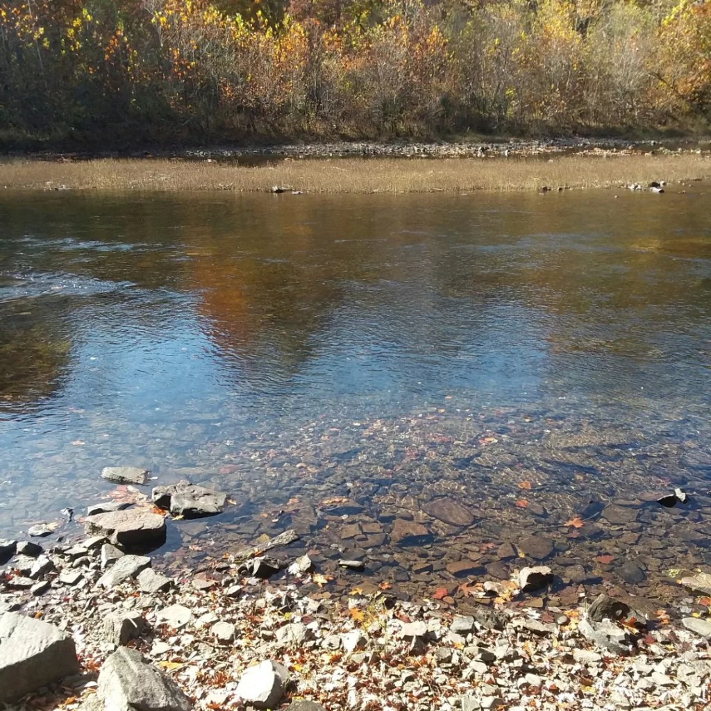
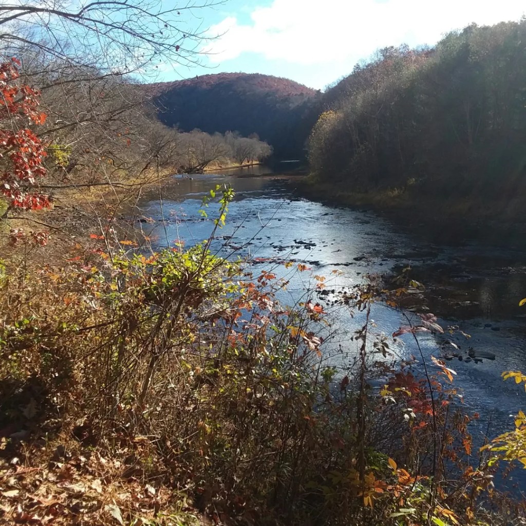
The Greenbrier River is 77 miles long. Bikepackers typically do it in 2 days if they’re going one-way. I gave myself 7 days. This is a crazy amount of time under normal circumstances, but I didn’t entirely trust my ankle. Also, I had to accommodate the schedules of Elliott (dropping me off en route to a college reunion) and Richard (picking me up en route – well, not really en route – to a trail work event). So I ended up with 7 days and that was great for both my ankle and mental health.
Some fun facts about the trail:
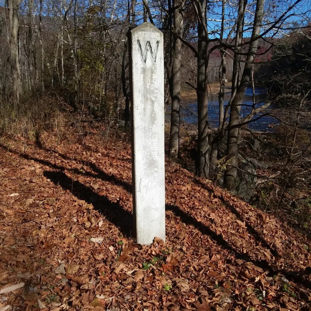
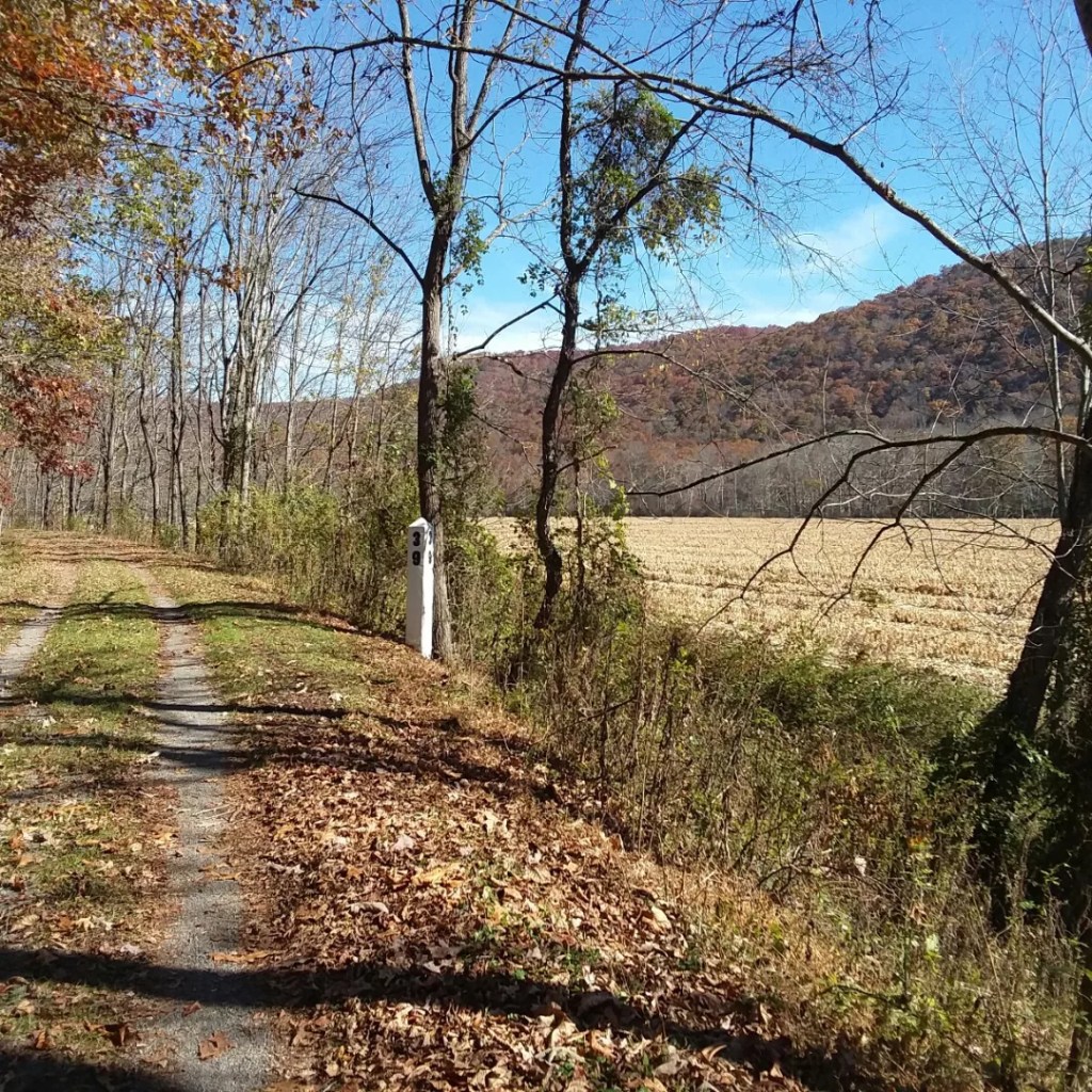
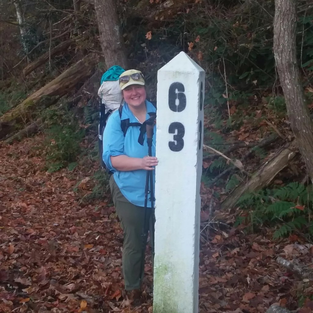
- Mileage. Although the trail is 77 miles long, it begins at mile 3 so each mile marker is 3 ahead of one’s actual mileage. The final mile marker is mile 80. But for the next several years, the southernmost miles are closed due to a water pipeline project, so the trail is 74-75 miles long right now. Are we confused yet? There is a white post marking each mile, so even if you can’t figure out how long the whole trail is, you can at least do some basic math and figure out how far you have come.
- Camping. The trail only allows camping in designated spots. This is due to a lot of private land in many areas. The camping infrastructure is fantastic, but slightly limiting for someone on foot. My options were not always ideal, but again, I had an entire week, so most people wouldn’t be out there as long as I was – the more miles you cover, the better and more varied your camping options would be each day.
- Locals. People LOVE this trail. I met many locals out using the trail who clearly adore it. But they are fair-weather users – I saw virtually no one during colder parts of the day or when weather was not optimal. I probably saw an average of 12 people per day, with a slight skew towards bikers, but only slight. The town of Marlinton was the busiest.
- Weather. Forecasts were not accurate for the area when it came to temperatures and it was notably colder than claimed. I guess this is because colder air is running through the river valley – but that is an uneducated guess. I was not carrying a thermometer, but frost does not lie.
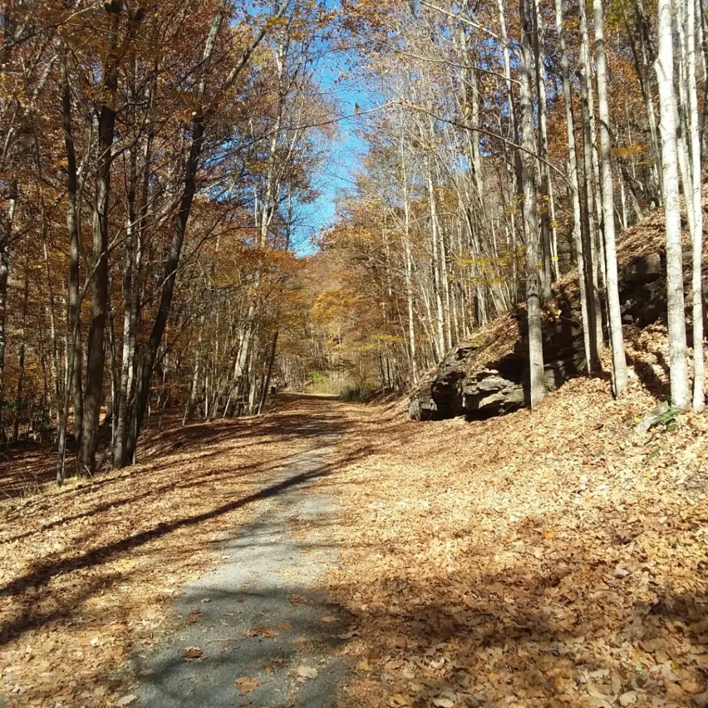
- Maps. There are free maps online but you don’t need much. Really. I don’t know how you could lost. Each road crossing has a big sign.
Day 1: Big Draft Wilderness, MM 14.2 + Detour
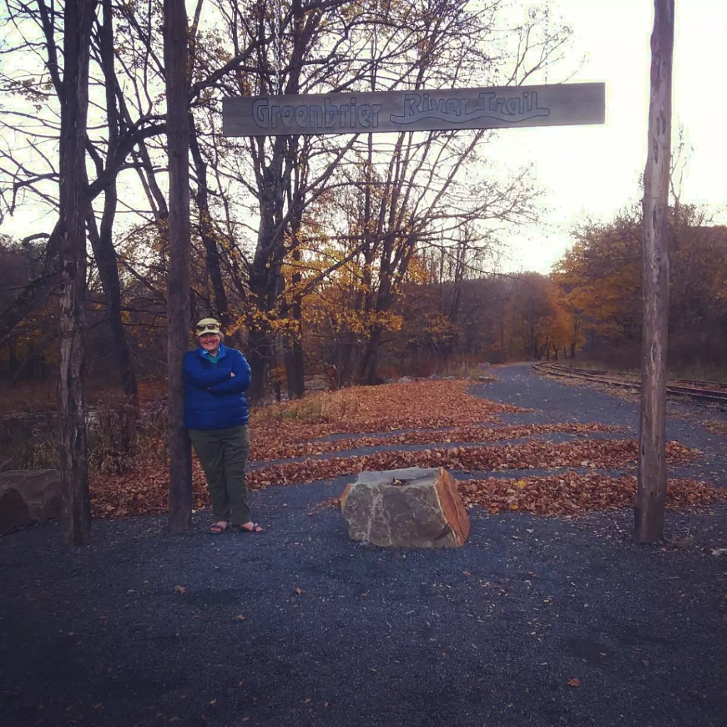
Elliott and I visited the true southern terminus of the Greenbrier River Trail at Caldwell – rightfully plastered with closure notices regarding the water pipeline project ahead. He then drove me to where the trail starts for the foreseeable future, a tiny parking lot at Harper/Hopper (name depends on who you ask), adjacent to a pile of closure signs for those heading southbound.
I said a sad good bye and headed north. As usual, I felt mild trepidation for the first few minutes, but within half an hour I was happy as could be. My ankle was holding up and I was appreciating having mile markers to look forward to.

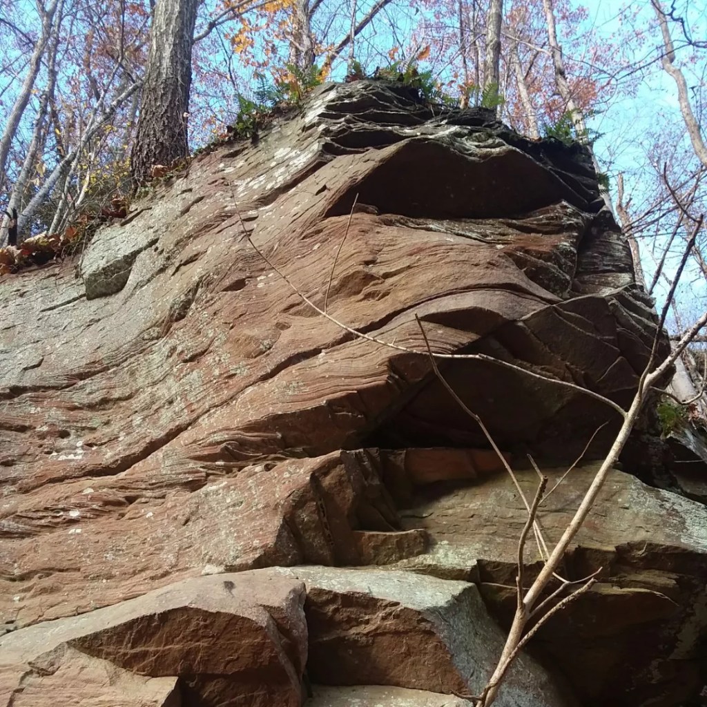
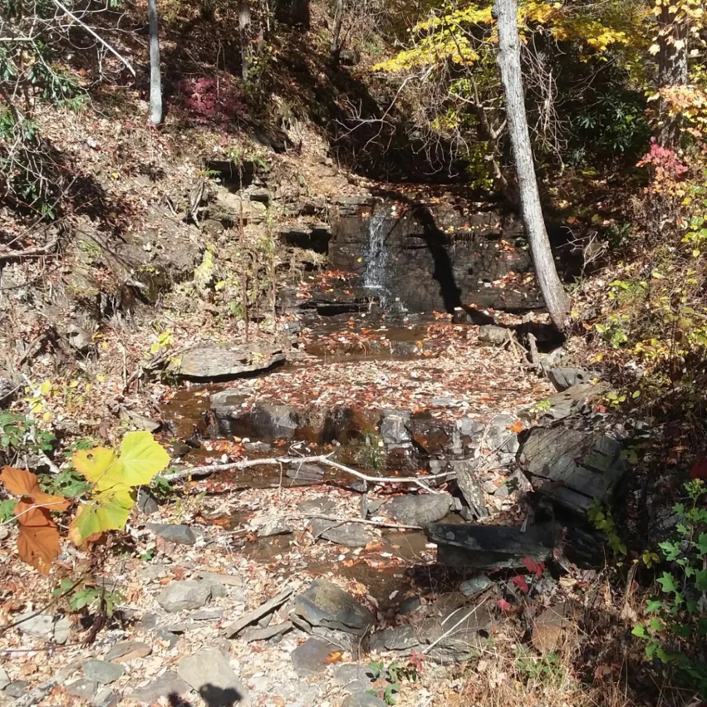
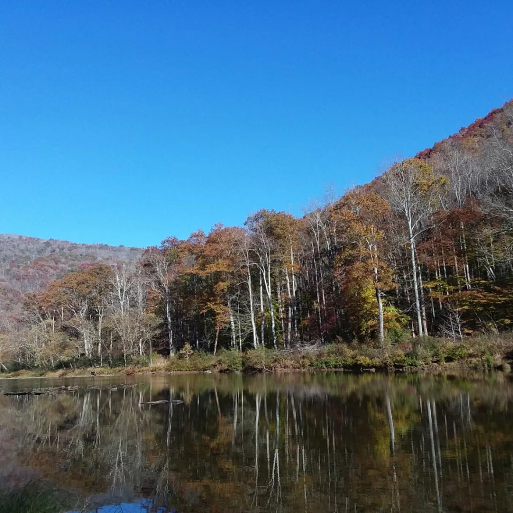
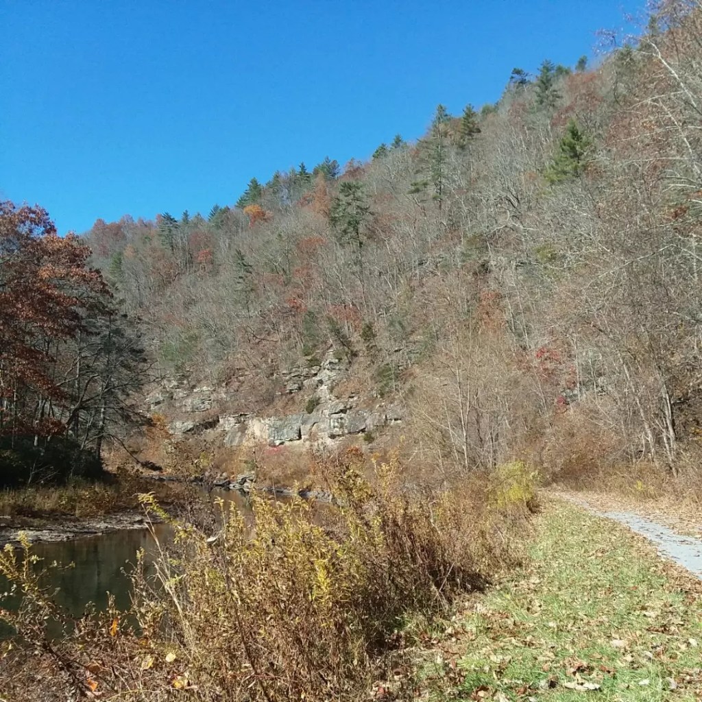
The first day I marveled over southern plants I had been missing – rhododendron and laurel – as well as cool rock formations, and the miles flew past. I stopped for a break at the first shelter / campsite. The water pump (yes, many campsites had water pumps – an odd luxury for me) discharged a very chunky water – perhaps if I had run it longer, the chunks would have disappeared, but I still had some water and I decided to not bother with the chewy water. Because ew.
I hadn’t gone very far and I had a special goal tonight so I packed up after a snack and kept walking.
After about ten miles, I came to a trailhead and road at Anthony. I left the Greenbrier River Trail and crossed the river on a small road bridge. Despite being a weekend, there was no traffic. On the other side of the river, I turned into a parking lot and walked right into the Big Draft Wilderness. I had never been to this wilderness area and I loved being on a narrow trail for a little while. I hiked until I found a perfect campsite on a ledge above the the river.
Given the late season, darkness came early, so I spent a good portion of the evening tucked into my tent reading by headlamp. I could hear the gentle murmur of the river below me.
The Big Draft Wilderness was a great option for me – the mileages for legal camping along the trail were not terribly helpful for my needs on this day (only available at miles 9.5 or 20.5 – too few or too many). For less than a quarter-mile detour, I had an entire, gigantic, legal camping area.

Day 2: Golden Campsite, MM 28.5
I awoke just before first light and packed up by headlamp. Even getting this “early” start meant 8AM, since the days were so short. I didn’t have that far to go today, but there’s something psychological about getting an early start. It was bitter cold the night before, but I had great gear and was fine.
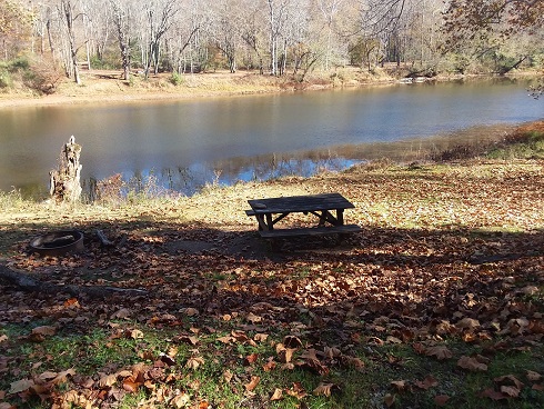
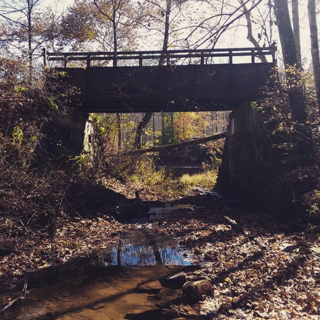
One highlight of the day was going up “the hill” which to be honest is not much of a hill. It is where a horrific 2016 rain washed out a bunch of the trail. A picnic table now guards the area. Other interesting features were the pillars of an abandoned road, a private swinging bridge, and a singlewide on 12-15 foot stilts. I also loved seeing the whistle signs!
In a large U-bend of the river, the trail cuts straight instead of hugging the bend. This brought me through grassy farmland where hundreds and hundreds of woolly bear caterpillars shared the trail with me. I was grateful to be on foot and not on bike so I could avoid them.

At the town of Renick, I ate lunch and got water. There is a spectacular picnic shelter and a privy. I chatted with a biker for awhile and enjoyed some barefoot time. The final miles of the day felt long but the scenery was top-notch.
When I reached the shelter / camping area around 2PM, I anticipated having to share. It was Saturday, and I’d seen a fair number of people around. I decided to forego the shelter and claim a tent spot near the river. It had a picnic table and a gravel tent platform and could not have been more scenic.
No one else ended up coming and I could have had the whole shelter, but my tent spot was just too nice.
Day 3: Mill Run Campsite, MM 40.9
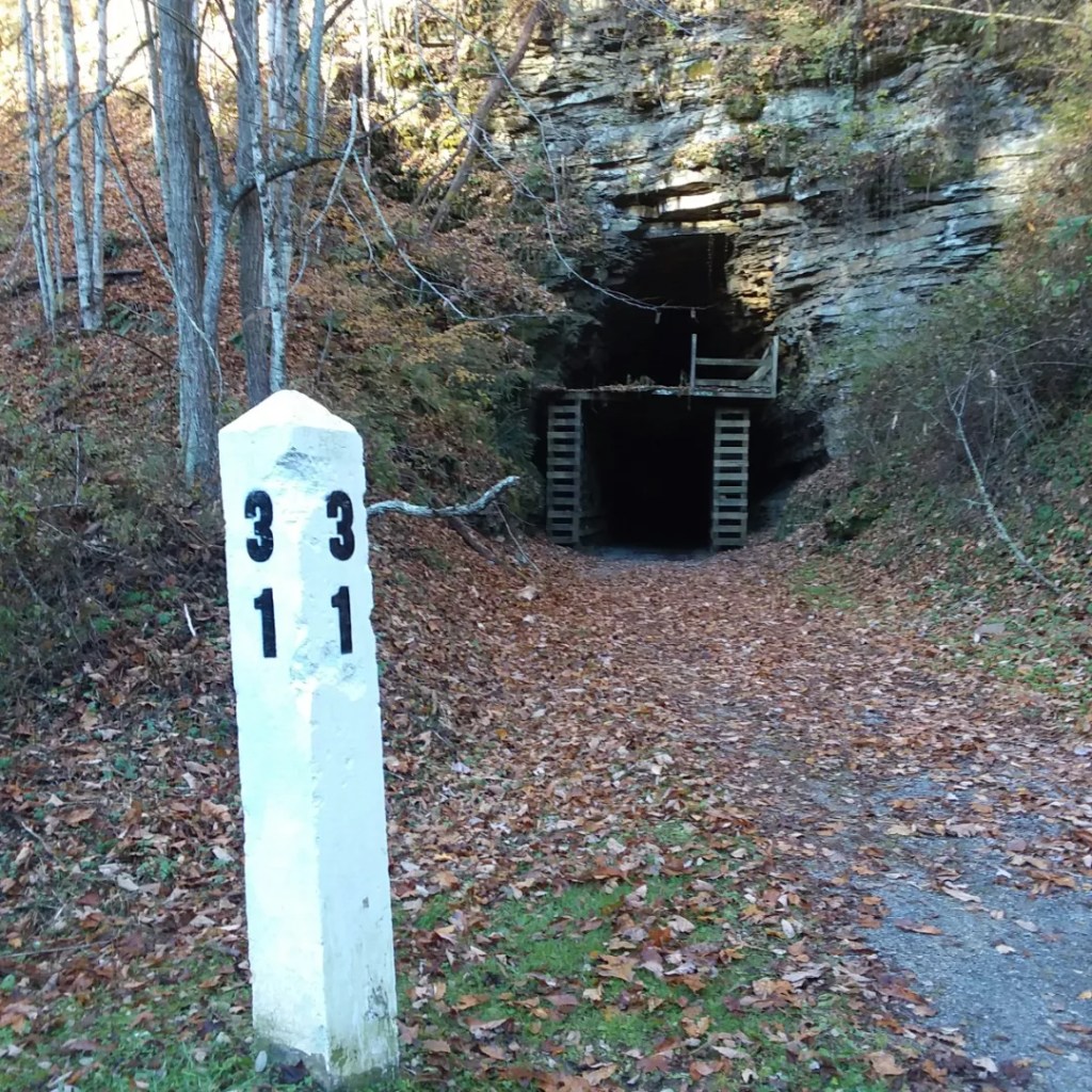
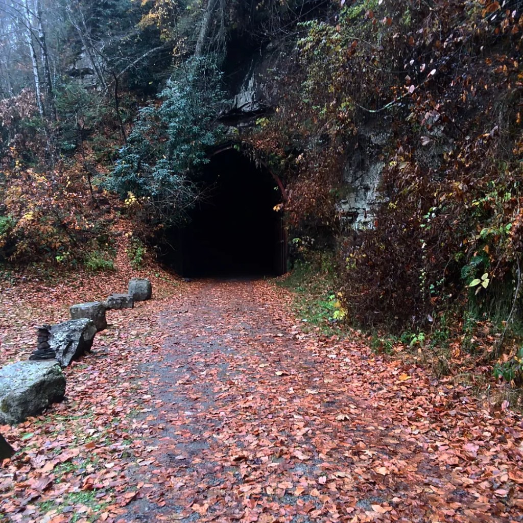
Again I awoke just before first light and began packing up. The morning was bitterly cold and I was in shadow waiting for the sun to poke above the mountains. It seemed to never come. There were a lot of landmarks this morning – small towns, and the 400-foot-long Droop Mountain Tunnel. I had my headlamp in my pocket for just this moment. The tunnel curves, so when you first step inside it, you cannot see the end, and it is quite eerie.
I passed some really nice campsites earlier in the day where I actually intended to stop, but I arrived at 10:30 in the morning and while I love short days, that felt far too extreme. So I changed my plan and headed for Mill Run, listed in my guide as a “really scenic and cozy camping site.”
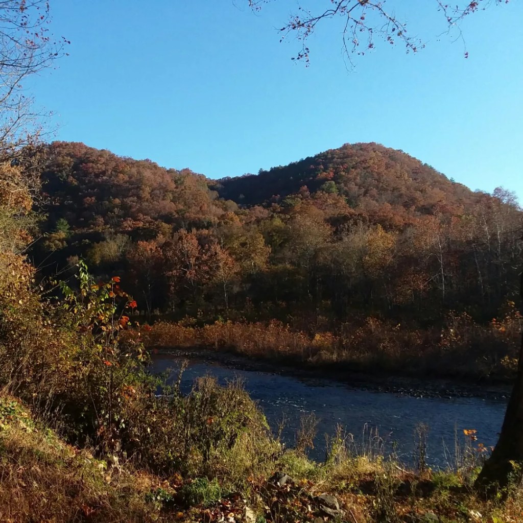
Along the way, I made a quick detour to appreciate Spice Run Wilderness Area, just across the river from the Greenbrier River Trail. I passed the halfway point of the trail this day as well. I love frontloading my miles.
Around noon it got very hot and I was tired. I finally found a patch of shade to rest in. I sprawled in the grass for 20 minutes only to discover, upon resuming my hike, that I was adjacent to a prison – right next to it. I had no idea the trail went by a prison. Might have been a useful thing to have on the mileage chart! I bet I was on their security cameras.
The campsite was scenic, as promised. The highlight was being by the stream. There were surprisingly few streams along the Greenbrier River – perhaps in part due to drought conditions impacting many trails. The only downside of the campsite was no latrine facility. Because the site was on a tiny ledge – on one side of the campsite was the mountain going steeply up and the other way was a streambottom. There was no bit of privacy and if you’re female, you know how inevitable it is – the minute you try to pee, that’s when someone comes by. Even if you’ve only seen five people the whole day. Even if you looked and no one was coming. Yep. That’s what happened.
Day 4: Stillwell Park, MM 551.
There was a lot to see this day. I walked through a trail town early in the morning. Seebert is for many people a noteworthy trail town due to legendary pizza. Unfortunately, the seasonal pizza shop closed for the year the week before I arrived. I was okay without pizza.

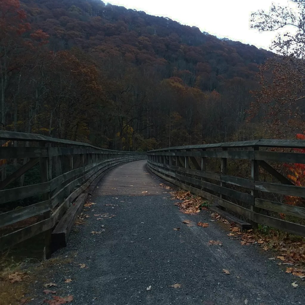
Another highlight was the Watoga Bridge, more glorious railroad infrastructure. From here I was now on the east side of the river. I felt a little lopsided looking to the west to see the river. I was thoroughly used to peering east.

I planned to camp at 51.5. I arrived, I spread out my tent and ground cloth so they could air out, and I enjoyed a late lunch. That’s when Franklin, an older gentleman on a bike, stopped to chat with me. I think every trail has a Franklin. Franklin knew everything, had done everything, and wanted to share all the information he could. Sometimes, encountering a Franklin can be overwhelming, but today it was enjoyable and helpful.
I learned from Franklin that camping was free and easy to access at Stillwell Park, a few miles ahead. I had seen on my mileage chart that camping was available, but I did not know if it was free, seasonal, or if it had other strings attached, so I was going to play it safe and stay at 51.5. But with the insight from Franklin, I knew I would have no problems there.
Stillwell Park was an attractive place to stay, because it meant I would be only a mile out of Marlinton the next morning and I had a lot to do in Marlinton. So I set off, and I was thrilled to encounter the only paved stretch of the Greenbrier River Trail. Normally I’d always prefer gravel, but on this longer-than-planned day, pavement allowed me to wear my sandals without getting tiny rocks in my shoes. Wearing different shoes for the final few miles really helped.
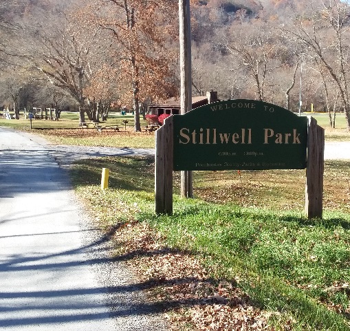
I arrived at Stillwell Park and ended up asking the maintenance guy where to set up – it was pretty obvious, but with no signage or map, and a big sign stating that the park closes at night, it felt like I was breaking the rules. The highlight of the evening was finding a working outlet in a gazebo. I charged my Kindle and my phone, two of the chores I was planning to do in town the next day. I also had reception, so I was able to catch up with family and friends.
Day 5: Shelter, MM 63.8
The night was bitter cold. Frost covered everything. I’d been sleeping with my water filter each night so it wouldn’t freeze, but it was particularly necessary now. When I got up to pee in the middle of the night, Orion kept watch over the river valley. There may have been yellow leaves clinging to some trees, but winter was coming fast.
So far on the trip, I had experienced no great challenge or difficulty. The only unexpected thing had been that the mashed potatoes I was carrying as suppers were inedible. I was trying a new brand, and they were absolutely vile. (And let me assure you, the bar was real low to begin with.) To avoid choking down any more poo-tatoes, I knew I needed to stop in Marlinton at Lucy’s Grocery. The store did not open until 9, so I didn’t wake up until 8. There was no point.
I arrived in town, mailed letters, stocked up at Lucy’s, and hung around at a park until the pizza shop opened. I may not have gotten pizza in Seebert, but I was going to get some here. I left town with half a pizza in a ziploc bag and several cans of food. Given the prevalence of trash receptacles on the trail, canned food was not the problem it would be on a normal backpacking trip.
For most of the trip I had been watching the forecast. A big rain event was moving in, and for a trail next to the river, it was something to keep an eye on. I knew it was going to blow in late overnight, so my goal on this day was to reach a shelter where I could spend the night.
When I arrived, the campsite was deserted. It was not the most appealing spot given extensive private property markings surrounding the trail and shelter. Whoever owns the land was apparently pretty unhappy with the trail’s existence and wanted anyone staying overnight to not even think about straying from the area. I think they don’t understand how tiring it is to be on a long adventure. I don’t want to trespass. I want to throw myself onto my sleeping pad.

Before dark, “Highlander” pulled in – he is on a 6,000 mile bike ride. There was plenty of room in the shelter but he was happy to just store his bike inside and set up his tent outside. We swapped stories and had some great conversation. It was the only night I shared on the entire Greenbrier River Trail. I had a really nice time.
Day 6: Shelter, MM 69.6
Today was my day off. I had met or exceeded mileage expectations for the entire trip, so I was happy that this rainy day meant fewer miles. It did indeed rain much of the night and until 9:30AM. I said farewell to Highlander, who had to make miles, but I sat around and read until the rain tapered off. I was on trail a bit after 10AM.
The trail was fairly wet and unsurprisingly I saw no one else enjoying it. I loved going over a curved bridge and being on the west side of the river again. Maybe because the trail began on the west side, it felt right to be on the west side. I also got to hike through Sharp’s Tunnel – another time to use the headlamp.
This was the first day I saw a maintenance truck, passing me and leaf-blowing at the shelter I was aiming for. Leaves were falling so quickly that blowing them off the trail seemed Sisyphean.
It was a cloudy, dark, humid day and an ideal day to only be on trail for a couple of hours. Grateful for another shelter, I set up and rested all afternoon. I read a lot of books.
Day 7: Cass, MM 80.4
My final day on the trail dawned cold but clear. I tried to sleep in, because I wasn’t due to meet up with Richard until 4PM and I only had 10 or 11 miles to go. Nevertheless, I ended up on trail by 9:20.
So I meandered. I sat at each bench. I took two lunch breaks. I took photos. I talked to an older guy. I walked as slow as I could, just thinking about the experience I had had, and how good it felt to be able to walk again without ankle pain.
One bittersweet moment was coaligning with the Allegheny Trail for a few miles. That was my original fall plan, and given my ankle, I had to change. I touched a yellow blaze and promised to return.

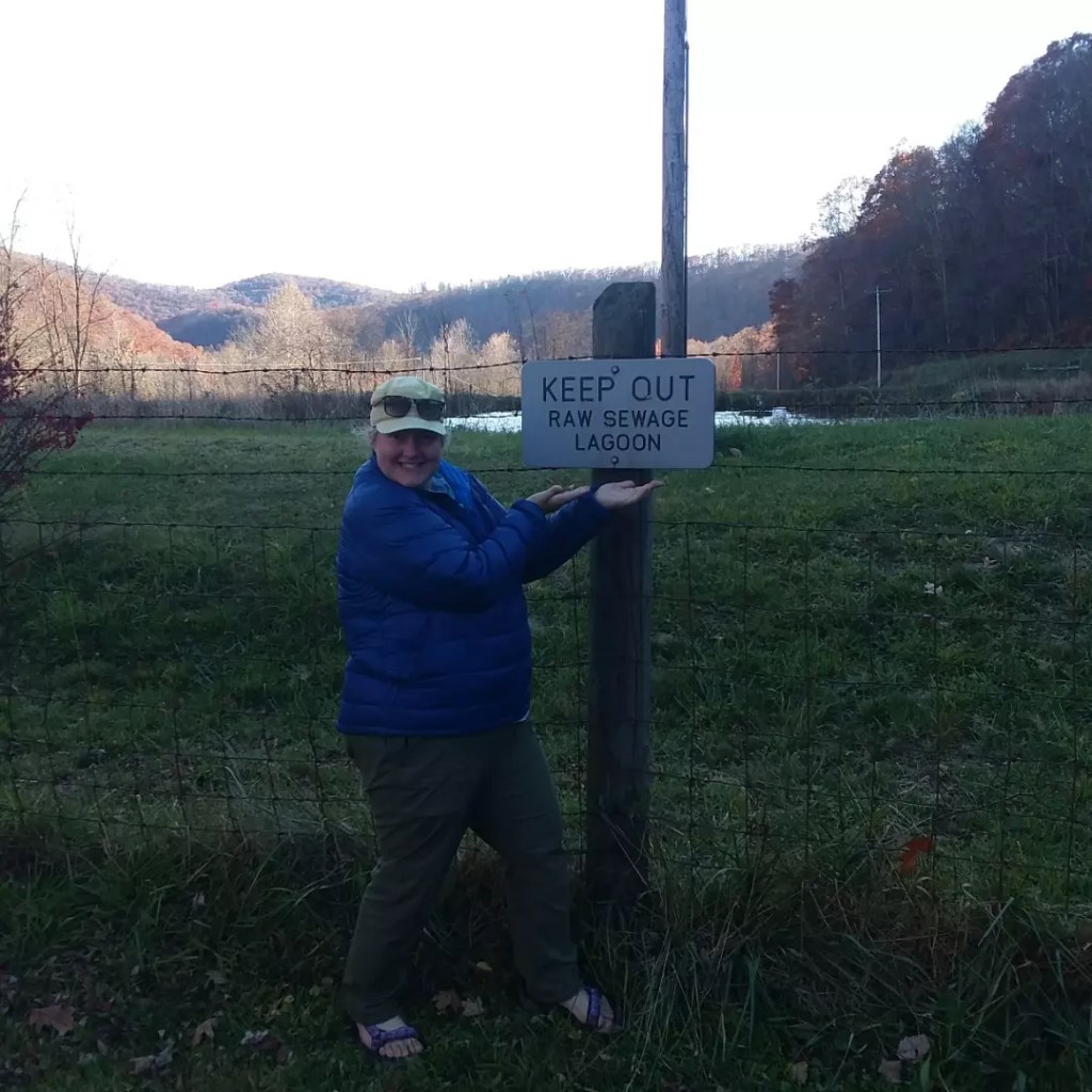
For my final mile, I decided to list all the things I was grateful for. I was able to keep the list going the entire mile. I still arrived at the trailhead around 2PM. I guess I can only meander so much. Unfortunately, the terminus is near a raw sewage lagoon, so it’s not a fitting end, but I found a nice patch of grass and continued to read.
Richard showed up just as planned and we spent the evening in Cass. It’s much nicer than the sewage lagoon would indicate.
It was a really wonderful trip, and while it would be fast and fun on a bike, it made for a really relaxed. lovely week of backpacking. The amenities were appreciated, the trail was meticulously well-maintained, and the views were gorgeous. I’m not exactly glad that all my original plans fell through, but given the situation, I made the best of it and the Greenbrier River Trail was a great place to soak up autumn.
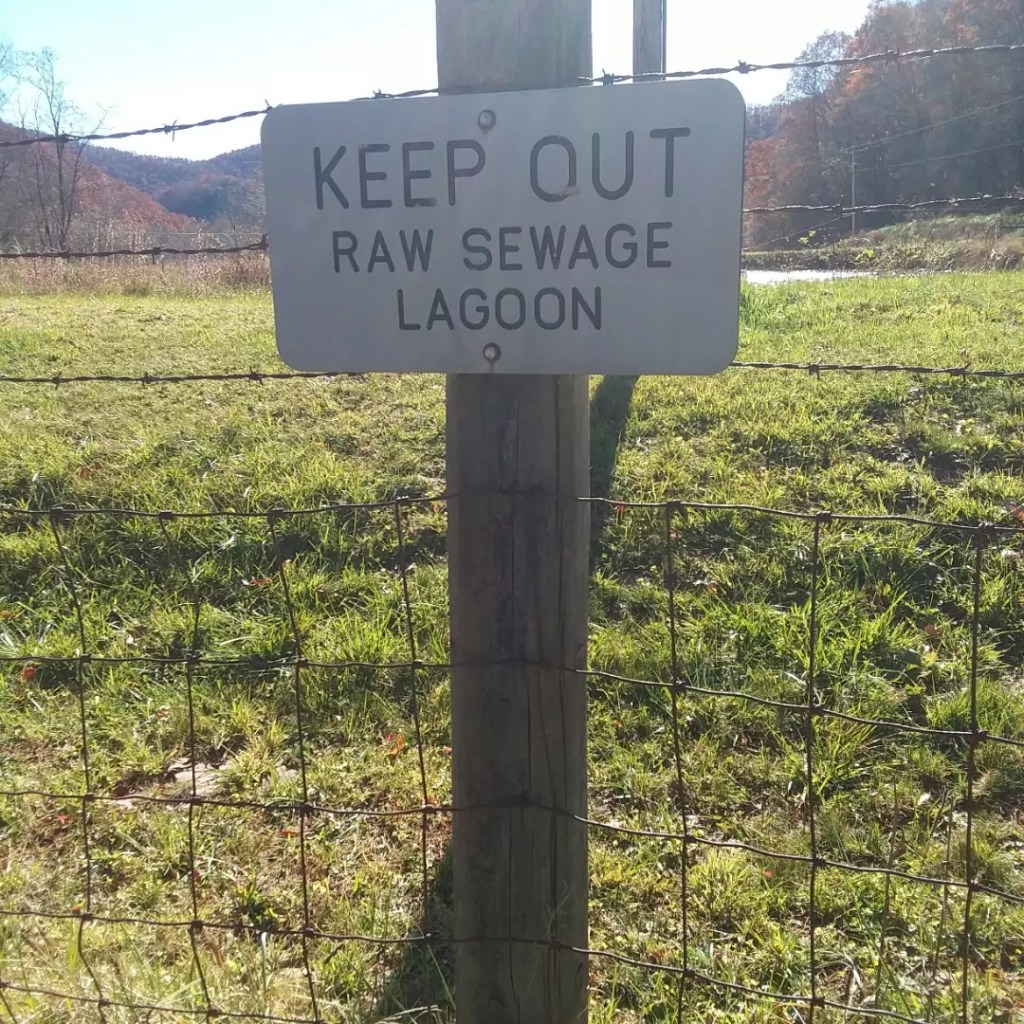
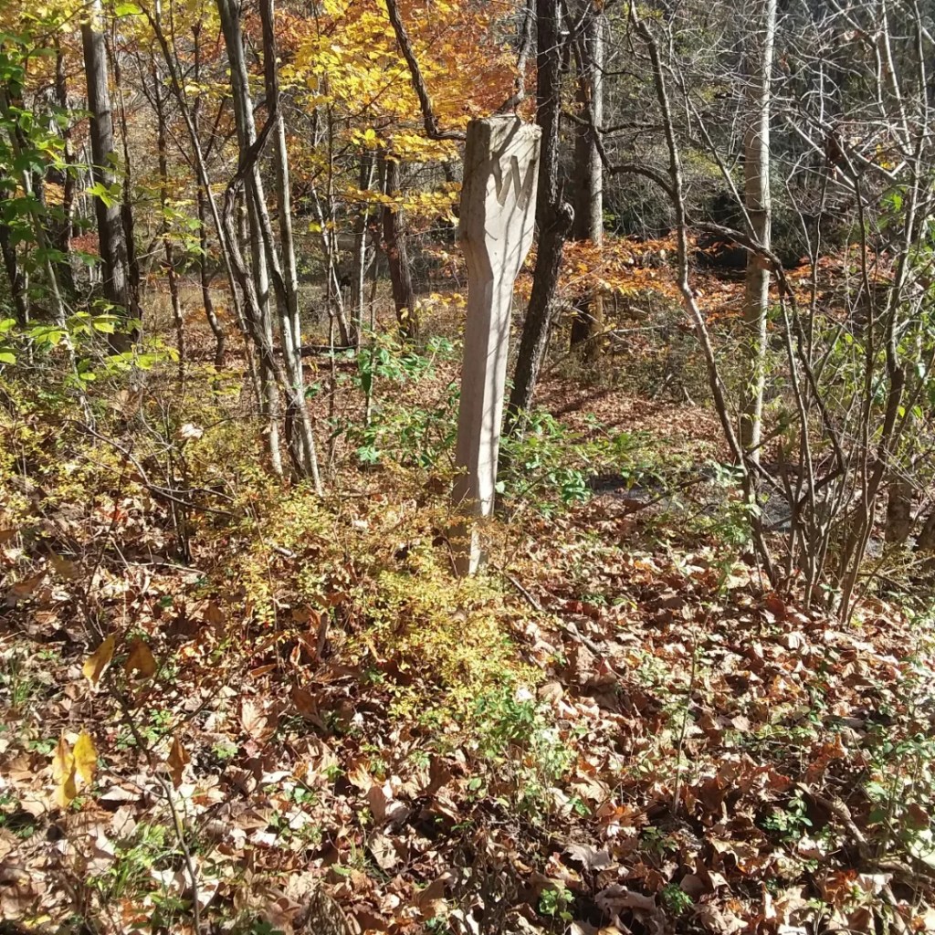
What the heck kind of a terminus is this?
