In 2019 I hiked the Solitude Trail (also called the Solitude Loop Trail or Trail 38). Whatever you call it, it is a 60-70 mile hike primarily in the Cloud Peak Wilderness. I went with my friend gistrailblazer.
The Solitude Trail can be accessed by many different points. It is a lollipop loop where you hike in on a “stem” trail to access the loop — but there are many trails that could be used as the stem. After much discussion, gistrailblazer and I decided to start our hike from the Hunter Trailhead due primarily to the fact that we weren’t confident we could get the rental car down the much-more-convenient but far sketchier road to Coffeen Creek. Entering the loop from Hunter Trailhead meant an extra five miles each way, but it is such a convenient location for people driving from Buffalo that I think the driving convenience is worth the extra mileage. Another thing to consider is that there is a horse camp at the Hunter Trailhead, which means that there is a good chance your car will have people nearby, which may cut down on random acts of car thievery.
The Solitude Trail is an overlooked trail. Because it is “short,” it seems many people aren’t interested in it. That’s great, because solitude can still be found on this trail. But there are only a few journals online for this trail, so I’m putting extra effort into mine in the hopes that it will help answer some questions for people. At the bottom of this page I list some advice and superlatives.
August 25, 2019
Trip mileage: 10.1
Switchback Campsite
We got on the trail before noon today which, all things considered, was pretty good.
There was ample parking in the Hunter Trailhead and, joyously, even a rustic toilet and garbage service. We finished last-minute packing and headed out on the trail. We would be taking a combination of jeep road and hiking trail from Hunter Trailhead to the Cloud Peak Wilderness boundary.
First we followed the Ditch Trail, which seemed like it belongs in a fairy tale. We also visited Soldier Park, aptly named for the graves nearby. All the while, giant mountains were getting ever giant-er.


By the time we reached the Cloud Peak Wilderness, we were already tired – it’s all uphill from Hunter Trailhead to the wilderness boundary. Luckily there was lots of pretty stuff awaiting us. I always feel energized when it’s so beautiful.


By the time we reached Trail 038, the Solitude Trail, we had gone five miles.


One challenge in the beginning of the trip was the many fords. While none of them were challenging, they were all time-consuming.
We set up camp in an un-ideal location due to booming thunder. It was a pretty terrible spot – I had a dead tree above me, moose poop below me, and there was not much flat land. At least I had a view of a waterfall. We decided to do better the following day.


August 26, 2019
Trip mileage: 22.6
Poacher Lake
I awoke after a non-restful night of hail and wind. We quickly packed up, relieved to see the dark clouds rising were just morning fog. The storm was over.


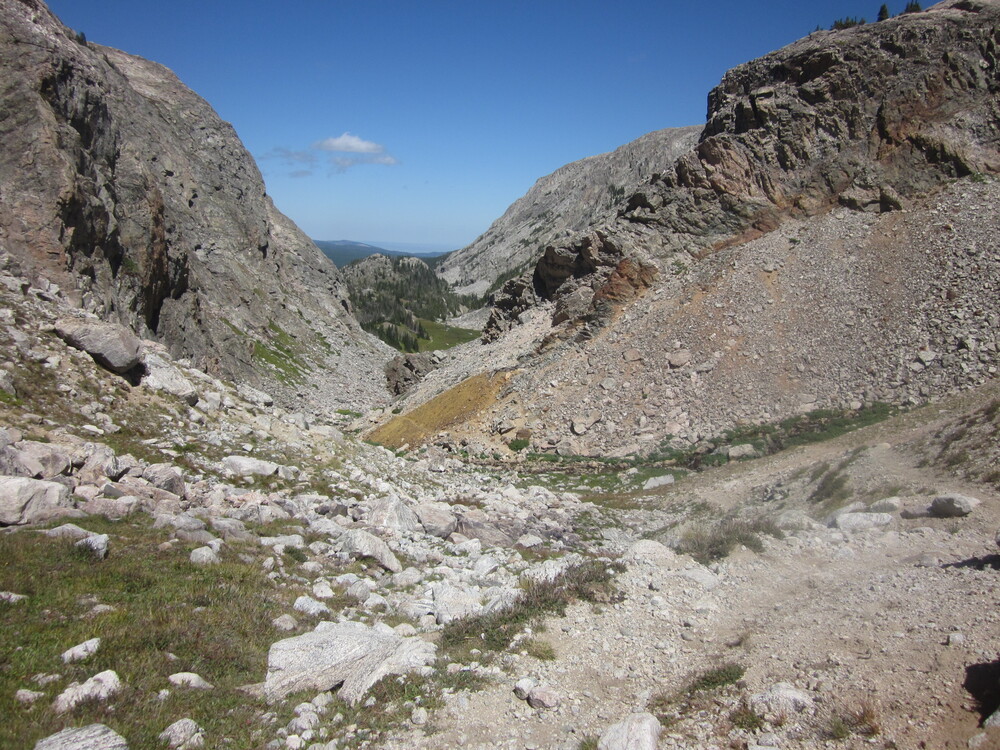
We ambled up Medicine Cabin Park with gorgeous morning sunlight, and stuck together when we began the true ascent up to Florence Pass. It was the kind of trail that I needed to hike first and think about second. A couple of times I froze in nervousness. A fall here would mean the last fall of one’s hiking career. I was intensely happy to be hiking uphill. Florence Pass is perhaps the best argument for hiking the Solitude Trail clockwise: I can only imagine that heading downhill on this terrain would be scarier. Full disclosure here: I am very, very nervous about heights.


It was an intense two and a half miles to Florence Lake. At one point I could look behind and see the thin line we’d walked. At the Bomber Mountain Memorial I thought we were nearly to the pass, but not quite.


From the map I’d been using, Florence Lake looked like a potential place to stay for a night, but in real life I can think of few places I’d feel less welcome. It’s barren and unwelcoming, though beautiful. The final ascent to the pass was much less gnarly than what we’d just come though; still, it was a relief to finally be headed downhill. From the pass I could look in each direction, but I didn’t linger long.


We reached a vista of Gunboat Lake where I began pointing out the moose far below. As we descended we watched them grow larger and larger, and multiply from one to two to finally three. We had to skirt the trail to give them more space, though they seemed to not care a bit that we existed.


We ate lunch by Mistymoon Lake, then began a long, long couple of miles to Solitude Lake. Along the way we were treated to views of Cloud Peak and saw where people leave the Solitude Trail for the hike up to the summit.


We found a rare treat: a bridge in the wilderness. They exist in many wildernesses, but only in special cases. It was fun to see and nice to experience. The lake itself had a couple of parties already set up, and I was happy to be moving on, though I enjoyed a sweet bit of trail design along the lakeshore.


The final miles to Poacher Lake were a slog to say the least. I think Florence Pass took a lot out of me early in the day, and I was ready to be done an hour before we were. We set up camp at Poacher Lake and happily didn’t need water, as getting to the water would have been a muddy, reedy challenge.


August 27, 2019
Trip mileage: 34.0
Coffeen Junction
Tons of elevation today, but we made good choices with breaks and snacks and more breaks. The biggest challenge today was getting up and over Geneva Pass. We woke up knowing that the pass was the goal, and we kept a steady pace to reach it.


About a mile from the pass we ate lunch and enjoyed the view. We then entered a very open, gorgeous mountainside meadow. Luckily the sky was friendly and we felt no danger. In fact, the hike up to Geneva Pass was deceptively easy. It wasn’t until we reached the top and looked down to what we had to descend that my heart skipped a beat.


The descent down Geneva was far too steep, often on crumbly soil or small pebbles that didn’t want to stay put. I inched my way down, though at least I was not in danger of falling down a mountain if I did lose my footing.
It was heading down this pass when I ruptured a blister under my toenail. I limped to the bottom where we took a long break. After some ibuprofin and a rest, I could face the trail again.


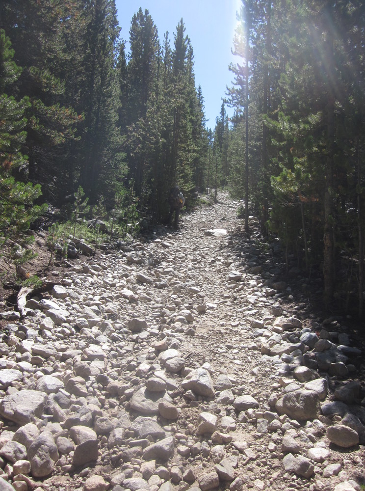
We came to an area near Crystal Lake where a microburst of wind or a tornado or something had decimated the forest. We were never more grateful for the hard work of trail maintainers. If not for their hard work, I would still be out there fighting my way out. Remember that this is within the Cloud Peak Wilderness, so only non-mechanized tools can be used. And it’s a day’s travel from a road. Seriously: kudos to all involved in this feat.


We reached a breathtaking view of Lake Geneva and spent the next half an hour hiking down the switchbacks. This is one area where the Nat Geo map is completely wrong. The map shows a straight descent to the lake, but a more accurate line would show some squiggles as the switchbacks were more than I managed to count. It was a solid 30 minutes of switchbacking.


We took a short break at Lake Geneva. If I did it over again, I would try to camp here, as it was amazing. We hiked alongside it to its north end where we took another break. I was beat after the Geneva descents (pass and lake) and it was all I could do to find a third or fourth wind to continue on. We camped near the trail to Coffeen Park in a grove of pines. For a long stretch of trail we enjoyed seeing ruins of old homes and sheds. I wished they could talk, but glad they couldn’t at the same time.


August 28, 2019
Trip Mileage: 44.6
Kearny Reservoir Overlook
Today was long and tiring and I wasn’t sure we were going to get here.


First thing in the morning we gained nearly a thousand feet, only to immediately lose it in descending to the Bighorn Reservoir ATV trail. It was disheartening to be leaving the wilderness area today but the trail we were on was much worse than that. I know it is not always possible to hug a contour line, but this just felt mean.
I lagged behind to take care of business and when I turned around, I was being watched by a bull moose. Good thing I took care of business before I saw him.


Then came the toughest ford of the whole hike, though that’s not saying all that much. Cross Creek was narrow but deep and fast. I was a little surprised that there was no bridge, given that we were outside the wilderness area and near an ATV trail.
The day had been rough already, but it was going to get harder. We began our next ascent back into the Cloud Peak Wilderness, which took hours upon hours. It was only 1300 feet or so, but it never stopped. I am amazed, looking at maps afterwards, to wrap my mind around 1300 feet, because it felt like significantly more.


We took a break high above Sheridan and gistrailblazer pointed out that we might have cell reception. To date we’d had not even a whisper. I did have reception, and was able to confirm plans for the end of the hike and let the world know we were still alive.


The trail then proceeded to drop down steeply, very steeply, to a hollow, only to immediately climb back up. Eyeballing the terrain and the conditions, I’m baffled as to why the trailbuilders didn’t hug the contour along the mountainside – it wouldn’t be appreciably longer to stay high.


Eventually we ascended for the final time that day to stunning Highland Park. The day had, thus far, kind of been demoralizing– but Highland Park made it worthwhile. This is my favorite place in the entire wilderness.


We stayed as long as we could, then began the descent. We could see the lake we were aiming for – Lake Winnie – far beneath us.


When we got there, Lake Winnie didn’t feel like a good place to stay. There was nothing wrong with the lake. I think we were just zombies at that point and we just kept walking. And walking.
We left Cloud Peak Wilderness again and popped out onto a woods road where we found a great campsite overlooking Kearney Lake Reservoir.


August 29, 2019
Trip Mileage: 56.4
Elk Lake
This was a hot, hard day.


It began benignly enough with beautiful morning light, a gentle walk near the reservoir, and some actual Solitude Trail signage – first time we’d seen the name on a sign. The first four miles, in fact, were downhill and fairly scenic considering they were outside the wilderness boundary.


We also enjoyed numerous bridges – a perk of being outside that boundary.
However, there were some map discrepancies that I’d been noticing all morning. For example, the cutoff via Story Penrose Trail was farther east than the Nat Geo map showed. I even turned on my phone to check that we were on the right track because things felt so off.
From there, although I didn’t have tracking on, I am certain that the maps are very wrong. The Story Penrose route goes to the Gaging Station and thus, the mileage around Willow Park Reservoir is longer than the map indicates. I’d read about counter-clockwise hikers getting lost here, and I can see why. The maps are simply wrong. No one using their map to navigate the Solitude Trail would end up at the Gaging Station, but that is where it goes.


By the time we finally worked our way around the reservoir, we were about to begin the worst four miles of the Solitude Trail. With instances like Geneva Pass or Florence Pass, the hiking was hard, but there was payoff – both passes were actually pretty impressive trailbuilding too. But the route of the Solitude Trail south of Willow Park Reservoir has not a single redeeming quality. To be fair, every trail has some section which is a connector, which has no inherent charm. Usually it’s not as malignant as the Solitude Trail’s suck section, but every trail has one.
In fact, it even has an out-of-place sign, which angered me greatly, because I thought we were farther along than we were. There is no trail to Frying Pan Lake where this sign is: not a trace.

You can tell from the glare of that photo how hot and miserable it was.
By the time we reached the wilderness boundary, I was pissed: angry at Nat Geo for a sloppy job, irate at the Frying Pan Lake sign, and also upset because the trail to Gem Lake was completely gone. We were not going to Gem Lake but the trail was a pretty important landmark that we were counting on.
Then, as we entered the Cloud Peak Wilderness again, instead of it being a pristine experience, there was cow shit all over everywhere: in the trail, in the water where I wanted to get a drink, over everything. Further research proved that it’s legal to use wilderness for this purpose, which makes me so angry.
We eventually made it to Elk Lake which had moose swimming in it. Because we couldn’t get water at the cow-shit-infested stream, I had to scare the moose from the water when I went to fill up there. It felt like a cherry on top of the crap sundae of the past few hours.


It was crazy windy and the forecast for the evening didn’t seem so great. We set up camp hurriedly and hunkered down for a long, windy night.
August 30, 2019
Trip Mileage: 64.6
Soldier Park Graves
I could barely sleep due to anxiety. There’s something about windstorms that freaks me out. Mostly I was worried that we wouldn’t be able to get over Ant Hill. Although we were sleeping at its base, if the weather was bad, we wouldn’t be able to get over it.


Luckily we awoke to sun and quickly-moving clouds. With a chance for rain later, I hiked far too fast at first. As we ascended Ant Hill, I finally got a good glimpse of the clouds surrounding us and determined we were in no immediate danger. It felt good to slow down after that.
We watched Elk Lake disappear and saw a herd of real elk run across the mountain. There were dozens, all moving too quickly to get a good picture.


We had only five miles to go before we completed the loop and the first half of that was all uphill to 10,000 feet yet again. It was unreal to think that on the other side of this giant mountain was the car.


After summiting the saddle of Ant Hill, we walked cross-country until we met up with built trail again. Then it was a long downhill to the stem of the lollipop loop, the place we had initially turned left and decided to hike clockwise.


Ending this trail was no big moment; after all, we still had several miles to our car, and due to our schedules there was no hurry to end. We decided that rather than seek a place to camp in Buffalo, we would just camp along the trail and hike out the following day.


We bid farewell to the Solitude Loop and the Cloud Peak Wilderness and hiked downhill to Soldier Park, where we set up for the night. It was quite early in the day. I demolished more books (nine total read this hike) and enjoyed being inside when the forecasted storm did in fact hit.
August 31, 2019
Trip Mileage: 67.1
A quick jaunt back to Hunter Trailhead; this time we elected to take the longer but drier-feet route along ATV trails. We were back to the car quite early and enjoyed changing into clean clothes.


Summary and advice:
Overall, this is a sweet little trail that can easily be done with a week of vacation. If you’re looking for more miles, there are a ton of ways you can add in side trips, either on trails or bushwhacking. I recommend the Circle Park loop, which is quite close to Hunter Trailhead by car. I wish we’d had time to do the side trail to Seven Brothers Lakes or to do the high-elevation lakes loop near Geneva Pass. There also would be value in adding a couple of days but not intending to do any more mileage: it would have been lovely to camp by Crystal Lake or Lake Geneva, but we pushed on. Splitting up the sloggier bits would also have been wise.
- If you can get your car to Coffeen Park (4WD required), it’s possibly a better place to start than Hunter just because it cuts down on your hike in. But Hunter is so convenient, and the presence of people at the adjacent campground made me feel safer in leaving a car there.
- We were able to use a mileage chart made by my friend Tim. He compiled it using a book and maps and it was a total blessing. If you have time to make something similar, I highly recommend it.
- There’s no good reason to trust the map. Especially in the Willow Park Reservoir area. Especially if you are counter-clockwise.
- Speaking of, clockwise is probably your best bet, though I’d still rather be counter-clockwise on Geneva Pass.
- There are a ton of moose out there. We saw a dozen or so. Be aware.
- Know the forecast and camp carefully. Some places on the map look inviting for camping but would be a disaster in bad weather.
And now, our superlatives:
Favorite campsite: Kearney Reservoir Overlook (g), Soldier Park (Jo). Strangely, these were both outside the wilderness boundary!
Favorite pass: Geneva (g), Highland (Jo)
Favorite other place: Sheridan Overlook (g), Highland Park (Jo)
Favorite animal encounter: Gunboat Lake moose (both)
Most unexpected thing: Highland Park (g), all the old cabins near Coffeen Park (Jo)
Favorite lake: Elk (both)
Worst place: Switchback campsite (g), Frying Pan Lake sign (Jo)
Seriously. What was up with the Frying Pan Lake sign?
