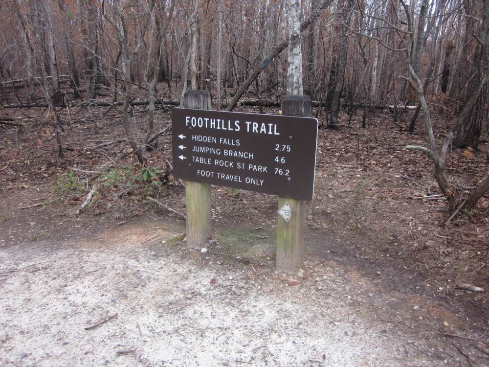
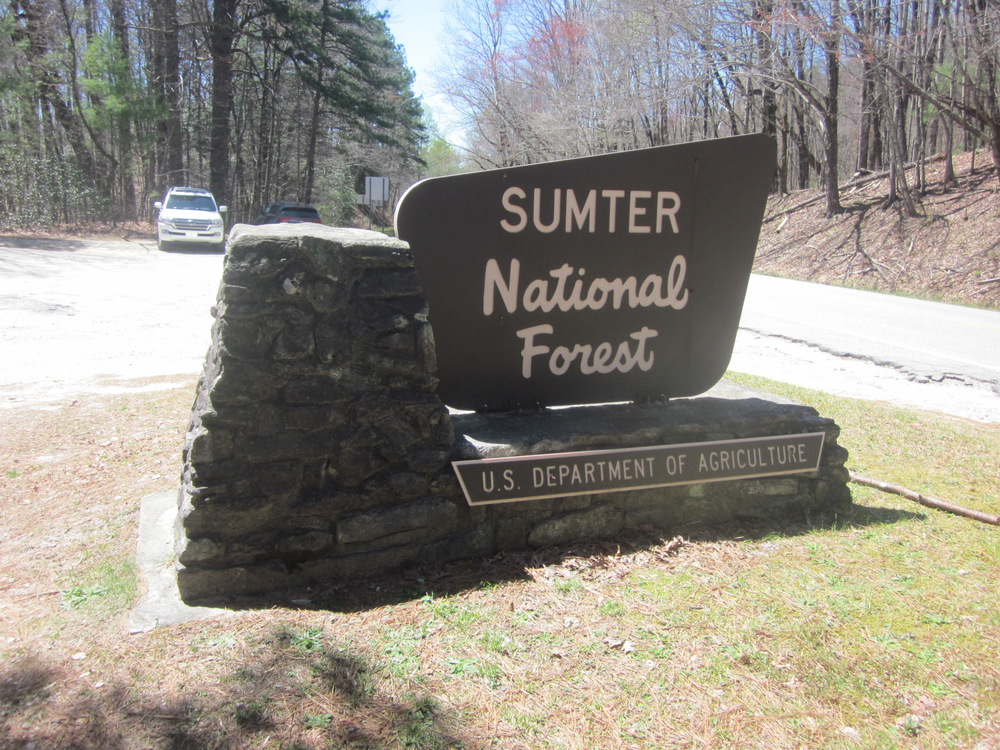
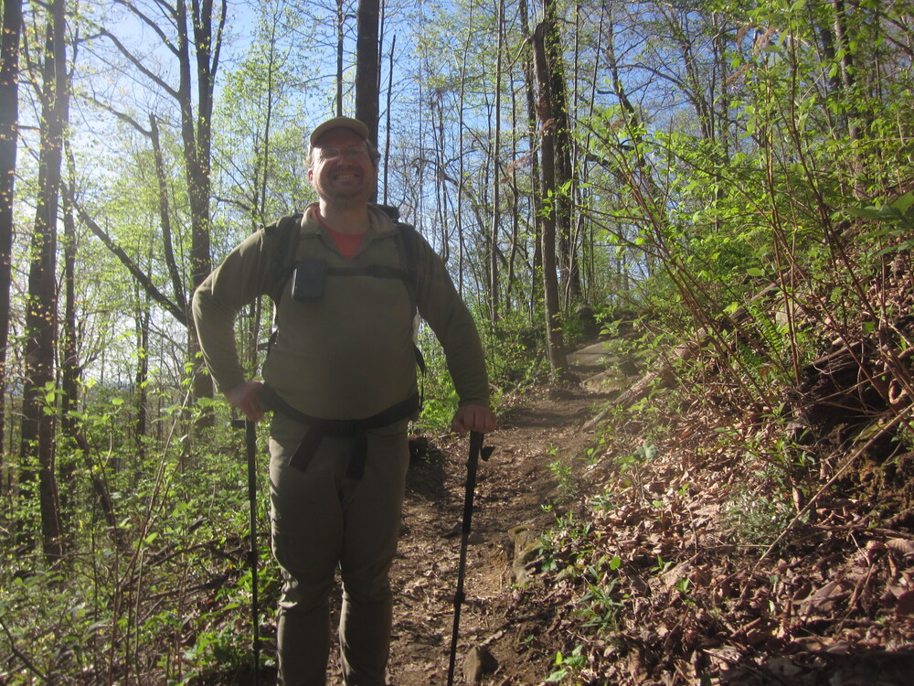
In early April 2022, gistrailblazer and I thruhiked the Foothills Trail eastbound, from Oconee State Park to Table Rock State Park. This trail is in South Carolina and North Carolina. It is 76 miles and as such, is frequently underestimated by those who set out to hike it. Maybe even us.

Below is more information about our experience. Many of the photos were taken by gistrailblazer.
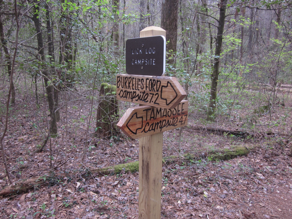
Day 1: Oconee State Park to Licklog Campsite, 8.3 miles
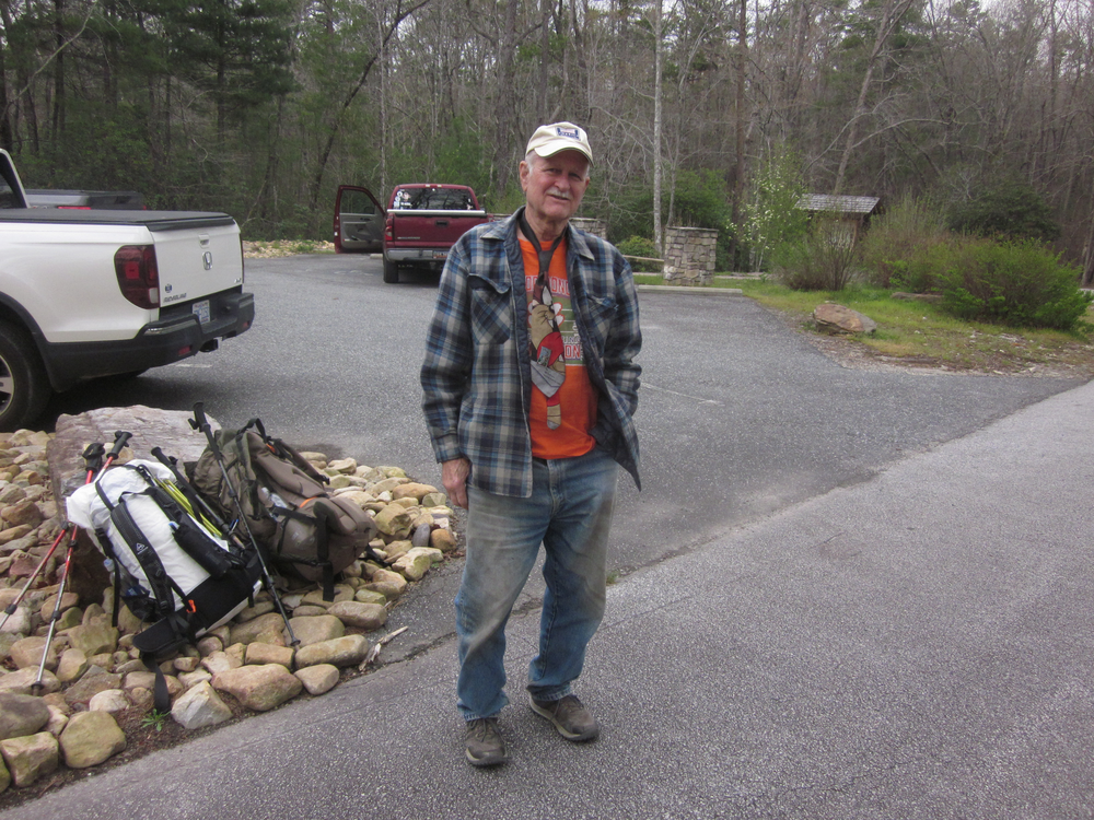
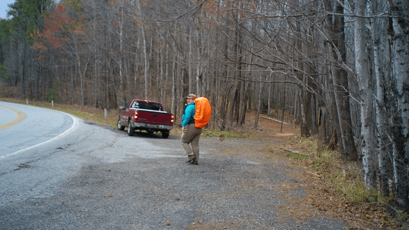
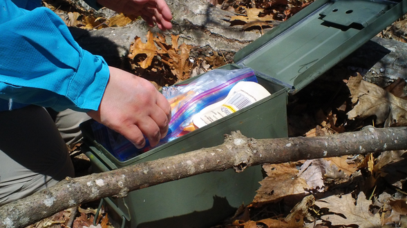
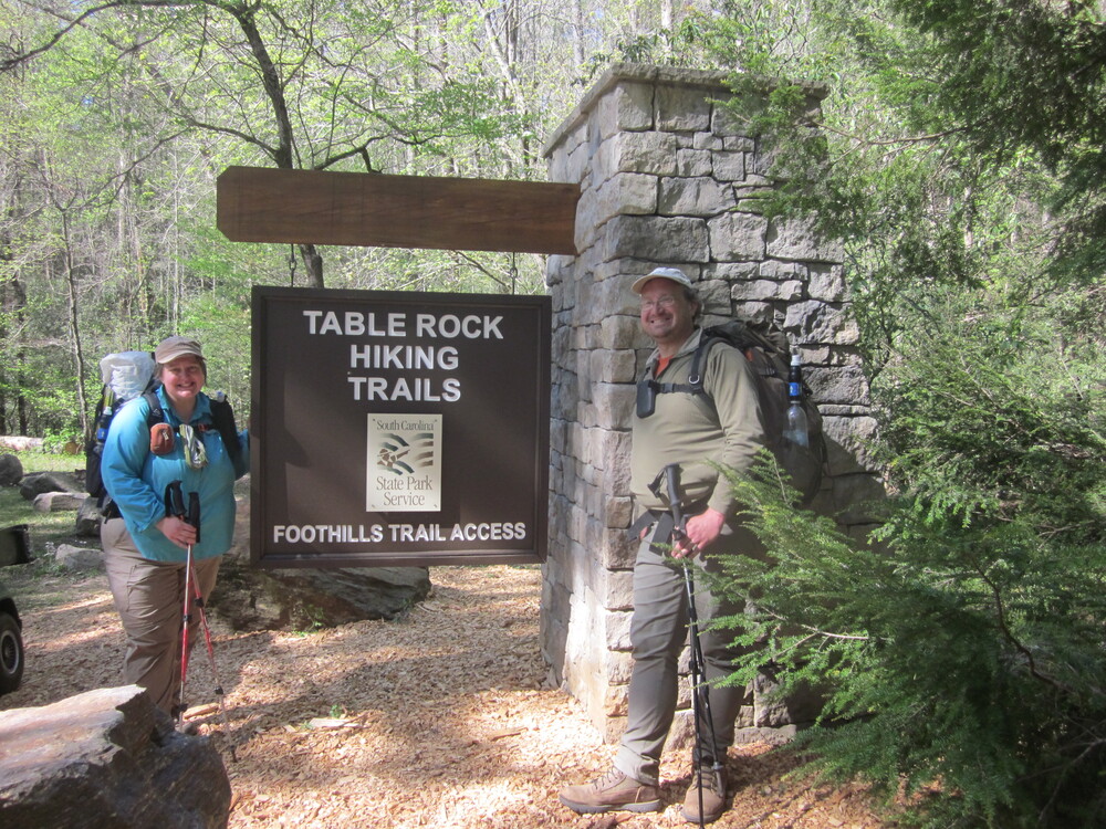
We met Taz at Table Rock State Park and left our car in the designated lot. Taz is an absolute legend on the trail — a very cool guy who told us stories and interpreted the landscape. He helped us stash a resupply in the woods to lighten our packs. Because gistrailblazer and I were planning to go slow on this hike, our food cache meant we would not need to carry a whole week of food and for that we were very grateful. We feel lucky to have had the chance to meet Taz and we are thankful for his help and stories. Our experience was deeply enriched by him.
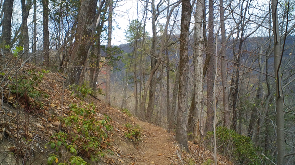
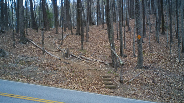
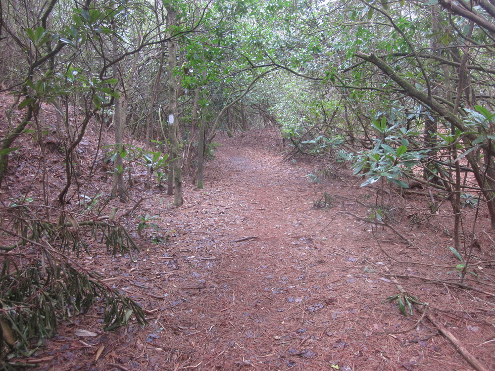
We started at Oconee State Park a bit after noon – earlier than we thought we would be on trail. I had assumed we would only make it to the first campsite (4 miles in) due to the shuttle, but we got to the campsite for a late lunch and kept going. The trail was inviting – well-marked and well-maintained.
At the first road we crossed, we saw Taz! Again! I ran over to his truck to say hi. He had been dropping someone else off. I could hardly believe it — if we had taken 20 extra seconds at lunch, or hiked a hair faster or slower, we wouldn’t have seen him again.
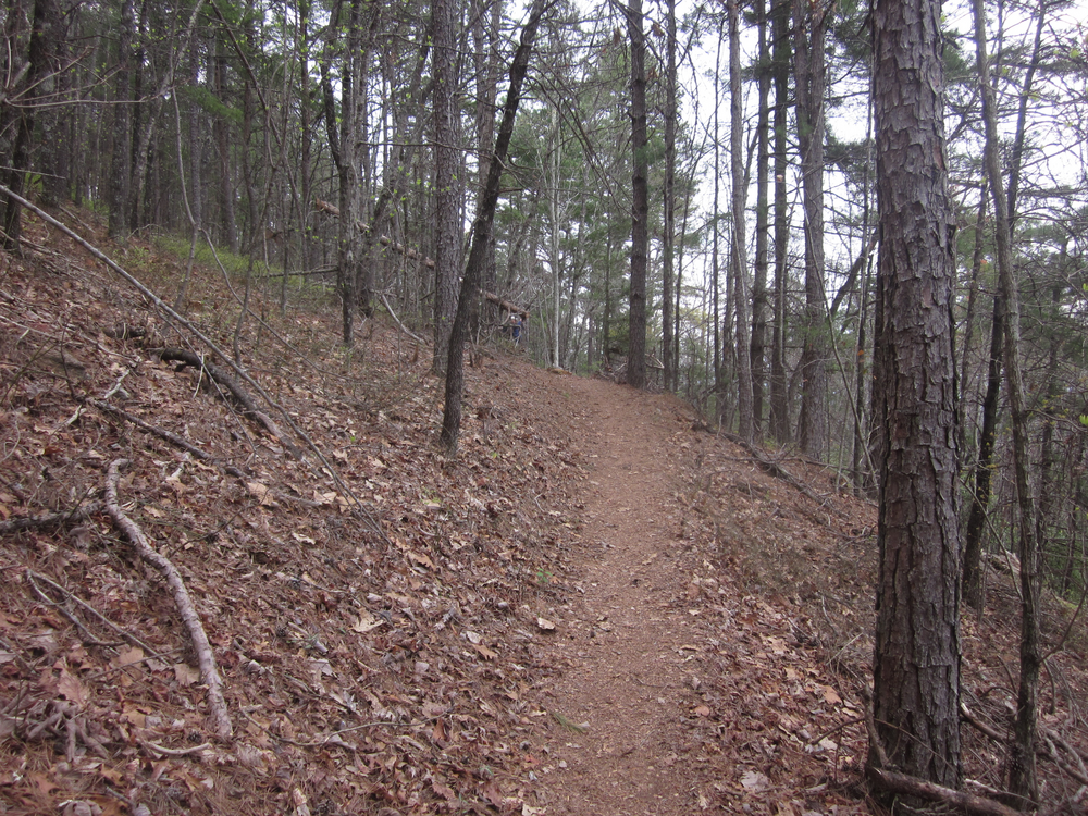

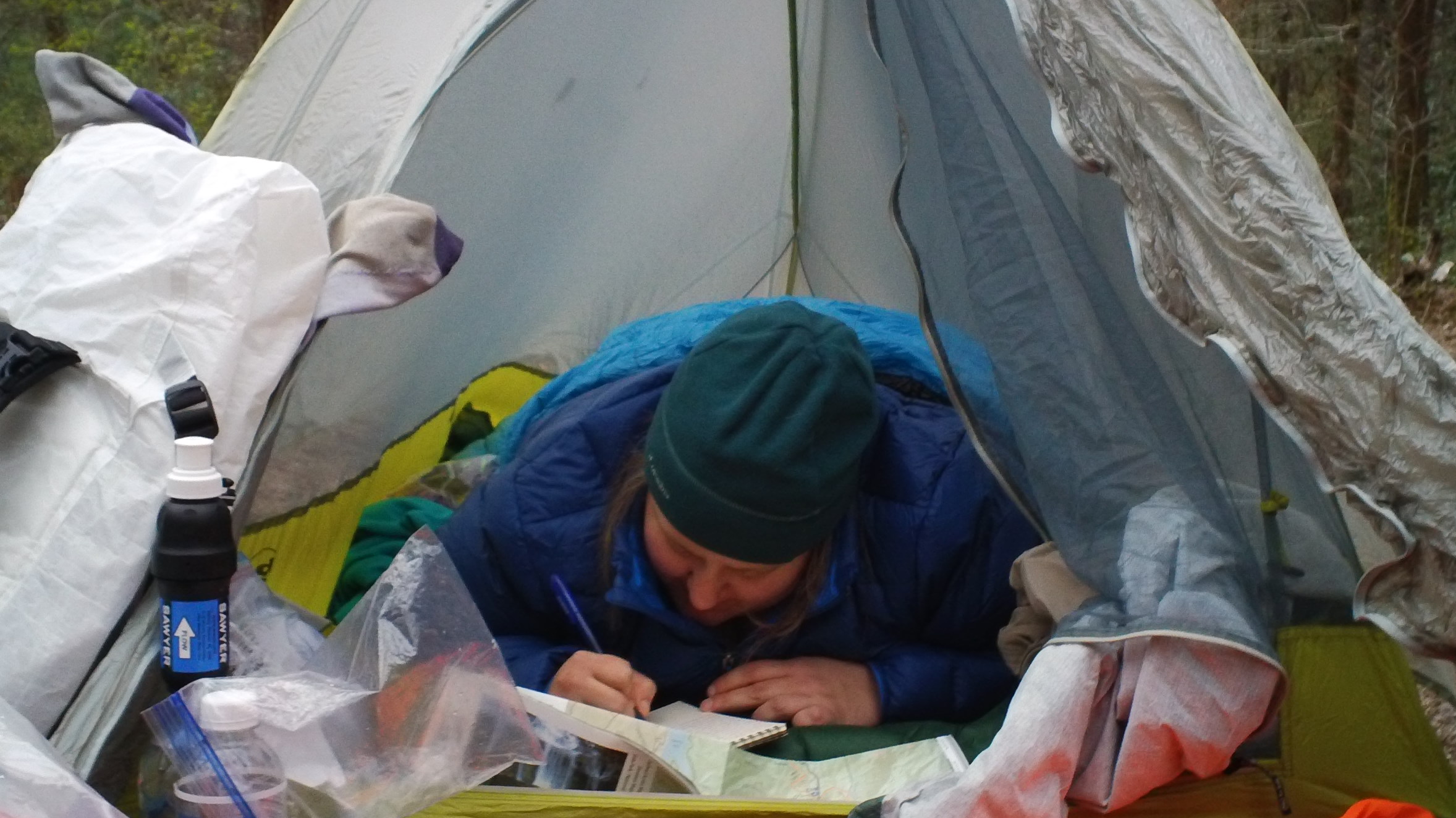
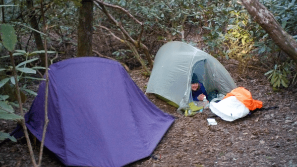
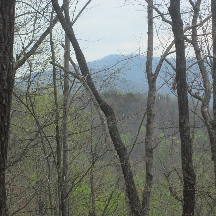
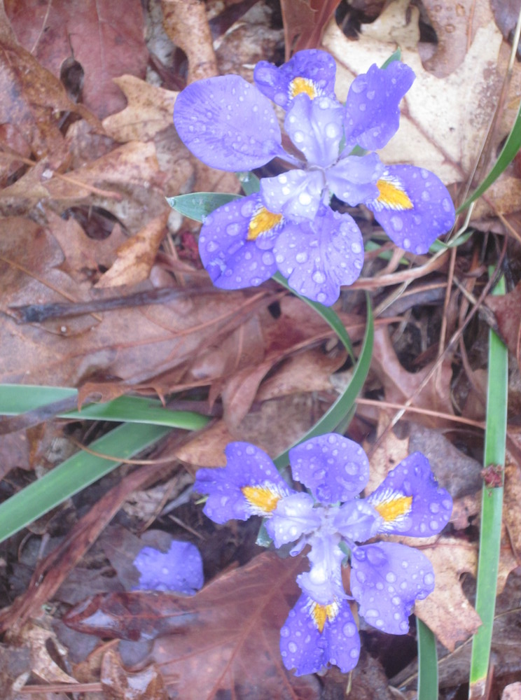
We hiked through a long burned area which was still scenic. All along the trail I was seeing irises, my favorite flower. Eventually we arrived at Licklog Campsite, which we had all to ourselves. It was very, very cold so I did not linger outside after I ate supper. I crawled in, grateful for my puffy jacket and 10 degree sleeping bag. I needed them. All the cold from the steep hills around us sank down by us and into our bones.
Day 2: Licklog Campsite to Rhododendron Stream, 12.7 miles
Day 1 lulled us into a false sense of security. I had heard that the trail gets harder as it travels east, and Day 2 was the first taste of that. Yes, it does get harder!
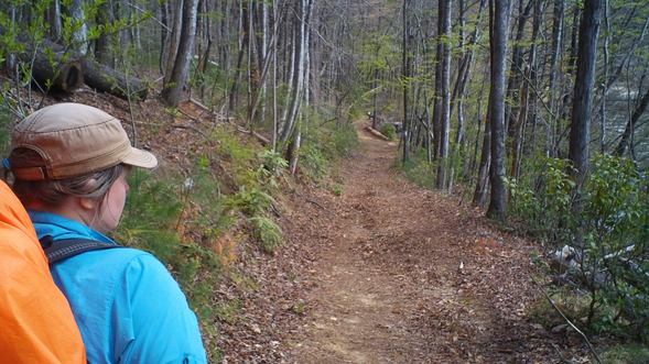
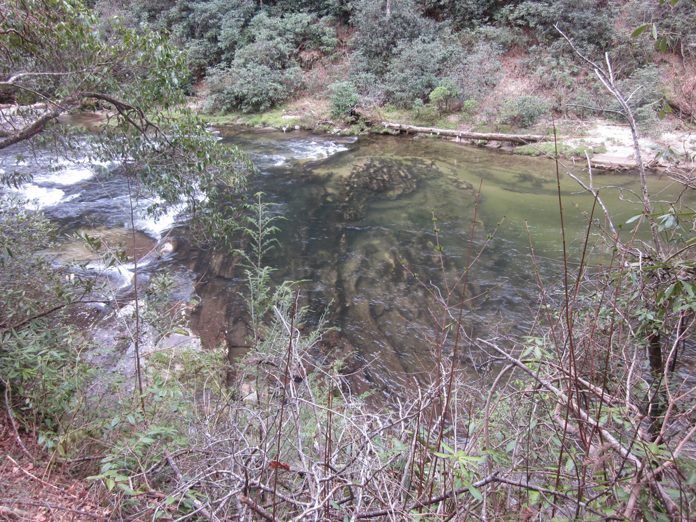
After a morning climb and then descent to the scenic Chattooga River, the trail got narrower and more challenging. It was also a weekend, so we often met people on skinny trail and needed to negotiate passage. Because the trail hugged the river, there was an enormous number of small but belligerent up and down portions, often in mud, as the trail had to be built in places where the river could not erode it. As a result, it felt like most of the day was climbing or descending. Small climbs add up quickly.
But the real noteworthy challenge was the freezing rain/snow combo. It was very hard to regulate our temperatures because we were working quite hard, so we were hot, but if we tried to take off a layer, we began to freeze. The bright side of this is that we just kept going. There was no incentive to take long breaks.
Late in the day we had a 1,000 foot climb when temperature regulation was especially challenging. The climb was fairly well-graded and pleasant, with a small water source with a bloated mouse in a bucket. Luckily we could get water without using the bloated mouse bucket. One other bright side of the climb was that it took us next to Ellicott Rock Wilderness, so we diverted to visit it.
We pulled over at a little stream covered by rhododendron which had clearly been used for camping but is not one of the large campsites which exist along this trail. It was not the flattest place I have ever camped, but it was pretty good. We were so tired that it didn’t need to be perfect.
Day 3: Rhododendron Stream to Whitewater Campsite, 11 miles
This was one of the most challenging days we had on the trail. It started easily enough with gentle terrain, Hiker’s Peril Falls (the best-named waterfall on the entire trail), and an actual (pit) toilet at a trailhead which gistrailblazer did not use and he’s still disappointed to this day.

We climbed to the North Carolina/South Carolina border. At the top of the climb we rested and I had cell reception for the first time. It was nice to sit in the sunshine and tell people I was, in fact, alive.
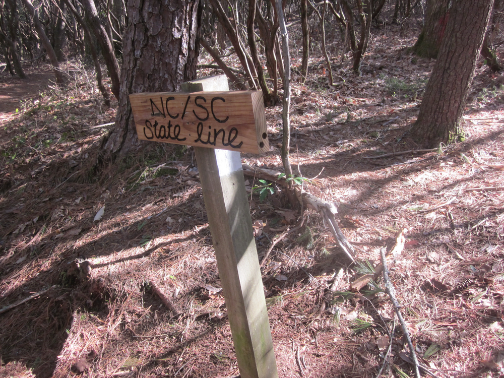

The long descent to Whitewater Falls went on a bit, but it had lovely views and even some benches! We knew we had food and toilets awaiting us, so the long down hardly mattered. Finally we arrived at another NC/SC border (there were several on this trip) and retrieved our food. We ate a picnic lunch and we dried our boots, filtered water, repacked, and just rested. There were several covered picnic tables and it was the best thing ever. Lunch took us a delightful hour and a half.


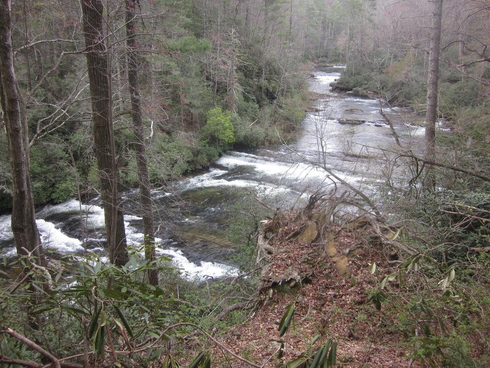
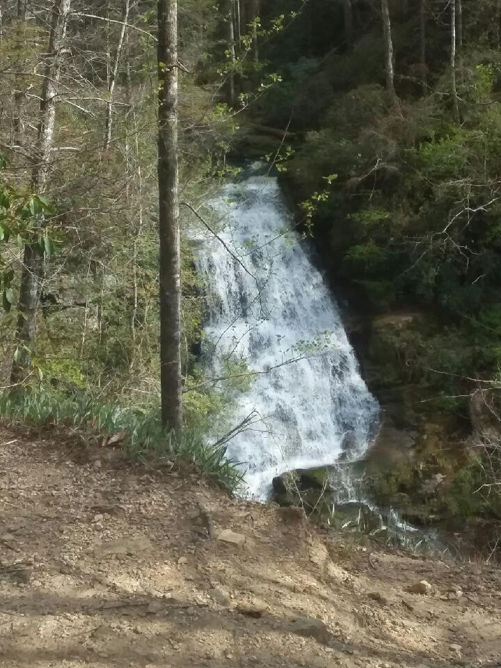
We diverted to see Whitewater Falls – truly spectacular.

The trail from the falls to Whitewater Campsite was, I would say, the hardest stretch of the entire Foothills Trail. First, the descent from the falls viewing platform to the river was a plummet. It was knee-grindingly, toe-poundingly steep – though to be fair, it was also very hot, and my memories are never quite fair when I feel I am going to burst into flames.
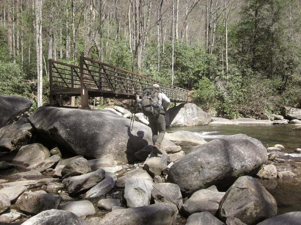
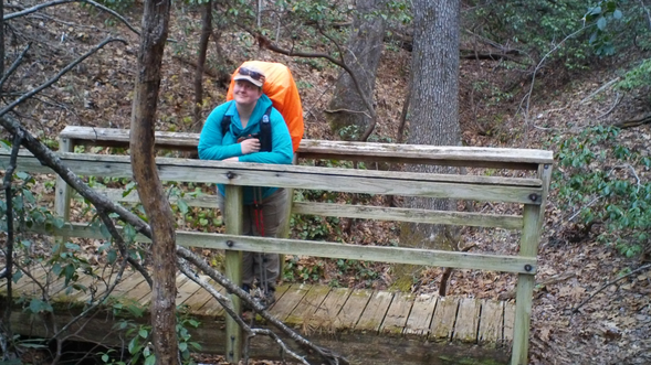
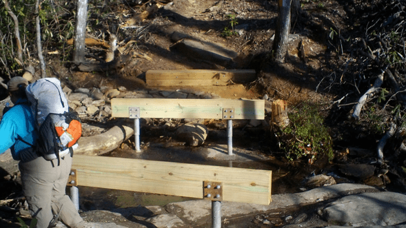
When we finally scraped our way to the river, there was a funky bridge to cross. I struggled here, because I was not tall enough to do what the rock was demanding of me. Eventually I hauled my pack up onto the rock where gistrailblazer was able to grab it, and then he helped me ascend. Had I slipped off the rock, I would have gone into the fast-moving river or onto rocks. I believe this area received work in late 2022, and that it is not as dramatic as it was in early 2022.
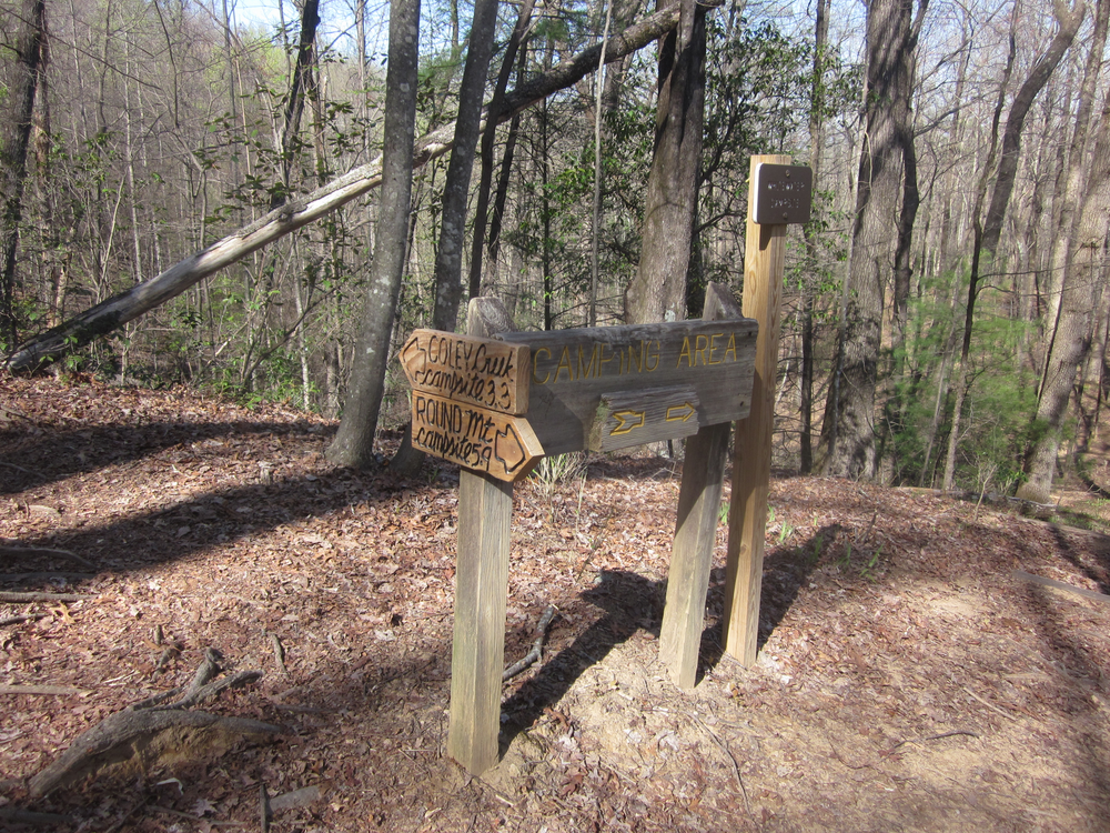
The next couple of miles were rough. The trail followed the river and featured many old structures. It was slick and occasionally felt like an obstacle course. When the trail finally leveled off, my mood immediately improved. We were close to the campsite and getting there was a triumph: there was a small piped spring, several sets of benches, a bear cable, and soon company: Russ and Giselle who were a total hoot, and another couple who came in late. It was our first shared campsite, and it was a nice experience.

Day 4: Whitewater Campsite to Bear Gap Campsite, 10.5 miles
This was a very long day. Despite hiking from 8 – 4:45, we didn’t even hit 11 miles. Mileage on the Foothills Trail often seems understated – it feels like significantly farther than it is. I’m not saying the mileages are wrong; the miles just make you work for them!
We took a long lunch break at Bearcamp Creek. In the afternoon there were many miles on old roadbed (“troad” = trail-road). Though this terrain was fairly gentle, it was winding and felt never-ending.
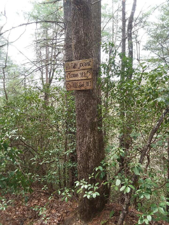
But! We hit the halfway point. And we had more than half our time remaining, so we knew we could have some easy days in our future. That’s a nice feeling.
Toward the end of the day we arrived at Horsepasture River, a scenic spot with an insane number of steps. It was a hard way to end the day, but I managed to laugh about it. A little.

The miles between Horsepasture River and Bear Gap were some of the hardest we did. Not because they were really that tough, but because we were exhausted.

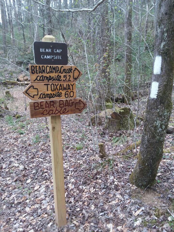
We were relieved when we arrived at Bear Gap Campsite. There was only one other camper there, but by nightfall there were nine of us. Wow! Popular place.
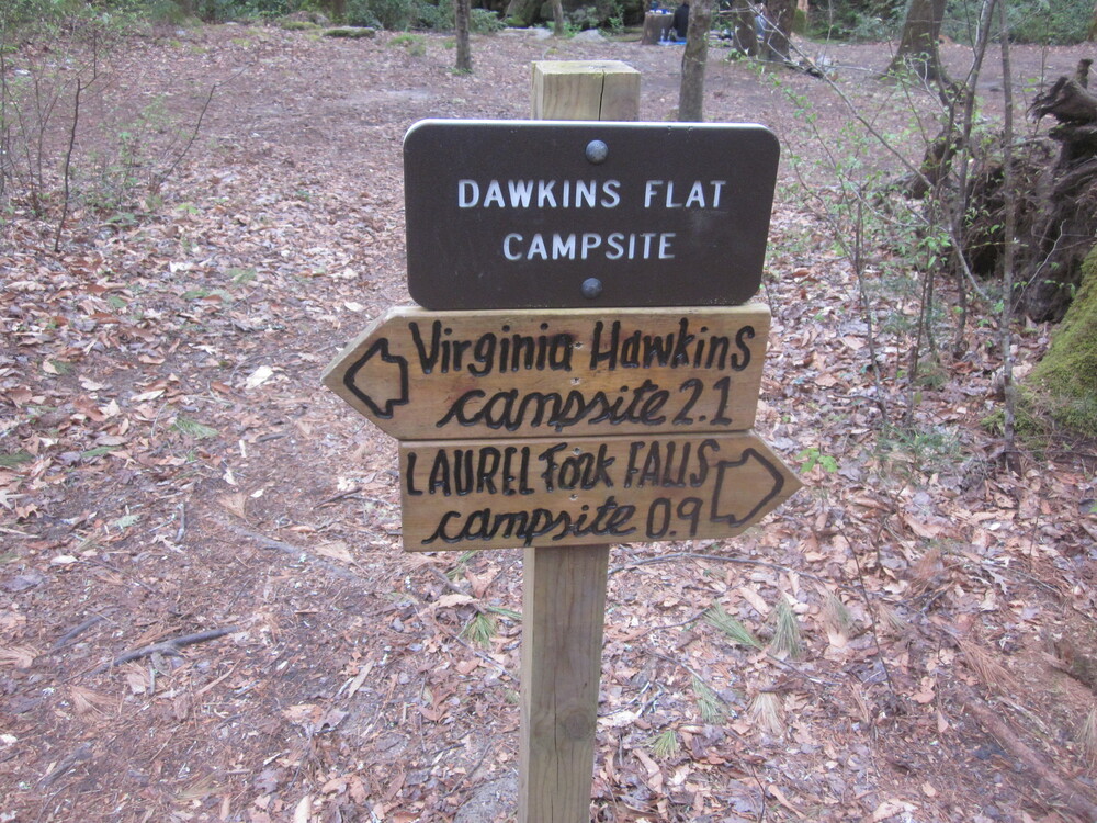
Day 5: Bear Gap Campsite to Dawkins Flat Campsite, 12.3 miles
We got an early start to beat the heat, but by the time we arrived at Lake Jocassee and the Toxaway River, I was wet with sweat and a little bit miserable. A long lunch near the shore helped – I cooled down and got food. I was bummed that we could not stay at Toxaway, which I think is the most pleasant campsite and certainly the most unique. But we had miles to go.

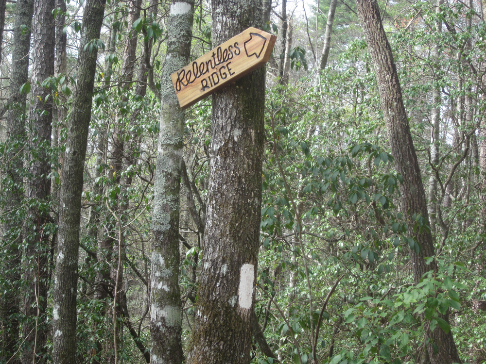
It was good to lighten our packs before the climb up Heartbreak Ridge. Earlier that day we had descended Relentless Ridge, but Heartbreak has the worse reputation. It’s a long, long climb on steps.
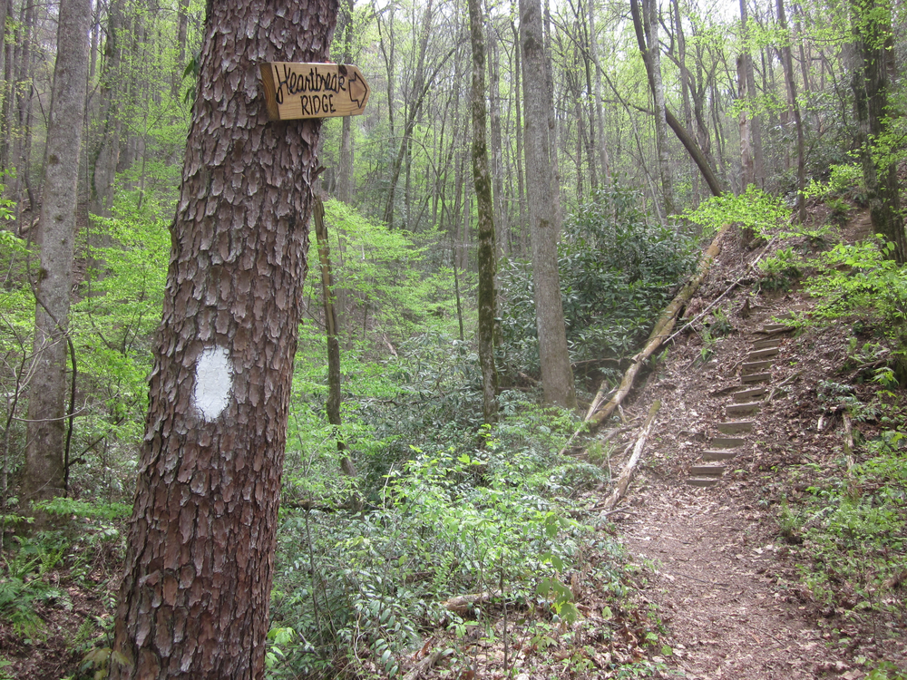
The area gets a lot of attention online due to its name, but as one of the cool hikers we met said, “The entire Foothills Trail is Heartbreak Ridge!” Thinking back to Horsepasture River, I agree. The names give these hills power, but the whole trail is relentless: I thought the harder climb was east of Heartbreak Ridge: a long, steep, climb with fewer steps but more elevation.
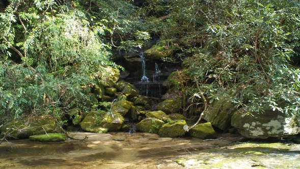
We got to see Laurel Fork Falls and when we arrived at Dawkins Flat Campsite, my favorite mini-falls of the whole trip. Might have something to do with sitting in the water and soaking my feet. We shared the campsite with two women from Florida who we had been leap-frogging since the morning of Day 2. They’re pretty awesome.
Day 6: Dawkins Flat Campsite to Sassafras Stealth, 9.3 miles

By 8AM, it was already hot and muggy and we’d hiked a couple of miles through the Laurel Valley to Virginia Hawkins Falls. It was tough to drink enough water today, especially when one source we were relying on was shallow and impossible to get to. This was really our fault – there’s no reason to wait until the last minute to get water even when water is very plentiful like it generally is on the Foothills Trail.

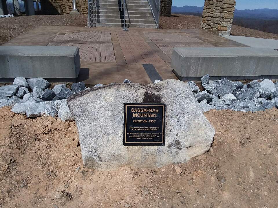
Today our goal was to set ourselves up for success for the following day. We had one more major climb of the trip: Sassafras Mountain, the highest point in South Carolina. We saw it looming for much of the day. Although we were not aiming to summit it until the following day, with a storm on its way, we needed to ensure we were in a good position to ascend early the following morning.
And so, we kept hiking past a gorgeous campsite to a less gorgeous campsite on a knob above Chimneytop Trailhead. It wasn’t my favorite place I ever camped, especially because it was windy and there were boar (?) snuffling about at night, but it got us to within 1,000 feet of the mountain’s summit.
Day 7: Sassafras Stealth to Long Ridge Campsite, 7.2 miles
The forecasted rain did not hit until 5 minutes before gistrailblazer was packed up. Poor guy. After thousands of nights of camping, I was able to get packed up before the rain fell, but I have totally been in his situation, wishing that I could just have had a couple more minutes.
The storm was supposed to hit around 11AM and we had no intention of being the highest people in South Carolina when it came. Thanks to our extra endeavor the night before, we were at least halfway up Sassafras Mountain and it seemed as if we ascended the harder half the day before. (Or maybe it was because we were freshly-rested in the morning!) There was even one stretch of the climb that leveled off where we could hike instead of trudge. The temperatures were cool and the rain was light and tapering off. It was okay.

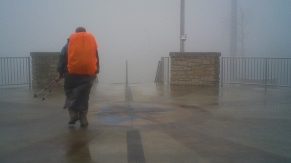
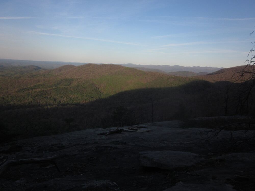
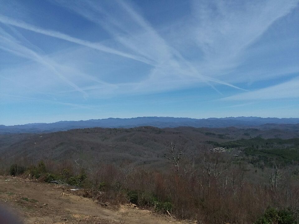
By the time we reached the summit, it had nearly stopped raining and we walked through a low-hanging cloud obscuring the view – but it wasn’t lightning, so I could hardly have cared less about the lack of view.
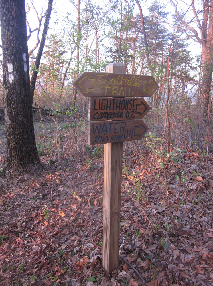
We availed ourselves of pit toilets, threw away our trash (this is VERY exciting when you’re a hiker), and took a break, meeting a couple of other thru-hikers who were heading for Lighthouse Campsite. We intended to stay there as well.

When we got up to hike again, it was a long descent, well-earned after our morning climb. We passed the Palmetto Trail, an old homesite (we didn’t explore because a large group of Scouts were there and were having a grand time — didn’t need to disrupt the fun), and an old toll road.
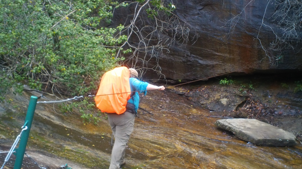
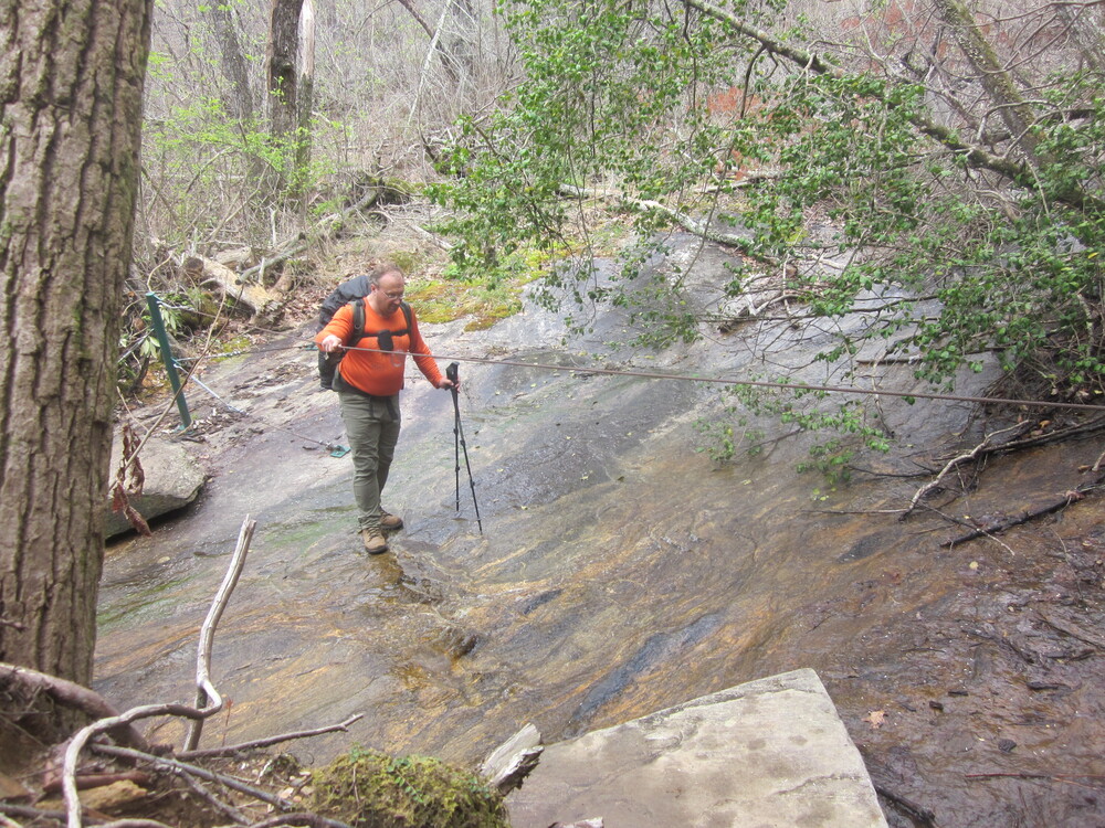
We caught glimpses of large rock faces and eventually came to a very interesting water crossing where a cable was strung up to help us. While the water was shallow, the rock was slick with water and algae, so it was a little more disconcerting that it looks. We stopped to filter water, and filter water, and filter water.
We arrived at Lighthouse Campsite and assessed that it was very small, and two hikers with a dog were already there. I would always choose to not share a site with a dog and to not be crammed in. We decided to continue on a little bit to the last legal camping area of the trail.
It. Was. Perfect.
This was the day we had waited for – the clouds literally parted, no storm happened, and we got to take half a day off and just enjoy the view, lounge around the site, read, and nap. We could easily have hiked out to the car… but… why?
Day 8: Long Ridge Campsite to Table Rock State Park and civilization, 4.9 miles
Wind began howling last night the moment the sun set. I thought my tent was going to collapse. I did not get much sleep and almost regretted not making a run for the car — almost. Around 3AM the wind died down and I finally got some good sleep, instead of the half-sleep I was getting before.
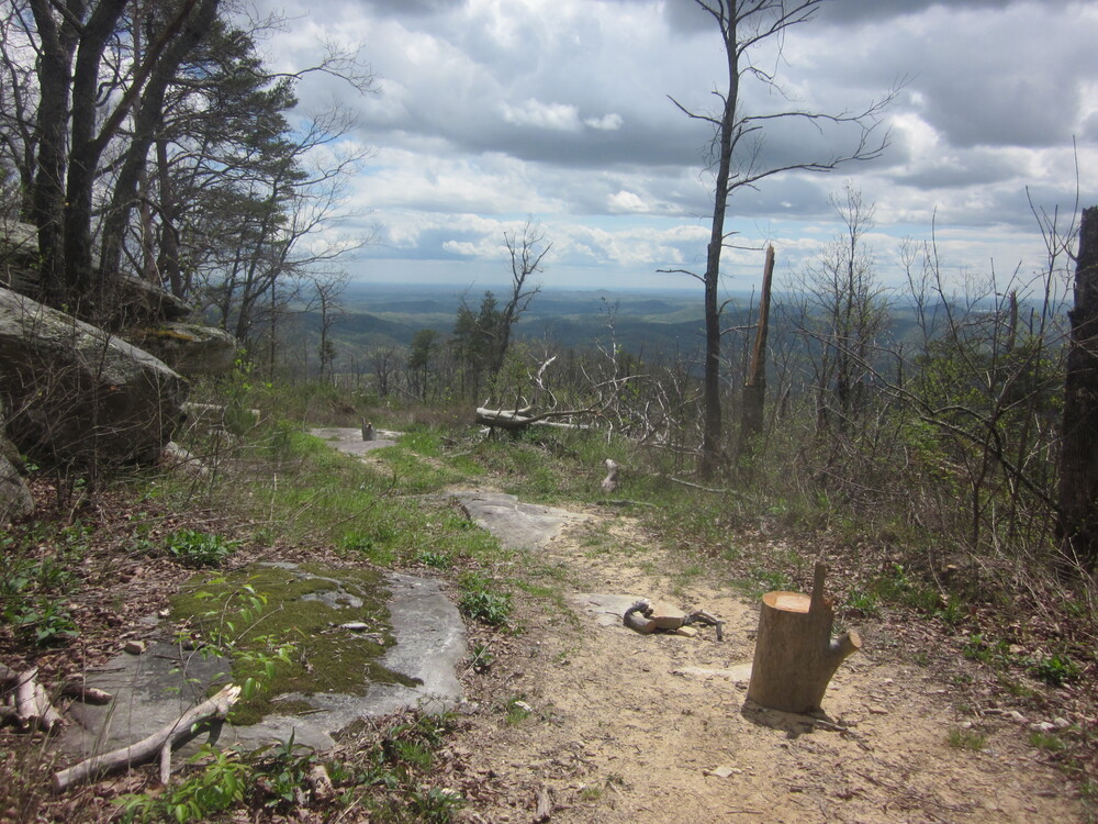
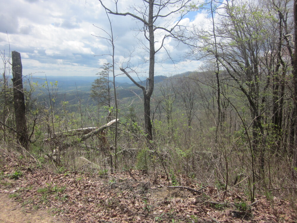
But the day dawned most beautifully and we had a great time hiking up towards Pinnacle Mountain. The descent to Bald Knob was some of the most rewarding hiking the Foothills Trail has to offer.

So. Pretty.
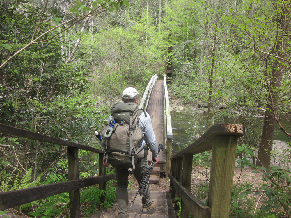
It is obvious that this is a very well-loved piece of trail. We passed the beginnings of a new bridge as we descended. As we approached Table Rock State Park, we began to see more people and more infrastructure.
And then we were there! We were done!
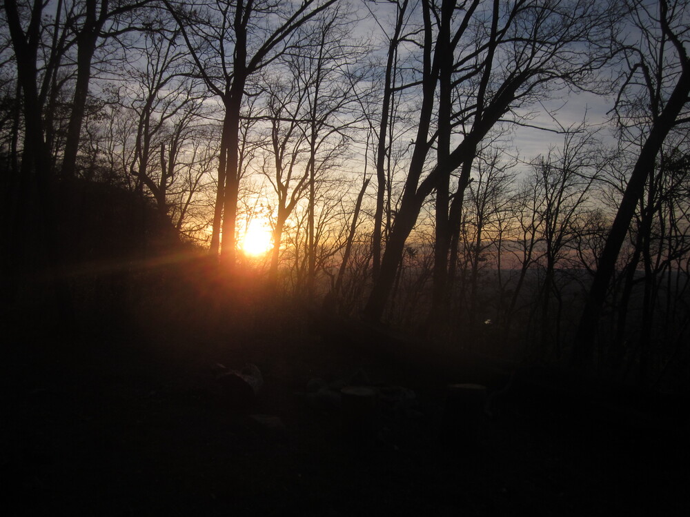
But wait, there’s more! We got into the car and drove up to Sassafras Mountain to get the view we didn’t get in the rain cloud. It was pretty great.
I am grateful for the time I spent on this trail – it was a great way to get to know South Carolina, a state I had never hiked in before. I appreciated the community of hikers we met – some really great people who we loved seeing. And now, here are some things which stand out.
Foothills Trail Superlatives:
Hardest section:
Someday – Whitewater Falls to Whitewater Campsite
gistrailblazer – Climb up Sassafras Mountain
Favorite section:
Someday – Sassafras Mountain to Long Ridge Campsite
gistrailblazer – Last day of the hike within Table Rock State Park
Favorite campsite:
Someday & gistrailblazer – Long Ridge, probably because we spent half a day there
Best water:
Someday – a drip off the rocks above Horsepasture River (I was hot)
gistrailblazer – the pipe at Whitewater Campsite
Favorite waterfall:
Someday & gistrailblazer – Whitewater Falls
Favorite structure:
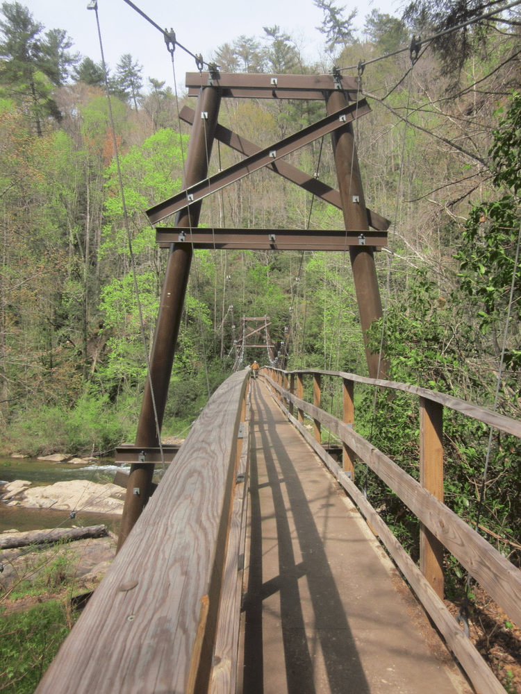
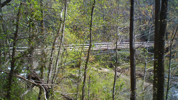
Someday – the long suspension bridge over Toxaway River
gistrailblazer – the platform at Sassafras Mountain
Most challenging aspect of the Foothills Trail:
Someday – relentless steep terrain with wood steps
gistrailblazer – at times, excessive elevation change
Favorite food:
Someday – loaded mashed potatoes
gistrailblazer – buttery mashed potatoes
