Planning a hike on the Ozark Trail? Check out Ozark Trail Advice for more information.
October 12, 2017
Day 0: Getting to the Ozark Trail
There is something uniquely terrible about having to wake up in the dark to get to the airport on time. But thanks to Mom for getting me to the Skyline Shuttle, I at least didn’t have to drive. Before the sun rose, I was well on my way south for a two-week adventure in a state I’d never really explored.
Why the Ozark Trail? It actually wasn’t my plan for 2017 — I’d planned to go west to the Tahoe Rim Trail for my first real experience with hiking at noteworthy altitude. However, the intense snow levels this year made me change my mind; I’m not ready for that.
In 2015 I’d researched the OT, and then this spring OT volunteer “Spiffyguy” visited with me at work and I was able to talk to someone who really, really knows the Ozark Trail. He (perhaps foolishly) offered to help out if I ever came south to hike the OT.
My gear and I arrived safely in St. Louis, and soon I was picked up by Spiffyguy who was my ride to the southern end of the trail. I do not see any way I could have hiked the Ozark Trail without help on this. There isn’t any easy way to get to the southern end (or even the northern end). I was beyond lucky to have his help in getting there.

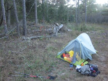
We made it as far down the road to the terminus as possible. There was little daylight left so we set up camp in a clearing. I would get an early start on the trail in the morning. I fell asleep, nervous about what the next two weeks would bring.
Friday, October 13, 2017
Day 1: Eleven Point
Miles: 17.0
Bonus Miles: 0.5
OT Mile: 17.0
Auspicious start date.
I awoke and packed up in the dark. Spiffyguy had plans to meet a friend at the next trailhead north and shuttle back. He was sure they would catch up with me, and I looked forward to seeing them and maybe even camping together.

It was perhaps half a mile walk to the southern terminus. The “road” that leads to the southern terminus is impassible to the vast majority of cars, so my bonus half mile didn’t feel like a roadwalk at all. (Pro tip: If you’re southbound and getting picked up, don’t get to the terminus and flop to the ground to wait for a ride, as you’ll be waiting a long time.)
I got to the terminus at 7AM, just as day dawned. The first couple miles of any trail are the most nerve-wracking to me, because it’s when I learn how terribly, terribly wrong I’ve been in my planning. But this time, I was pleasantly surprised. Although every foot of the hike today was either up or down, it was well-switchbacked at a gentle grade and extremely well-marked. Because of this, I was able to move at a decent pace and felt confident that I could do the hike in the time allotted.

The highlight of the day came at mile 9.4 – Brockman Spring. I nearly walked by it without seeing it, and that would have been a tragedy. It is perhaps the coolest spring I have ever seen. I ate lunch there and drank as much as possible — it was getting hot.


Later in the day after a couple nerve-wracking near-misses on turns, I slowed way down and wasn’t making more than a mile an hour. A bushwhack to Eleven Point River and 20 minutes of rest and water-gathering helped.

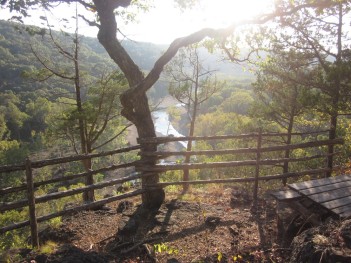
I reached the spur to McCormack Lake late in the day and decided to carry on, maybe another mile or so. I reached an overlook of the river which had a picnic table, and went off-trail uphill until I found a passably flat spot for the tent.

Saturday, October 14, 2017
Day 2: Between the Rivers
Miles: 15.0
Bonus Miles: 0.1
OT Mile: 32.0
This was the hottest day I ended up having. The forecast had been for a high in the 88-90 degree zone. I got an early start at 7:10 and managed to beat the heat for a few hours at least but by afternoon it felt like all of 90 degrees. I got off-trail accidentally at Greer Recreation Area because I followed OT markers instead of my map. I popped out at a campground and realized my mistake. It was a quick backtrack to get where I wanted to be.

The OT splits in a couple of places in this area. The biggest split is the High or Low Route – the Low being right on the river, the High above in the hills. The High Route is considered “official” and so I chose it. According to my map, the High Route is 6.75 miles, almost 3 miles longer than the Low Route. I am extremely skeptical about mileage in this area. The High Route went on and on. Its huge, sweeping switchbacks never seemed to end. At one point, the trail nearly made a circle. If I hadn’t found some unexpected water in a hollow, I would have been in trouble. Even though it was very hot, I was moving at a good pace — still, it took me hours longer than anticipated.

The entire day I expected Spiffyguy and friend to catch up to me, but it never happened. After fording lovely Hurricane Creek, I left a note for him at his car and continued on my way. As I crossed the dirt road, I moved out of the Eleven Point Section and onto the Between the Rivers section.

Day 3: Between the Rivers
Miles: 17.9
Bonus Miles: 0.1
OT Mile: 49.9


Monday, October 16, 2017
Day 4, Current River
Miles: 17.1
OT Mile: 67.0
On trail by 7:20 and made decent mileage despite numerous rocky sections. The rocky sections here are rocks just smaller than my fist. Bigger rocks are fine — you can step on them solidly. Smaller rocks are fine — you can step on them without twisting an ankle. But the rocks on the Ozark Trail are that in-between size, which tend to really slow me down.
I was excited to run into two dayhikers. They’ve been hiking the whole OT and only have Between the Rivers and Eleven Point left. Very cool!

The viaduct under Highway 60 was a neat experience. On the north side of it, I saw my first snake. It’s really hard to see, as it was slithering into the rocks by the time I got my camera. It was a non-venomous snake but didn’t want to be friends.
I’d been thoroughly warned about the Pikes Creek ford. The water was low, so the only hard part was navigating the bottomlands. At some point the markers disappeared and I had to guess where to go across. Once on the other side, however, I saw fresh footprints and followed those. I soon found OT markers.
My next water source was Mint Spring and when I got there, two backpackers were getting ready to leave. We chatted a few minutes and they carried on. It took a long time to collect water from the shallow spring, so they were long gone by the time I was ready.

I planned to camp at the fenceline of Peck Ranch, since I can’t camp within the ranch, but about 3/4 of a mile before the fenceline, there was a large clearing where the two backpackers had set up. They invited me to camp with them, and although I first declined, I changed my mind. Good decision. This ended up being my only night with other people on the entire trail.
Robert and Allison also started their hike at Eleven Point, but unlike me, they are ending at Taum Sauk. This isn’t considered a thru-hike but I suspect that it’s a better hike than what I’ve got planned. Also a better hike idea: they are tackling reasonable mileages, meaning each day I’ll be going 6-8 miles farther than they will. I won’t see them again. That’s too bad. They are super cool.
Day 5: Current River
Miles: 16.4
Bonus Miles: Oh, I don’t even know.
OT Mile: 83.4


I managed to make it to what looks like my first established OT campsite — it has a bench and a fire ring. I’m right on the edge of a bluff overlooking the Current River. I set up my tent as far from the edge as possible.

Despite my trail issues at Peck Ranch, today was a stunning day. This is without a doubt the most stellar, interesting, dramatic day of the OT. Amazing!
Day 6: Blair Creek
Miles: 16.4
Bonus Miles: 0.5
OT Mile: 99.8
I suppose because yesterday was so epic, and today started with miles of briers along the Current River, I was in a funk. Don’t get me wrong, the Current was gorgeous — but dang, did I end up with a lot of scrapes. I have to put it into perspective, though — there was devastating flooding along the OT earlier this year, and that fact that the trail is open at all is inspiring.


Day 7: Karkaghne
Miles: 18.5
OT Mile: 118.3
I woke up and immediately felt the benefit of last night’s All You Can Eat Foodbag. I felt human again.


Day 8: Karkaghne
Miles: 19.0


Saturday, October 21, 2017
Day 9: Middle Fork
Miles: 15.0
Bonus Miles: 1.0
OT Mile: 152.3
15 really hard miles.The miles weren’t that hard, really — but I hadn’t slept. I eventually gave up on sleep at 5AM. I packed up in the wind and night-hiked to the spur trail to Brushy Creek Lodge. This place is a godsend for hikers – they are half a mile off the trail and accept mail drops. Although I had a ton of food left over from my Powder Mill cache, I was excited to get my mail drop.The spur trail down the lodge is very much down — down, down, and then down. But very well-marked and easy to follow. I got my box, was able to drop off what little trash I’d accumulated in the last day, and was allowed to call Mom and Dad. It was good to let them know that my box had arrived as planned.

That spur trail to the lodge was a lot less fun going up — I had 6 days of food in my pack plus all the leftover food. Despite leaving a big pile of food at the lodge (like an entire package of tortillas), my pack was bursting.Luckily, the next miles were gentle, hugging a contour line. Even so, every hour I had to lay down in the middle of the trail to rest. And I mean really spread-eagle in the dirt, halfway passed out from exhaustion.
I left Karkaghne today and entered Middle Fork/John Roth Memorial Section. Beautiful tribute to John Roth on this section.

With a storm blowing in and crazy wind, I looked at maps to try to find a sheltered place to camp. I knew I could not stay on a ridge tonight; I needed to sleep. The only place that looked suitable was a hollow near Barton Fen. When I got to the hollow, I was thrilled to find a flat place. It was only 4:00, but I was completely done in. I took special care in staking out my rainfly, knowing that tonight was supposed to be a big storm.
Sunday, October 22, 2017
Day 10: Trace Creek
Miles: 16.8
OT Mile: 169.1
Mile remaining: 61.7The storm hit late — 3AM as opposed to midnight as I’d heard. It rained and thundered and the lightning put on a show, but I was able to mostly sleep through it. I woke up at daybreak and read until I was sure it was over. I managed to get on-trail only half an hour “late.”

It was a joy to hike without rain this morning. Barton Fen was very pretty to hike through, though I didn’t see dragonflies, endangered or otherwise. I pulled over to eat an early lunch, and I’m glad I did, because as I finished it began to mist. It slowly got more intense, until my last 4-5 miles which were in rain.
It was a good section to hike in rain — few rocks to make slippery. Very well maintained.My goal today was to get to the Council Bluffs Lake spur, and I nearly stopped there — it was flat enough. Instead I carried on another mile or so. The trail was doing the “hug the contour line” thing again, with nowhere to pull off to camp, until I saw a majestic pine below me next to a pool of water. It looked too good to be true. I could see evidence of other hikers bushwhacking down there, so I did the same. Nazarenko Spring, I later learned — the nicest, most pine-needly campsite on the entire trail.

Monday, October 23, 2017
Day 11: Courtois Creek (barely)
Miles: 16.7
OT Mile: 185.8
Miles remaining: 45
I woke up in the middle of the night to the most amazing noise: Nothing. No rain against the tent.I packed up with patches of clear sky winking at me and I felt a huge cloud of my own lift: for the past couple of days the weather has felt unsettled, and I have been nervous about maintaining my pace each day if the weather were any more dramatic.

Sun. Fluffy clouds. Cold… but good.
After my first mile, a big noise in the woods startled me. A huge black pig was running up a hill to get away from me. I knew pigs were around from the markings along the trail. But I’ve seen only a few in all my travels. I like it when they run away from me.

I felt kind of in a daze the whole day — like I was just meandering through the forest. The Hazel Creek ford wasn’t half as dramatic as I was expecting. Everything just kind of felt muted.

Half a mile before stopping for the day I ran into thru-hiker Mike heading southbound. We chatted just a few minutes. As we parted, I felt relief and joy that I am northbound and the end is in sight — while it has been a good journey, I am exhausted. I’ve gone nearly 200 miles. I’m thrilled to be on this end of a thru-hike.

I set up my tent near Snapp’s Branch and settled in. As I was in my sleeping bag reading, I watched a tree fall over on the ridge near my tent. All the trees around me seemed stable. But the howling wind was back. At least I was low and out of most of the wind.
Tuesday, October 24
Day 12: Courtois Creek
Miles: 19.2
OT Mile: 205
Miles remaining: 25.8
The highlight today was a cool spring. I’m always impressed by the water on this trail. It’s cold, clear, and delicious.

There were a lot of miles today — I hit the Berryman Trail loop, which feels optimized for mountain bikes. Big, sweeping contour-line hugging swoops. It was easy to cruise on it, but not so great for finding a spot to camp at the end of the day.

Meanwhile, it was the windiest day yet. I just wanted to crawl into a small space and hide from it, but it’s safer to be out hiking in it and there’s no point in waiting it out. On the plus side, it made me hike much faster!

I found a nice flat pine-needly spot just before the wildlife pond. I hadn’t been settled in more than 10 minutes when a southbound thru-hiker came by. I hollered at him and we chatted for awhile. Gene has a lot of Ozark Highlands Trail experience and is interested in a trail I know very well, so perhaps our trails will cross again soon.When the moon rose, it was so bright that I thought someone was in the woods with a headlamp shining it on my tent.
Wednesday, October 25, 2017
Day 13: Courtois Creek
Miles: 16.6
OT Mile: 221.6
Miles remaining: 9.2!I woke. I walked. I choked down some tuna.Then, on a bluff above the Courtois, I got reception for the first time since leaving St. Louis. I texted Mom to confirm that I’d be done a few hours earlier than planned, then I called my partner Elliott who I hadn’t talked to in weeks. The roadwalk through Bass Resort was strange — no one was around so it felt like the end of the world, but then finally I saw some signs of life.
My last water source of the day was a bust — too much life in the water to drink it. A filter would have been able to handle it, but my Steripen couldn’t deal with it. This is the only water source that was a bust for me due to using a Steripen and not a filter — pretty great odds. I’ve been happy with Steripens for seven years now. Anyway, rationing water overnight felt like the tiniest, most minor inconvenience. I was in the home stretch. It was gonna be fine.There weren’t many good camping spots, so I went uphill. No wind to speak of, so I didn’t mind climbing to the top of the ridge to camp. In fact, I found a fire ring -I wasn’t the first person to head uphill there!

As I settled in, 20 turkeys visited my campsite and a distant cow mooed. That was a new noise I’d not heard on this trip!
Thursday, October 26, 2017
Day 14: Courtois Creek
Miles: 9.2
OT Mile: 230.8I woke, as usual, at first light and packed up for the last time. Ahead of me was the easiest day since I started: under ten miles!

My last day was incredible. Views from a bluff greeted me in the morning, and soon I was walking across The Narrows. In leaf-off, I’d have had views to my left and right as the trail was routed atop a narrow ridge. I got glimpses of views — enough to remind me where I was.

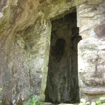
I soon entered Huzzah Conservation Area, a fitting name for the end of a journey. I descended to the Bat Cave (so cool!) and forded Courtois Creek (so cold!).


I saw more little caves today than the rest of the hike combined. It was so interesting. I was grateful to have this on my last day. It’s like the Ozark Trail wanted to surprise me just a few more times.

I saw my third and final snake of the trail, but it was on a road crossing, so does that even count? I flew through the last handful of miles in a blur. Ends of journeys always feel strange. I reached the northern terminus around noon, 2 hours before I told Mom and Dad I would be there. I had given myself some cushion so I wouldn’t be late. I had my journal and Kindle to keep my company.

But 15 minutes after I arrived, I saw a familiar white car drive by. My mother in the passenger seat was reading some nearby signs and didn’t see me sitting in the shade. I watched as they drove away. Luckily, they came back, and I flagged them down. It could be a tricky place to find: the name of the trailhead is “Onondaga,” but there’s no sign with that name on it there. But it all worked out!

We then had a fantastic trip back to Minnesota. We went grocery shopping so I could get salad-in-a-bag, potato salad, broccoli, peppers, hummus, and local beer. The roadtrip home was a wonderful way to ease back into civilization. I couldn’t be more happy or grateful that my parents wanted to come on an adventure to the Ozarks to find their wayward daughter.