Two overdue trails on the horizon

Spring 2013 was life-changing and amazing.
Spring 2023 will bring me back to those footsteps.

This spring I’ll be flying to Little Rock, Arkansas to hike the 230-mile Ouachita Trail. This has been on my to-do list for a long time. Its best season (I think) is early spring, but that is also when all weathers are possible. Because I could get dramatic weather, I didn’t want to hike it until I had enough time so I could hunker down in one of the 20+ shelters along the trail if needed.

Yeah, shelters! It’s going to be so cushy!

The Ouachita Trail is special to me because I have never been to Oklahoma or Arkansas. There aren’t many states I haven’t been to, so I’m excited to see these two states – and two wilderness areas, too! This trail was very important to a dear, lost friend, and I think it will be healthy for me to hike it and process that loss.

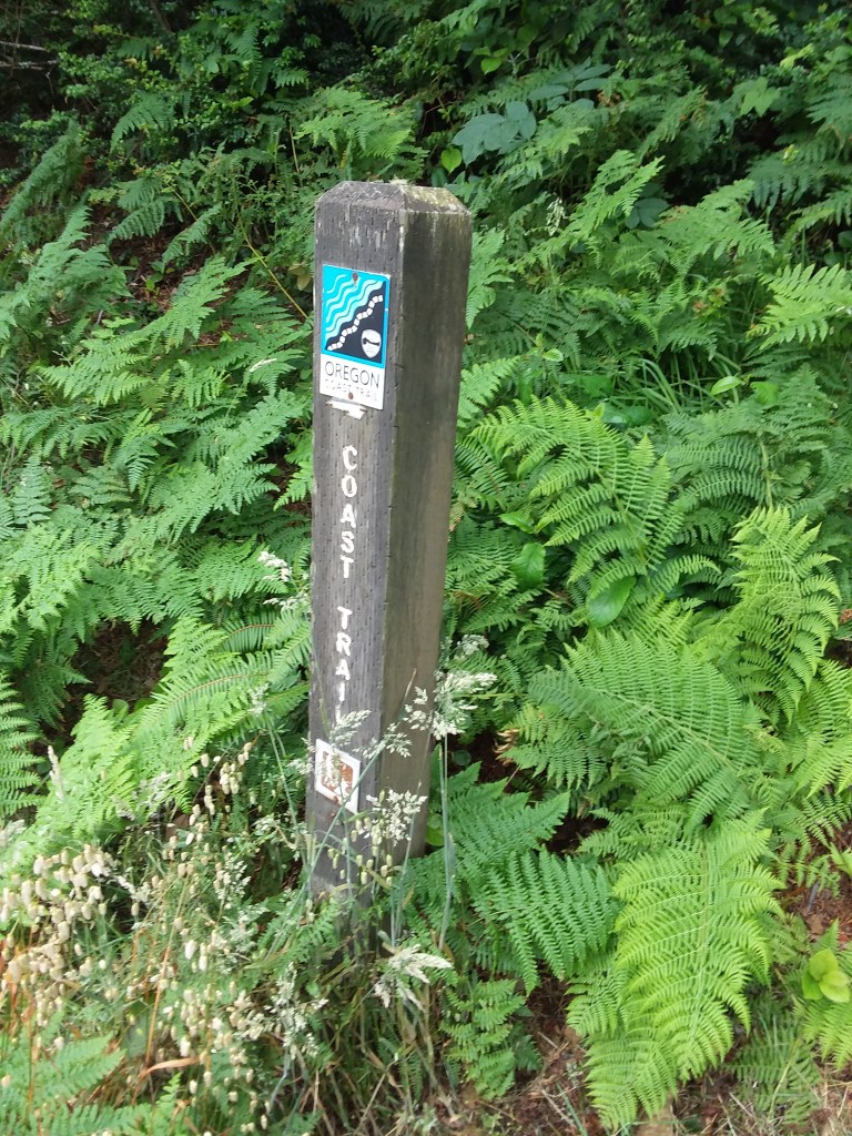
After the Ouachita Trail, I will take a train to White Sulphur Springs, West Virginia, where I plan to finish the Allegheny Trail – while it likely won’t be a thruhike, I’ll probably end up hiking about 285 of 311 miles. I hiked the southern part of this trail a decade ago as part of the Great Eastern Trail hike, and I may not re-hike all those miles.

Ever since 2013, I thought I would return to the Allegheny Trail “next year.” “Next year” never comes for me with the Allegheny Trail, so it’s THIS year. Finally! The Allegheny Trail is a magical place. I so enjoyed the southern part that I even dragged my mom up to see Hanging Rock Raptor Observatory, long ago and far away.

People are always a huge part of any trip. I’m grateful that my friend Julie/Brew Dog from Texas will join me for a piece of the Ouachita Trail and my friend Sourdough who lives in Georgia will join me for part of the Allegheny Trail. Even gistrailblazer is meeting me at the terminus when I finish. There might even be a Great Eastern Trail Association board meeting thrown in there somewhere. I cannot wait to see them all. It has been too long.

Oregon Coast Trail journal

It only took half a year, but I created an Oregon Coast Trail journal. It’s a combination of blogs I posted while I was hiking and other information/recollections from the month-long journey. It’s very long because there are a lot of photos and it was a month of my life, so lots of memories.

I continue to have zero regrets about the decision to skip the Continental Divide Trail and head farther west to the OCT. It was fantastic. If anyone is considering a hike on the OCT, check out Oregon Coast Trail Advice and learn from my mistakes. I made several, but the trail itself was not one of them.

December 3rd comes again

December 3rd is an important date for me for two reasons: first, because it’s the day I completed the Appalachian Trail back in 2010. The AT was an incredible experience in my life and led to me where I am today. Reaching Springer Mountain was a moment I had dreamed of since third grade.

Then, last year, December 3rd was my final official day at my job. I had been at my position for 6.5 years and had been involved with the organization since 2007. I felt like my job was a huge part of my DNA. Its mission certainly was among the most important parts of my life.

Walking away from that was extremely hard. I loved so much of it, and I loved so many of the people involved. But I was burned out and very unhealthy. I needed time.

This December 3rd, I am remembering not just Springer Mountain and the Appalachian Trail, but the year I’ve had because I took a deep breath and left the security of a dream job.

I am extremely grateful for my family, who understood and accepted the fact that I needed to make a change They helped me get ready to sell my house. They also supported me through the loss of my best pet ever, Mitsie, who died last December. I am beyond grateful that I was home, with her, during her last month of life. I also was able to be in a safe place during my bout with Covid-19 and be around when it found my parents.

It was a very strange, but good, year. I cannot list everything I am grateful for, but here are a few highlights in pictures.

I am grateful to have experienced early spring on the Foothills Trail with Richard.
I am grateful for completing a hike I’ve dreamed of since 2010 – the Bartram Trail. It was spectacular.
I am grateful for spring in the Smokies.
Chef’s kiss of perfection.
I am grateful for roadtrips with my parents –
and home time too.
I am grateful for a month walking the stunning Oregon Coast Trail with Julie — and our trail family.
I am grateful for local adventures with Elliott, who always cheers me on.
I’m grateful for the ability to make a last-minute plan to visit Glacier National Park and a few perfect days there.
I’m grateful for a spectacular autumn hike with great friends in the Chequamegon National Forest, even if my ankle was not doing so well.
I’m grateful that my ankle recovered enough to spend a relaxed week along the Greenbrier River – and then visit wildernesses of the Carolinas with Richard.
I’m grateful for getting the chance to walk the land where Elliott grew up.
I am grateful that I had time to watch this little one grow up. Elliott and I rescued him last winter.

It has been a year: what comes next? Well, this year didn’t turn out at all like I envisioned, so I hesitate to even make a guess at what comes next. I hope to be surprised.

California!

Other than a short bike trail and a mile and a half on beach, the trail between Harris Beach State Park and the California border is all on road. We left our tents and gear behind and planned to do a quick out-and-back of 16 miles to reach the border and get back to Harris Beach.

The roadwalk was uneventful; the roads were mostly small or had a sidewalk, which is better than usual. When we got onto the beach, our final beach walk, we were greeted by really cool starfish pools, which never grow old.

Somewhere along the way I began to suspect that the guidebook’s mileage was off, which turned out to be true – it was more like a 19 mile day when all was said and done – absolutely not 8.1 each way. At least we were not carrying much!

We forded the Winchuck River and visited the nicest visitor center ever – the folks at Crissey Field were probably more excited about us finishing than we were, which is saying something. They gave us postcards and a shirt and took our pictures.

We then walked down to the border, where we officially finished. California. We were done (1).

The walk back was monotonous and hot. I was exhausted from the past couple of days. The two hardest days of the entire trip were there at the end – Gold Beach to Brookings is, without question, the toughest part of the trail. There is no comparison. I was tired.

After a celebratory meal (in which Julie finally got crab!) and a visit to the nicest library ever, we returned to Harris Beach. We were done (2).

Of course, when you finish a trail 1,700 miles from where you live, you’re not really done

The following day we did chores and rested, and the day after that began our bus tour of Oregon — we walked 1.5 miles to the Point Bus from Brookings to Cave Junction. In Cave Junction, for inexplicable new-owner reasons, the bus company makes everyone change to Josephine County Transit. We arrived in Grants Pass one hour after the Greyhound’s scheduled departure, so we had booked a motel room, just half a mile from the bus stop. After doing laundry and later enjoying too much food at The Haul brewpub, we both kind of loved Grants Pass. The next day, our Greyhound left town at 1pm. (Fun fact: different bus stop than Josephine Public Transit!) The bus was on time and we rode up I-5 to Portland. We were less than half a mile from our motel (same place we stayed the night we flew in), and in the morning we enjoyed a small breakfast before taking MAX light rail 40 minutes to the airport. At the airport, I finagled my way onto an earlier flight, saving myself seven hours of people-watching at the airport. Julie and I bid farewell, and I flew to Minneapolis on Delta, where I got onto a Groome shuttle to Hinckley, where I got picked up by my dad. Meanwhile, Julie also made it home safely. We were done (3).

In case you were wondering why we needed days off, it was to figure out all of those logistics.

I have a lot of thoughts on the Oregon Coast Trail – things we did right, things we did wrong, and so on. I assume I’ll compile those at some point, but for right now it’s just nice to be home. Until Tuesday.

Whatever the heck that was…

We had a beautiful morning along the coast, most gorgeously at China Beach, which we hit at low tide so we could see the tide pools filled with starfish. Because we had gone so far the day before (over 20 miles, not that I was counting, except yes I was counting), we thought this day was going to be comparatively super easy. After all, we were only about 14 miles from our next (and legal!) campsite.

Along the way, we crossed the tallest bridge in Oregon – Thomas Creek Bridge. It was one of the few flat sections of the trail – the Boardman Corridor maximizes how much trail it can squeeze in and how much elevation gain it can muster. All that would be fine, except for the legal camping situation, a total lack of potable water between Gold Beach and Brookings (literally nothing), and the fact that I was still tired from the day before. This was the first morning I woke up when I was still tired, maybe even more tired, than when I had gone to bed.

Then things kinda went downhill for me. Literally. We hiked down to Whaleshead Beach, which was beautiful but short. The guidebook suggested it may be a bit of a rock scramble to get up from the south end of the beach, and a blog from a year ago showed steps carved into the muddy hillside. None of this was still the case. The way up was totally eroded, completely overgrown, and someone is going to die, because if you slip, that’s just it, that’s the end, there is not even a shrub to hang onto. If it was raining, I cannot imagine how dangerous it would be. It was dry and it was still absolutely stupid.

I have no pictures because I totally lost it. I was so angry at the trail, angry at the organization, angry at anyone who thought that route was acceptable. My hands were wet with sweat, and thank goodness that Julie is not afraid of heights. She came and got my pack for me, so I could focus on just getting up to where I needed to be.

Julie and I later started referring to this area as “Whatever the h- that was.” With other words often substituted.

The day got better, but I’ll admit, I was happy it was the last full day. I hated that my last experiences on the trail had to be filled with anger and disappointment. I think the hardest part was not even disappointment in the trail, but disappointment that I’d come all this way and gone over so many challenges, and then on the last full day, I get to a challenge that my body just shut down on. What a demoralizing way to wrap up a beautiful trail.

Luckily that wasn’t quite the end. Cape Ferrulo still awaited us, and I think it was among the cooler capes we climbed. It was nearly treeless, and with sea fog blowing in and out, it was pretty magical to walk across.

10/10, would hike again. It felt like Scotland or somewhere like that. Having never been, I guess I should say it felt like my fictionalized version of Scotland.

Some people consider the end of the Boardman Corridor to be the end of the Oregon Coast Trail. We do not. We roadwalked into Brookings and set up at Harris Beach State Park at a very nice hiker-biker campsite. For the first time since June, I knew where I would sleep for three nights in a row.

Gold Beach and golden places

The trail from Honey Bear Campground to Gold Beach was incredibly varied – some beach time, some time on Old Highway 101 (which is small and enjoyable; not at all like today’s Highway 101), some time on singletrack, and a meander through town.

Something I will miss about Oregon beaches is the way the sand breathes when it is warm outside and the sand is wet. Waves of fog rolled across our path. We also loved seeing all the professional and recreational boaters as we neared Gold Beach.

In Gold Beach we took a zero day. We dried everything out, as the field at Honey Bear had been very wet, and I got a grilled cheese. What a stellar day off.

In the morning we awoke knowing it would be a long and tough day. We heard horror stories about Cape Sebastian and that was going to be our day. Actually, only part of our day — due to a complete lack of legal places to camp, we didn’t know where we would end up, but it would be far, far away.

To be honest, both Julie and I enjoyed Cape Sebastian. We were lucky to have Julie on the Gaia app, which helped, and we had some words of wisdom from those who came before. The overgrown trail didn’t bother me as much as an unmarked intersection or two (so easily fixable!). And of course, we saw The Mole Hole, which makes no sense and I like it that way. The only part of Sebastian I objected to was a butt-slide down rock. The rope wasn’t super helpful, and it was steeper than it looks.

We walked many miles, avoided the Pistol River as suggested in the guidebook by bopping onto Highway 101 for awhile, and soon reached the Samuel Boardman Corridor, a totally gorgeous long stretch of trail where legally, you can’t camp anywhere.

So we spent some significant down time at one of the few places not plastered with No Camping signs. It’s a secret.

Humbug to Honey Bear

It was one of those days when we had to remember to look behind us. Humbug Mountain grew smaller and smaller.

The beach provided pure joy today. We saw lots of cool stuff. This was jelly.

I don’t know what this is but it would win in a fight.

We camped that night at Honey Bear Resort due to a lack of good and legal camping options. It was a charming, if frigid, field to camp in.

Our site was next to a little trail. I’m always amazed by how dark the woods are here!

Sixes River, Cape Blanco, and Elk River

We got an incredibly early start from Floras Lake – up at 5am. We needed to cross the Sixes River before high tide, and every minute we delayed, the worse the crossing would be. So naturally this was the day we got turned around as we tried to cross Blacklock Point.

Luckily, we moved quickly and discovered the error and the crossing was okay. I was glad the water was low, however. I did manage to lose my buff in the crossing – it was beautiful and I loved it. It’s not my trip for gear retention…! Meanwhile, the distant Cape Blanco Lighthouse grew ever closer in the distance.

We ascended from the beach and got to enjoy Cape Blanco before crowds arrived. For a moment we were the westernmost people in Oregon.

We hiked an awesome ridgetop trail with jaw dropping views. It was probably my favorite mile of the whole trip.

We camped at the Cape Blanco hiker biker site and in the morning we again got up at 5am to tackle one last river crossing.

The Elk River was, I think, the toughest crossing we’ve had. It was only knee-deep but the current was wild.

We crossed safely, watched seals and seagulls, and continued on toward Port Orford.

We took an extended break in town before getting back on the beach. With views like this, it was hard to leave.

Something about southern Oregon beaches feels more interactive than the north.

It was really a varied day. After hiking on the beach, we climbed through woods, ran into our trail angel Jeff from a couple days ago (what are the chances?!), did a quick jaunt on the road to get to an abandoned highway (so cool) and arrived at Humbug Mountain for the night.

Improved days

Of all the places for my poles to be stolen, that particular spot was a pretty good one. We were only six miles from the town of North Bend. Next door to the grocery store where we planned to resupply was an outdoor shop, so I was able to replace my poles. I am still very sad about the loss of my poles. They were only the second pair I have had in my entire hiking career and I was attached to them. However, I am beyond grateful that I was able to find another pair because I really struggle to hike without poles.

The day soon got even better as we took a bus to avoid a long road stretch. I would rather have more time to spend in prettier places than long, long roads. And this meant that we got to Bullards Beach State Park much earlier in the day than we otherwise would have.

Bullards Beach State Park has probably the nicest hiker-biker site I have experienced. It had a charging station, shade and sun, and a somewhat secluded corner where we set up.

In fact, we liked the park so much that we decided to spend another day there. It was a spontaneous day off, but as the end of this trip nears, we are confident in the number of miles we have and the time we have left.

Because we took a day off, we had time to visit the Coquille lighthouse, attend 2 ranger programs, make friends with camp hosts Tom and Sharon, hike to a cemetery, and get recharged.

Hiking through Bandon the next morning was fun. It seemed like a funky and friendly little town.

We were pretty stressed though. The nearby New River was running too high for us to safely cross. The only alternative was a 24 mile day along a lot of Highway 101. No legal camping could break it up. It sounded like a horrible way to spend a day.

Luckily, we ran into Jeff and Kingsley and got a ride to Langlois, cutting out the Highway 101 deathmarch. It was a true gift to not have to endure those miles on foot. We are so grateful.

We walked the remaining miles to Floras Lake and enjoyed a spectacular evening there. We were relieved to be south of the New River.