Dunes

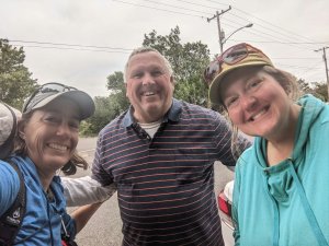
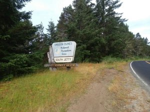
Leaving Florence into the dunes was quite exciting. I love national recreation areas, but I admit this one is the least favorite I’ve visited.

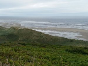
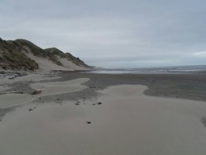
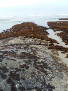
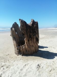
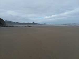
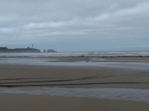
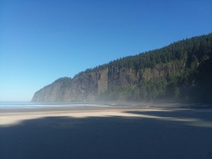
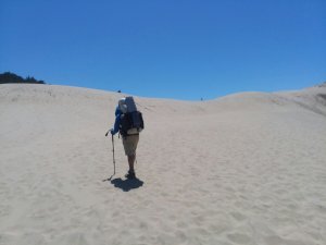
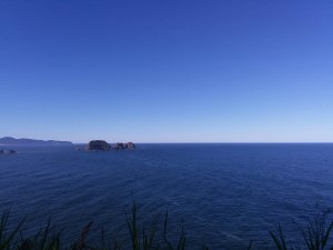
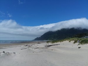
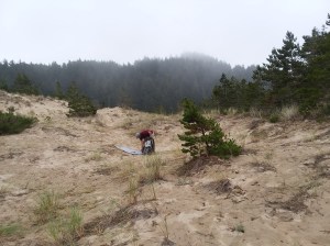
The dunes are scenic and strange. We walked in a cloud for a full day which made them tremendously ethereal.

One major challenge with the dunes is the restrictions involving snowy plovers. These are very endangered birds and due to their nesting, big portions of the beach are closed for half the year. Hikers are allowed to walk on wet sand around the areas in question, so we can make it work. But camping becomes extremely challenging.

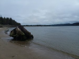
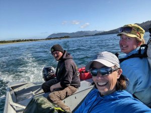
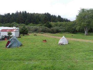
One highlight in the area was taking a boat shuttle across Winchester Bay. It was fun to zoom across… and then we camped in town at a lovely little campground where we were the only tents. Lots of RVs. No tents. It was cool.

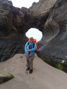
Our next day of dunes was more challenging for me.

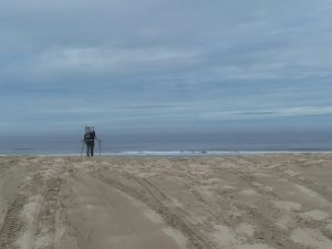
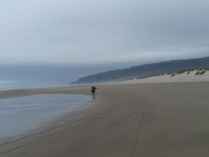
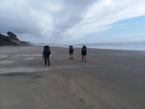
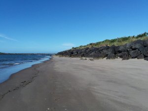
A substantial portion of the dunes is open to off-highway vehicles. I am in principle fine with that. I think machines like that are inherently wasteful and destructive but, as they exist, people should have places to play. But dang, it’s not pleasant to walk through an exhaust-fest. I’m also really skeptical about the plover restrictions for hikers adjacent to areas where off-highway vehicles rip everything up. Really? How does that make sense?

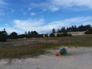
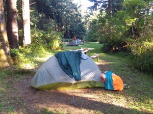
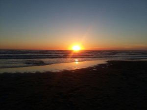
We finally got to a place on the beach where we could legally camp without hurting the snowy plovers and without being run over by off-highway vehicles. This was the first time we camped directly on the beach.

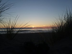
And it was an absolutely beautiful evening to be on the beach. Unfortunately, that night, someone came to our tents and stole my hiking poles. What is even creepier than being stolen from is the fact that my poles were directly next to my tent and somebody came within one foot of my body while I was sleeping in order to steal them. Given our proximity to where the off-highway vehicles roamed, and the complete lack of hikers we have seen, I know which user group it was.

The parting of ways

Our morning hike involved some amazing sand dunes. It was my first real taste of the sandpocalypse to come. As I type this, I’m pretty sure I have 3 cups of sand in my backpack. I have sand in every Ziploc baggie, in every article of clothing, and inside my ear.

But it was still fun and exciting at first. We enjoyed the morning hike with Blade and Unplugged, but halfway through came the parting of ways. Julie and I had a zero day booked for Florence; they had one in Bandon. Our little tramily was done. It was really sad.

But I felt really really lucky that we had the time with them that we did. As Julie and I started our walk into town, we realized that the place we had intended to camp was kind of terrible. Luckily we met a couple of locals out walking their dogs and they suggested a place we could legally tuck in for the night.

It was an absolutely beautiful place to camp. In the morning we woke up and started our walk to town when we ran into one of our locals again! Ed gave us a lift to the laundromat where we took $4 showers (EXCELLENT VALUE) and did laundry.

Yay Ed!

We got breakfast and made it to Lighthouse Inn. Charming place and people.

Florence was a lovely place to take a day off.

We had a chance to visit Homegrown Brewery, see some seals, walk around the Old Town, and enjoy the fireworks right from our front door.

So far I think Florence was my favorite town. It felt touristy without being too touristy. It felt like people actually live there and can perhaps even afford to live there… but that may just be ignorance on my part.

Cape Perpetua

We knew we had a pretty interesting day ahead of us, going through the funky seaside town of Yachats and then climbing a thousand feet up Cape Perpetua. But first: urchins and barnacles!

Yachats was indeed pretty cool. We resupplied and got a bite to eat. There was a nice trail network through town.

This is one of the only bits of trail on private land.

As we neared Cape Perpetua, we saw several statues. These bears are dancing, in case you were wondering.

The more well-known statue is that of Amanda De-Cuys, an Indigenous woman submitted to horrors by the United States government. This part of the trail bears her name.

There was a cool suspension bridge and many random elevation markers. None of them were at normal elevations – they were like 194 feet, 820 feet, etc.

Not normal increments.

The trail was very rainforesty and the view from the top was spectacular!

We camped at Carl Washburne Memorial State Park because Cape Perpetua got rid of their hiker biker campsite (side eye skeptical glare). It was very busy with bikers, but we were happy to have a spot and I even took a shower. It was a pretty great day.

18 miles and a dozen rest breaks

We knew the day would be long so we got an early start. Luckily, the weather was perfect and the views were gorgeous. We took our first break near the ford of Beaver Creek.

We only had a short jaunt on a road to get around a beach with no possible southbound exit. Oddly, being above the beach was ideal so we could see this mandala artist.

The trail went through Waldport and we crossed this enormous bridge. We then returned to the beach for the final miles to Beachside State Recreation Area.

When we were 1 mile from our campsite, we came across this 1200 year old stump from when redwoods grew this far north. It was an evocative location so we took an hour+ break just laying in the sand enjoying being there.

Rarely on a trail do you know you’re living the happiest moment of the adventure. And it’s possible that wasn’t the peak. But it sure felt that way.

I walked the final mile barefoot.

When we finally did get to our campsite, the nearby bathroom had this sign. What? Why is this a thing??

I appreciated the park helping this poor little tree.

Sunset was lovely that night and my little site was a delight.

South to South Beach

We knew we had a pretty easy day ahead. Sometimes the mileages of legal camping opportunities mean a long day, sometimes short.

We took more time than usual to explore and enjoy the coast. Schooner Point was a delight to hit at lowish tide.

Sometimes the coast is just especially interesting and I thought this area had character. It also helped to be sharing it with our two new friends.

Throughout the day I watched Yaquina Head get bigger and bigger. Soon we went up and over and then into Newport where we got food.

We crossed a huge bridge and made it to South Beach State Park, where Blade’s friends just happened to drive by us. Wild. What are the chances?

It was an odd night, because we shared the hiker biker campsite with a drifter who built a fire late at night to cook crabs. He did not seem dangerous at all, but it was a weird vibe.

1st 2 days of 4

From the Cape Kiwanda area, Julie and I met up with Blade and Savannah who were just ahead of us. We walked a cold, crazy-windy morning together.

We hung out in Neskowin and ended up camping together at Devil’s Lake State Park near D River that night.

In the morning we took a bus to bypass a long haul on Highway 101. We got dropped off right at Gleneden Beach where the trail picks up. It was super easy and helpful.

The weather, however, was not. The howling wind and misty rain were pretty miserable. Luckily we were near Depoe Bay where we stopped for lunch.

By afternoon the rain stopped and after climbing Otter Crest we detoured to see Devil’s Punchbowl before a final beach walk to Beverly Beach State Park.

It was a lovely hiker biker campsite.

Capes Lookout and Kiwanda

In the morning we had to summit Cape Lookout by road because the trail to the summit was wiped out by landslides. I was hell-bent on getting a ride to the top, but not a single car passed us. Good thing we weren’t sitting at the bottom waiting on a hitch. We luckily had a trail to descend, and the views of the cape were amazing once we got back to a beach.

I loved hiking past Camp Merriweather, where Elliott once spent time. The beach was quiet and gorgeous. (Until we reached where the OHVs were allowed. Then it was loud.)

As afternoon approached, we had a tough decision. We had to either ford the Sand Lake outlet or walk 6 miles on roads around it. We had heard mixed reports on fording, but we were not hitting it at low tide and did not feel safe taking the chance. We began the roadwalk, and it was so hot, with very little shoulder and quite a lot of traffic – big rigs and wide vehicles.

A mirage turned into an oasis in the desert as a small store flickered into existence. There we met Taylor, who so kindly offered us a ride to get back to the trail south of the Sand Lake outlet. A true trail angel. She lifted our spirits and helped our feet.

On the beach again we could see Cape Kiwanda in the distance!

We had to climb that!

It was so hard climbing up the sand but it was also really fun.

From the top we descended to a Webb County campground. It was fabulous. There were bunnies!

Almost heaven?

Two capes

When it was time to return to the trail we caught an Uber to get us where we needed to go. The trail in this area is a little challenging because it requires a boat shuttle at high tide (unofficial route) and the official route is almost exclusively on Highway 101 which the guidebook encourages us to skip.

The bright side of being able to bypass certain unappealing sections is the ability to spend more time enjoying the parts of the trail that do call to us. Like Cape Meares. I had time to hike a trail to see a giant Sitka spruce and I’m sure I would not have taken the time for that trail if we had been worried about connecting our footsteps precisely.

What was fun about Cape Meares was not only the really cute and tiny lighthouse but the fact that my partner Elliott was here when he was a kid – he now works on the North Shore of Minnesota at Split Rock Lighthouse. So it was fun to see one of his earliest encounters with a lighthouse.

I was also excited because out in those Waters is a federally designated Wilderness Area!

We were there really early in the morning so there was nobody else around.

We also made the obligatory stop to see the octopus tree. From there we walked through a couple of small towns and ended up on a pretty busy road to get us to Cape Lookout State Park where we got a Hiker Biker site.

Our experience at Cape Lookout was not amazing due to how overcrowded it was and how understaffed the park was. We just happened to hit it on a weekend when temperatures were soaring and everyone in the state was trying to get to the ocean. One bright side of our time there was getting to watch a spectacular sunset. It was also here I realized that I hadn’t actually touched the ocean yet so I made sure I did that.

Bays, trains, and beaches

The day started out perfectly with elk near the campsite and an easy walk to Nehalem Bay. There we took our very first boat shuttle across the water. The folks at the jetty were incredibly helpful and we enjoyed a rest break with ice cream and a cat to keep us company.

PCO Julie

This was one of the more unique days of the trail because it not only required us to go by boat, but there was also an option written in the guidebook to take a scenic train in order to avoid a stretch of Highway 101. First we had to get there.

We walked some train tracks, long out of service, then got back on the beach until Rockaway Beach. There we had lunch and met up with two hikers who we met the night before at our campsite. It was fun to see Blade and Savannah again and I was sad that they were not taking the train with us.

The train was a fun way to spend an afternoon and we enjoyed avoiding the highway. When we arrived in Garibaldi we had time to look at some older trains on display and to hike out onto a really long pier.

From there we took a bus to a motel we had booked in Tillamook, as there was no affordable lodging in Garibaldi and it was time for a day off.

Our day off in Tillamook was restorative and much needed.

Up and down, rain and shine

I took very few phone photos this day due to rain and being an obstinate late adopter of phone technology (I’m out here for a reason). The great part was that the rain didn’t start until we had gained most of our elevation. I suspect we were just in a cloud.

We climbed up Cape Falcon and there was typical headland mud to deal with but also crazy overgrowth. I wonder what the trail will look like in even 2 weeks. We had to part the vegetation with hands and poles.

The trail meanders a lot in this area and we took a few breaks to help us get through it, mentally as much as physically. But it stopped raining and that was awesome.

Soon we were descending, our day made easier by the closed Neahkahnie Mountain. This mountain is the high point of the OCT but has been closed since a 2020 storm. We instead hugged Highway 101.

Getting back on the beach, we could look north to see all of Neahkahnie and where we had walked. Cool.

We reapplied in Manzanita and made it to Nehalem Bay State Park’s hiker biker camp. It was superb.