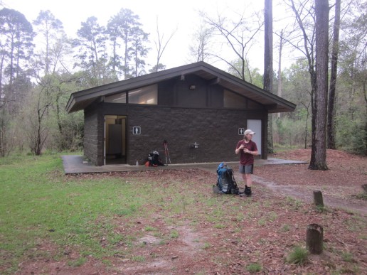
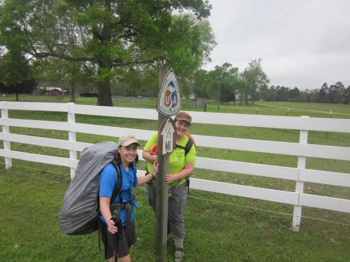
 In early March of 2017 I thru-hiked the Lone Star Hiking Trail, a 96-mile trail through the Sam Houston National Forest. It was a hike I did on a whim; I saw it mentioned in Backpacker Magazine and I happened to have a week of vacation to use. With a crazy spring on my horizon, I decided getting away for a week sounded about right. I booked a cheap ticket to Dallas-Fort Worth where my friend Julie lives.
I’d never met Julie. She was an Appalachian Trail southbounder in 2009 like I was. I knew her name, saw her notes in registers, but never met her. Like me, she struggled with the 100 Mile Wilderness in the deluge that was summer of 2009 in Maine. It was, at the time at least, the third-wettest season on record in Maine. All that to say, anyone who endured the 100 Mile Wilderness in Maine in June 2009 is a friend to me whether or not we’ve met. Thanks to the internet, Julie and I knew each other digitally at least, which led to us sharing this adventure.
From what I can tell, very few people hike the Lone Star Hiking Trail. Maybe I know why: the Lone Star Hiking Trail doesn’t have awe-inspiring vistas. There are no rock scrambles, there is very little “real wilderness,” and there are few-to-no amenities along the way. Good luck finding a shuttle, by the way.
And yet, it’s a worthy journey: you’ll find beauty, surprises, and learn about yourself. You’ll cross incredible bridges, push your skills as you ford streams and a river, and immerse yourself in a bayou. It’s also a trail that can be hiked at a time in the year when most of the country is pretty miserable. It’s a well-marked and well-maintained trail and even has a guidebook. This is a trail worth doing; it’s a Texas you probably haven’t met.
March 4, 2017
A schedule for Day 1:
1:45 AM Wake up
2:00 AM Leave for Sandstone
2:30 AM Catch Skyline Shuttle to airport
4:20 AM Arrive at MSP
7:00 AM MSP –> DFW
9:45 AM Get luggage
9:50 AM Meet my hiking buddy Julie in real life for the first time
10:30 AM-5PM Kroger run, driving, High-5, Buc-ee’s, finding the trailhead, a shuttle by Julie’s friend Gio.
Whew.
When we arrived at the trailhead, we realized it was all on fire for a prescribed burn. Fun! But we were able to walk though it, although it was disconcerting.

Our first steps onto the LSHT…

Nothing like an active burn.

This tent…! #smitten
We made it two miles before setting up in a tiny, unburned patch of earth.
In the moments when I could smell anything besides the smoke, I caught whiffs of southern forest.
Despite the insanely long day, it felt so natural to slide into my tent – in a new environment, a new state, and yet right at home.
March 5, 2017
It was a cool day with only a little rain. Today we passed through the Little Lake Creek Wilderness Area, which was a remote, jungly kind of wonderful. I was hoping to see an alligator, but no such luck.
Most of the day was a pleasant hike through somewhat wet terrain. Given the rain overnight, there was no keeping our feet and pant legs dry, so it was nice to not even feel like I should try.
After 16.6 miles we made it to Lake Conroe, and it was here that I found out that my cat Tibby had died.

My Tibby. ❤
March 6, 2017
Despite heat and humidity, we made it 17.5 miles today – a little farther than was comfortable but a poor forecast enticed us to go farther. Better to frontload the miles.
Stubblefield Campground provided a wonderful break and fresh water, plus a chance to recharge our phones. I used mine quite a bit the night before due to the death of Tibby. I was glad to have something to focus on during the day besides my lost cat.
Water was a top concern today, and we were very grateful for the use of a spigot at the spillway we crossed. The spillway could have been quite dangerous in high water, but crossing was uneventful for us. It was odd to see mansions along the spillway when we’re so scruffy-looking.
I was happy to flee the scene. The woods is a much nicer place to be. Prickly-pear and red-spotted purples were the natural highlights of the day.
March 7, 2017
We managed to make it to within a mile of tomorrow’s long-ish roadwalk. The roadwalks on this trail are not terribly noteworthy in distance, but they are one more logistical challenge to navigate.
This morning we emerged from the woods onto a short connecting roadwalk only to discover a freshly-placed porta-potty at a road junction. Upcoming road work is the reason for the season of rejoicing. It’s the little things.
Dramatic thunder greeted us around lunchtime, so we threw our tents onto the trail and crawled inside them. For 1.5 hours we rested while the storm blew over. At the same location we found a gallon of water left behind by a trail angel. It’s a very dry section of trail and we vowed to return to this section after hiking to replace the water we drank. (And we did!)
Once the storm was gone, temperatures dropped and I no longer felt like death.
The next miles were a gentle and quiet and the ford of Boswell Creek was safe and even enjoyable.
March 8, 2017
The cool weather stuck around and I was grateful.

Uff. Is this forest road really the best place to advertise? I feel like this could be a Texan-Nigerian prince’s advertisement.
Today felt long due to eroding slopes and frequent notches, but it was still a fun journey. We passed the miles by inventing stories about how each section got a name.
Better luck than average finding water today. Bonus water in the morning and at lunch. Trying to stay hydrated is a challenge out here.
Today’s natural highlight was seeing wild pig and their little ones. Luckily they were running away from us.
March 9, 2017
On the long roadwalk of the Lone Star Hiking Trail, we were able to fill up with water at the Evergreen Baptist Church and were later treated to hiking past a helicopter. We met our first long-distance LSHT hikers on this roadwalk as well.
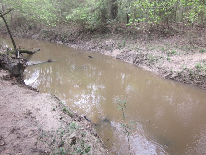
We stood around on the side of the road chatting for a few minutes. The big topic of the day is the San Jacinto River crossing, which has no bridge. Julie and I decided against the bushwhack walk-around and decided to ford the river. That was a questionable decision; it took us at least an hour to get across.
I should clarify: Fording the San Jacinto River is not challenging; getting into and out of the river is challenging. The banks on either side are slick mud with little to no traction.
One other challenge is that the river is brown. You cannot see where you are stepping. It looks and feels like a river of mud. It doesn’t make it much harder, simply slower.
Once we were both across and re-dressed, we continued on our way. Fun fact: the only picture of me from this ford is a nude photo and ain’t nobody got time for that.
Unfortunately there was a detour around Double Lake, but the detour was really well marked. We camped near Highway 77 after going as far as we could. Bad weather is in the forecast. We’ll see.
March 10, 2017
Big Creek Scenic Area was aptly named. Not only was it beautiful, but it also was where we began seeing snakes. Luckily, the weather held out and we made it to Winter’s Bayou, which may be the most romantic name I’ve encountered on this trail.
We are camped at Mile 91, which feels impossible.
March 11, 2017
Bayous are mysterious and beautiful and eerie.
We crossed the San Jacinto again, this time on a bridge, and passed remnants of an old fire tower. I always feel a tug in my heart when I see an old fire tower.
Wet, murky beauty on all sides of the trail. Occasional long, occasional sketchy boardwalks.
Watching the miles count down was exciting and sad at the same time.
Julie’s car was at the trailhead just as we left it. We changed into clean clothes and began the long drive back to Dallas.


