Please note that I hiked this trail in 2018; trails change and maps change and prices change, so read this advice with that in mind.
Before your trip:
- Buy the guidebook Hiking Centennial Trail. I photocopied the pages I needed and left the book itself with my family so they could follow along. The mileages in the guidebook are much more accurate than the mileages on the National Geographic maps. The elevation profiles are useful as well.
Though this book is worth the cost, there are a few challenges:- The book is geared towards northbounders, so it’ll be a bit harder to use if you travel southbound.
- It is definitely written for dayhikers and much of the information isn’t from the perspective of a long-distance hiker. Example: the “strenuous” and “demanding” sections are rated in large part (or entirely) due to their length, not necessarily the difficulty of the terrain. For a long-distance hiker, the length of a section is immaterial; we’re traveling 125 miles, so how those miles are divided really doesn’t matter to us.
- The books only lists potable water sources. There are many streams along the way that backpackers would happily use. You can get some of that information from the section description in the guidebook, but it’s not laid out as easily as the list of potable water sources.
- Buy the two Black Hills National Geographic Trails Illustrated maps. Yes, the mileage is out of date, but the maps are waterproof, tear-resistant, and more helpful than the maps in the guidebook. No, you probably don’t need these maps, but you’ll have a better trip if you bring them. Warning: the trail route is inaccurate in the following areas:
- north of Nemo
- north of Alkali Creek
- around Bear Butte Lake
- and probably others too that I didn’t catch.
2023 update: If I was doing this trail again, I would probably try to find a digital map rather than purchasing a hard copy of the Trails Illustrated maps. Avenza probably has a couple of options.
- Plan your food situation. I called and got permission from Pactola Pines Marina to mail a small food drop there. It’s not easy to get to, though, and hitching was unsuccessful. On the plus side, they have hot meals and relatively cheap shower and laundry facilities. Honestly, I would consider just carrying all my food if I did it again.
- Arrange a water cache at Elk Creek Trailhead. This may not be necessary depending on weather and water availability, but look into it.
- Get a backcountry permit if you intend to camp within Wind Cave National Park. They are free.
- Southbounders: to camp legally at French Creek Natural Area, you’d need to hike to the horse camp, register, and then turn around and backtrack a ways. Be mentally prepared for this, or, if you’re in the area ahead of time, see if you can register in advance.
- Figure out a shuttle. Actually, two shuttles — to Wind Cave and from Bear Butte, unless you are parking long-term along the trail. Rumor has it that a local outfitter in Rapid City is offering shuttles. Having a local friend made life SO much easier; I can’t even put it into words. Don’t assume you can hitchhike — this isn’t the AT.
- Bring cash. If you plan to camp at any of the official campgrounds, you’ll be glad you have cash.
During your trip:
- Watch for poison ivy! There is a ton of it. You can’t avoid it; it hangs over the trail up to your knees.
- Don’t count on being able to make it to French Creek Natural Area on Day 1 unless you get a very early start or are moving very fast.
- Take the Black Elk Peak Alternative for a much better experience (see below).
- At Pilot Knob Trailhead, take the time to hike the mile into Merritt to visit the Sugar Shack. (Plan ahead and check on their hours.)
- Camping along the off-road vehicle multi-use section of CT is possible but unpleasant.
- Actually, almost everything about the off-road vehicle multi-use section of CT is unpleasant. Sorry.
- As you near the northern edge of Black Hills National Forest, the pine beetles are really chowing down. Camping can be a little worrisome here. Avoid in high winds.
- There is a culvert underneath 79 near the Fort Meade Trailhead. CT signage brings you to a road crossing, but you can avoid almost dying by diverting less than half a block to the culvert — but you have to know it’s there, you don’t necessarily see it from the trail. Don’t be like me and stand at the side of the road for 8 minutes looking like a dork and then running across the road. (It might be more visible for southbound hikers — I only saw it once I was safely across the road.)
- The earlier you start up Bear Butte, the more solitude you’ll have and the lower your risk of getting caught in a storm or overheating (shade is rare). Camping at Bear Butte Lake Campground was $11.67 (probably more now) and was a great place to launch my final miles. Word of warning: only half of the “Lake Trail” shown on the Nat Geo maps really exists. It’s a quick and easy roadwalk, however.
Black Elk Peak Alternative:
To anyone looking into the Centennial Trail, I cannot stress this enough: the best hike in South Dakota is right next to the Centennial Trail but is not on the Centennial Trail. No hiking trip in the Black Hills is complete without summiting Black Elk Peak (formerly called Harney Peak).
Seriously — divert off the Centennial Trail and do this instead. You won’t regret it.
I read somewhere that the Centennial Trail used to ascend Black Elk Peak but was re-routed. Of course I cannot find that source anywhere now, so I don’t know if it’s true or if I dreamed it up.
The official CT route through the Black Elk Wilderness is fine — but only fine. Comparatively, the hike up to Black Elk Peak is stunning. This is the soul of South Dakota hiking, right here. And you can take it all in for just three extra miles — if you divert off the main CT.
Here is what I recommend:
For reference: the official CT route through Black Elk Wilderness to Big Pine Trailhead is about 9 miles. Here is the Forest Service brochure with a map so you can follow along.
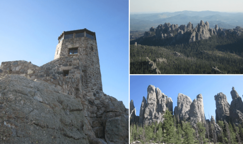
1. I recommend entering Black Elk Wilderness from the Iron Creek Campground/Norbeck Trailhead instead of the normal CT entrance. From Norbeck, it’s about 5 miles to get to the heart of the trail fiesta near Black Elk Peak. (If you’re ambitious, divert 0.8 mile to the Cathedral Spires.) Continue north about a mile to Black Elk Peak. Distance so far: 6 miles.
2a. From Black Elk Peak, it’s about 6 miles to Big Pine Trailhead via Harney Trail and Willow Creek Trail. This is the most direct way and probably the best, though I haven’t hiked this part and can’t promise anything. Total distance from Norbeck: 12 miles.
2b. Or you can take Grizzly Bear Creek Trail and Horsethief Trails to get back to the official CT, which I can vouch for — these are good trails. This route is 9 miles from Black Elk Peak to Big Pine Trailhead. Total distance from Norbeck: 15 miles.
There is no reason to hike the eastern side of Black Elk Wilderness when the western side offers such incredible scenery. Don’t be a purist; ditch the official route to hike an extra three miles and enrich your hike immeasurably.
Cell and radio reception:
- Cell reception (text, voice, not necessarily data) was excellent — much better than the average long-distance hiking trail. The most noteworthy dead zone was around Brush Creek Trailhead, but I suspect I could have gotten reception on either side of it — I just didn’t try.
- I carry a portable MP3 player/FM radio. Every night I was able to get radio reception to hear a forecast. Your best bet (unfortunately) is Kick 104, the twangiest country station in the Black Hills and possibly the world. Other radio stations had more limited and infrequent forecasts.
- I charged my phone at Pactola Pines Marina (charge: $1.50) and Sugar Shack in Merritt (free). Other opportunities to charge would be limited — Pactola Visitor Center and Legion Lake restaurant in Custer State Park, and probably somewhere in Nemo are the only spots I can think of. There may have been an outlet available at French Creek Horse Camp, but I can’t guarantee it.
Water considerations:
- There are many more water sources than the guidebook lists — they only list potable water, but there are streams and other sources of water.
- I made it through the hike only getting water out of streams a few times, but it was cold and I got most of my water through osmosis.
- Rumor has it that Dalton Lake Campground’s water is bad — there was no sign, no warning about that when I was there. I drank three liters from Dalton and survived with no adverse affects. I did Steripen the water in an abundance of caution.
- It’s a huge haul from Dalton Lake north to any water source. A water cache at Elk Creek Trailhead will make your life better. Warning: the road to Elk Creek is suffering from erosion issues. If you drive there, pull over when you see erosion issues and walk the rest of the way. You’re almost there.
- There are stock tanks at the Fort Meade Trailhead that may or may not have water.
- If you climb Bear Butte early in the day, there will be no water access at the Visitor Center. Your best bet is to fill up at the campground even if you don’t stay there. No one will know or care. Note: the water here tastes a little lakey, but it’s potable.
