It seems like the Maine International Appalachian Trail does not see a huge number of hikers, which I would speculate is for a couple reasons:
1. It isn’t seen as a stand-alone trail. To hike the entire International Appalachian Trail, even “just” the North American section, is a massive endeavor which does not draw many people. But I am not sure why more people don’t set out to “just” hike the Maine IAT. It stands alone just fine.
2. The Maine IAT has two long roadwalks and this almost certainly scares people away. To this, I would shrug and suggest that people don’t need to be purists to have fun. I had way more fun by being a non-purist. It is a worthy hike with or without the roadwalks.
If you think you might be interested in this adventure, here is what I would tell you. This advice is written for the MIAT as a stand-alone trail.
Go Southbound:
I hiked the AT southbound, so I admit a huge bias for heading south, but in this case I think going southbound is justified.
To me, ending with Katahdin Woods and Waters was a spectacular finale. There are only three noteworthy mountains on the IAT, and two of them (and the wild ones) are in the southern end. Ending on the border cut just isn’t quite as appealing to me.
I think resupply is easier as a southbounder, allowing for a lighter pack on the harder sections.
Those who have hiked the AT southbound will feel at home heading south, and those who hiked the AT northbound will feel at home heading towards Katahdin.
Getting to and from the Trail:
Buckle up. This is going to take time and effort. There is no easy way to reach either terminus.
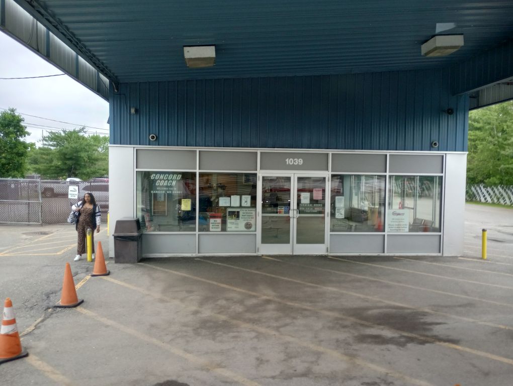
You can connect Boston Logan to the northern terminus by Concord Coach and Cyr Bus Lines which are reliable and comfortable. They have Wi-Fi and are affordable options and I was able to get a schedule that minimized downtime. But rather than rely on all the transit pieces fitting together perfectly in one hellishly long day, I would recommend planning to overnight in Portland. That breaks up the travel a little more sanely.
If you don’t want to fly into Boston, you can fly to Bangor or Portland. When I was checking prices, these options were about double the cost of Boston and meant I would need connecting flights, which I loathe with every fiber of my being. But you never know how flight prices go. Give it a try.
I did Boston to Portland via Concord Coach (they pick up at every terminal except one), changed to another Concord bus in Portland heading to Bangor, and changed bus and busline in Bangor to Cyr Bus Lines with a VERY tight connection. Cyr Bus Lines only runs this route once per day, which is one reason I’d say plan an overnight somewhere in your travels to give yourself breathing room.
Once arriving in Presque Isle, the only option for getting to the trailhead is either knowing someone local or finding an Uber/Lyft. Unfortunately, the once-daily bus arrives around 9PM and I would not recommend night-hiking to the first shelter. What’s sketchier than hiking along the international border? Doing it in the dark. Plan to overnight in Presque Isle too.
See what I mean about time and effort?
(An alternative would be to flip-flop your hike. The bus from Bangor to Presque Isle also goes to Houlton and Mars Hill, both of which have cheaper and easier lodging options than Presque Isle. You could exit the bus in one of these towns and hike north for a couple of days. It would mean eventually needing to hitch into Presque Isle and take the bus southbound afterwards, so this is likely more trouble than it is worth, but it’s something to think about.)
The southern terminus is very remote with rare whispers of reception for a text message – maybe. (I have Verizon.) You may be able to hitch a ride with tourists driving the Katahdin Woods and Waters Loop Road, but traffic is VERY light.
There is currently (2023) no legal way to enter Baxter State Park from Katahdin Woods and Waters National Monument. I hope that in the future, entrance can be negotiated so that at a minimum, hikers can get access to Baxter State Park, where hitching is reportedly super easy.
Your best bet for the southern terminus, if you don’t want to rely on hitching, is to arrange a shuttle with the Appalachian Trail infrastructure available in Millinocket. Because you need reservations to stay in Katahdin Woods and Waters’ lean-tos, you will need to have a schedule and stick to it anyway, so arranging a shuttle so far in advance is less risky than it might otherwise be. You can also probably rely on reception atop Lunksoos and Deasey Mountains to confirm your shuttle.
Once in Millinocket, there are shuttle services available which can get you back to that precious once-daily bus at its Medway stop to return to Bangor, Portland, and/or Boston.
Dealing with the Roadwalks:
Not a fan of roadwalks? Don’t do them. You don’t have to. You don’t have to prove anything. Maine residents are friendly and wonderful and somehow, you can get from A to B without banging up your feet.
Resources:
The Maine International Appalachian Trail is administered by the Maine Chapter of the International Appalachian Trail, and they are awesome – if you have questions, you can actually get a helpful response from a human! They also produce excellent resources. They created a free map set and guide which is periodically updated. Additionally, you can pay for the Far Out app which can be helpful especially if you are worried about current water availability. I would caution that Far Out, for any trail, shines when it has many people using and commenting in the app, and on this trail, there just isn’t the traffic to ensure that you’re getting a lot of user-generated content. What’s there is good, though, and the more people who use it, the better it’ll get. You can also post questions in the Facebook group, which is a great source of information.
Because I am a nerd, I downloaded the National Park Service app and saved the Katahdin Woods and Waters info for offline use. It was more for fun than anything else, but I could see it being useful. I also downloaded a few free georeferenced area maps onto Avenza. The Maine IAT maps are not currently available in Avenza. This was all completely unnecessary and you don’t need any of these supplemental resources.

Resupply and Special Meal Options:
- I resupplied (mini) in Mars Hill. The grocery store was full-sized and had an available garbage can if you need to repackage your purchases. There were some restaurants in town, I think.
- Houlton has a Hannafords and Walmart and every kind of restaurant you can imagine.
- Wilderness Variety on the roadwalk to Matagamon had some good supplemental foods and a great menu.
- Matagamon was expensive and I would not want to resupply there. But their hot food was worth the price and their showers were too. I loved staying there.
- There are other small options along the way, though with any of resupply options, I would caution that with staffing shortages, hours fluctuate wildly – your best bet is to double-check before you leave. You want the most updated information.
Noteworthy Sections:
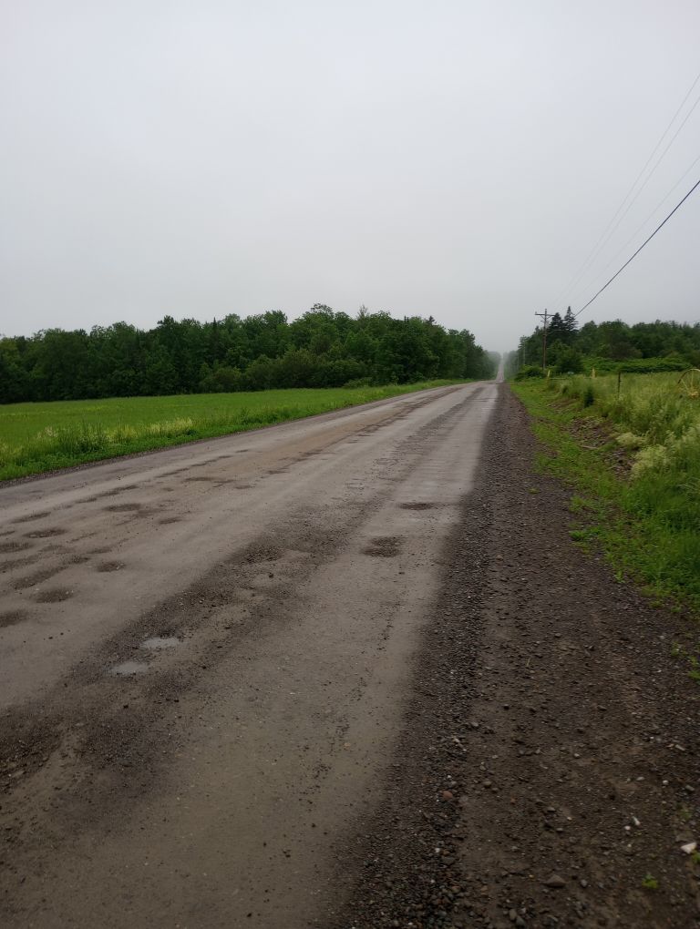
Do not underestimate the border cut. This area does not have switchbacks or enough traffic to tamp down the growth. Recent work had cleared blowdowns and created a beaver bog bypass, all excellent, but it was still very slow to hike through due to the overall wet conditions. Expect the section between Mars Hill and Fort Fairfield to take longer than expected.
Once you begin your ascent to Mars Hill Lean-To, there is only one chance for water, and it was barely flowing during my monsoon of a hike. I would not rely on it. Get water before you ascend. Also, the road leading up to the windmills is likely a faster, easier way than the trail which currently has many slash coverings. Both routes appear to be labeled as IAT on the ground, though the road is not listed in Far Out as an option.
Leave the town of Mars Hill with all the water you can carry. I was uninspired by the water I saw between there and Monticello Trestle. It existed . . . but . . . ew.
The Bangor and Aroostook Rail Trail is pretty nice to hike, but it is long with monotonous terrain, so pace yourself to avoid pain. It had no traffic in the morning and only light traffic in the afternoon, but the weather may have been a factor.
The town of Houlton is rather sprawling. I saved around $80 by booking an AirBNB close to downtown, over a mile from the trail, but the convenience of the motels nearer the trail may be worth it, especially if you are splitting the cost with a friend. The price difference may have been due to the holiday weekend when I was in town. Military Street Laundry was super friendly and near the post office and a pizza place which sold pizza by the slice.
Even if it has been recently trimmed, the trail leading to Roach Farm Lean-To is going to be wet in the morning with dew. Wear your poncho and sandals or some combination of clothes you don’t plan to spend the rest of the day in, and change once you’re on the roadwalk, or else your clothes will be sopping wet before you’re even on the main trail.
Camping near Mount Chase was okay. There did seem to be other options farther along, but I would be very cautious about potential trespassing. Err on the side of caution.
If you don’t want to do the whole roadwalk to Matagamon, Wilderness Variety may have connections to a ride. If staying at Matagamon, inquire if a site with a lean-to is available. Why not?
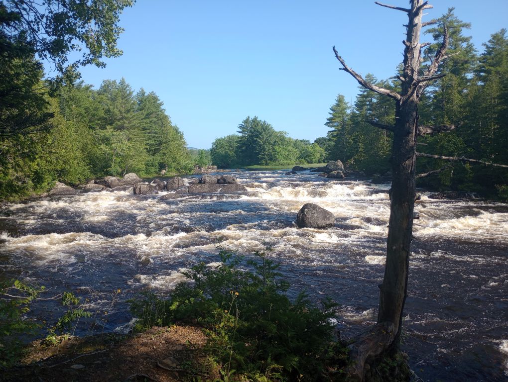
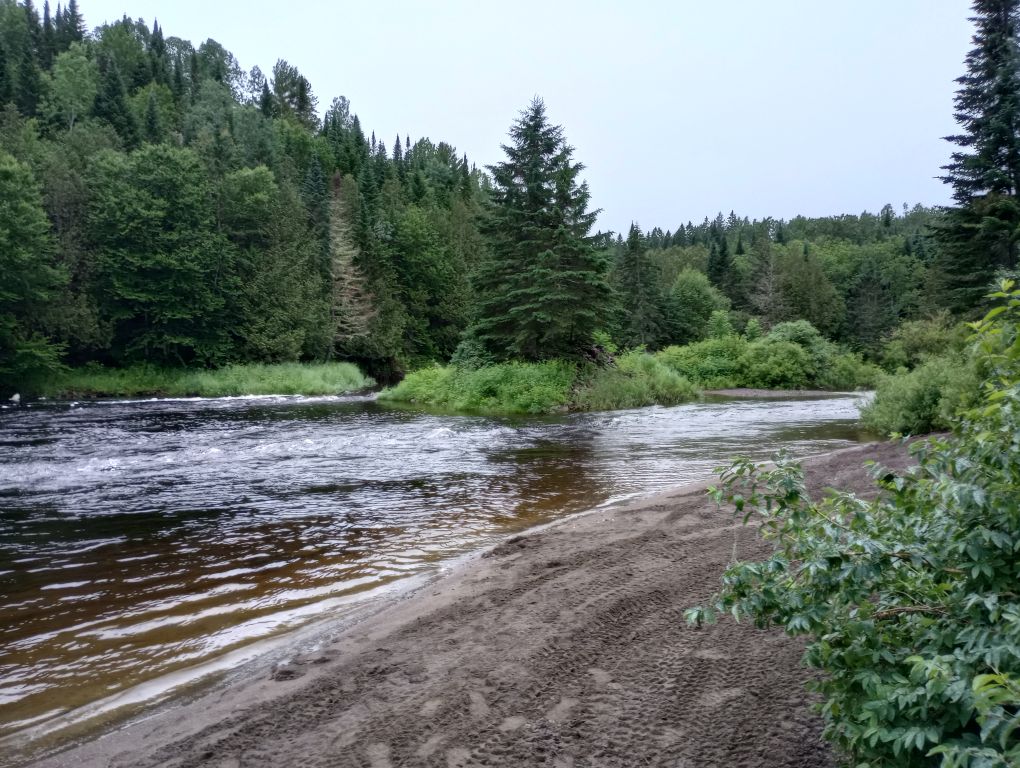
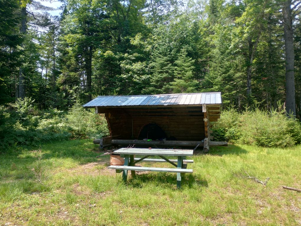
Slow down during your time in Katahdin Woods and Waters. It’s a magical area. This isn’t the place to bang out miles. Stay awhile. Meander. I stayed at three of the four shelters, no regrets. Grand Pitch was nice due to its proximity to water and nice open area in front of the shelter. Lunksoos was interesting because it’s very much in the middle of nowhere and sets you up for an early summit of Lunksoos Mountain and Deasey Mountain the next day. Note that it used to have a view of Katahdin, but it has sadly grown over. Wassataquoik was easily the nicest, but is much more likely to be booked due to proximity to a road.
The ford of the Wassataquoik can be really dicey. There is no good alternative if the water is too high. (There is a bridge far downstream, but I am not sure if the trail to get there is passable and the pictures of the bridge itself look terrifying, so the ford itself is the safer bet.) A local expert said that in high waters, go a little upstream of where the normal crossing is. The plus side is that when you reach the stream, you are nearly at the shelter, so if you get wet, you can dry off soon.
Final thoughts:
This trail is very much a variety pack. You get everything from the wide, weird border, to steep mountain ascents, to long, flat rail trail, to rolling roads, to rocky, rooty trails. Don’t be scared off by the roadwalks, or the fact that this trail is a piece of a larger network. It stands alone.