When planning my Appalachian Trail hike, I had no idea that one of the consequences would be an undying love of the Smokies. If you’d told me during my AT hike that this would be one outcome, I would have been shocked.
November 13, 2010
Groundhog Creek Shelter to Davenport Gap Shelter, 10.7 miles
Not all miles in the Smokies
Although this was a short-mileage day, it was strategic, and it involved a pizza for lunch. You need to have your priorities in order on the trail.
At the gap we followed a road to Standing Bear Farm, a beautiful piece of what the AT is all about: nature, tradition, trust, friendly hostel owners, and shelter registers full of friends. Frozen pizza made a much better lunch than bagels for the 80th day in a row. We enjoyed it immensely, checked the weather (we’d been hearing sketchy stuff about the weather), and went on our way.
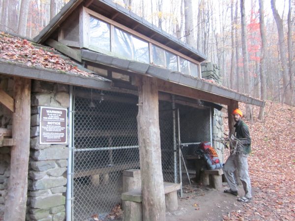
Davenport Gap Shelter is in the Smokies, but just barely. There was no sign to suggest that we had entered the most-visited national park in America. No “Hi! You’re in the Smokies now!” sign. Nothin’. The shelter sits 1200 feet above the Pigeon River gap. It’s only a fraction of the climb into the Smokies (the trail goes from 1400 ft to 5050 in about seven miles), but in the park you must camp at designated locations. This can be a problem in northbounder season, but today, the only people we saw were some horse riders – the first time I’ve seen such a thing on the trail, as it is forbidden nearly everywhere else.
It was a nice night with a toasty fire inside and a chain-link fence locking us in, away from bears. Creepy, but fun.
November 14, 2010
Davenport Gap Shelter to Tri Corner Knob Shelter, 14.8 miles
Today we finished the initial huge climb into the Smokies. With that out of the way, the mountains that we summit in this section, while having impressive height, will actually be small or normal climbs compared to what we are used to. The highest point on the whole trail is just ahead of us, and the climb there will be minimal.
This was a perfect day in the mountains. Breathtaking climbing and views. I felt like the effort I was putting into the trail was directly related to the quality of views I was getting. Don’t get me wrong; I love views of trees and normal forest, but after thousands of feet of climbing, a reward was quite appreciated.
Towards the end of the day I was tire and sore, having issues with my new boots, and the sky began to look menacing. I was following my guidebook pages and came to the conclusion that we hadn’t passed a certain trail junction (Guyot Trail). This meant we were still miles from the shelter, and I was beginning to fret. No way would we make it before the clouds broke into rain (or worse).
Karma consulted his GPS, which has coordinates for all the shelters but not the trail (I think sanity is saved quite often with this arrangement) and concluded that we were, in fact, mere tenths from the shelter. I gave him a big hug and was positively overjoyed. We made it just before it began to rain.
Cold, drizzling, endless rain. But: nice, dry shelter, all to ourselves. Water source mere feet from the shelter. Decent privy. Bear pulleys.
What a great day. I still don’t think we ever crossed Guyot Trail.*
*2026 update: We did not, because it is not a trail. It is an unmarked, unmaintained, unofficial path, called a “manway” to the top of Mt. Guyot. The waypoint no longer exists in the guidebook.
November 15, 2010
Tri Corner Knob Shelter to Gatlinburg, 16.6 miles
We woke up to fog. Wet fog. My heels had quit getting better and were sore to the touch. I optimistically wrapped them and stuck my feet in my boots that I bought in Hot Springs. I was already missing the meshy, holey boots I’d left with Scout at Elmer’s.
Without a single view, I hiked for a few miles before I was literally wincing with every step as I felt the skin get rubbed away from my heels. Giving up, I took off my boots and changed into my trusty crocs. I attached the shoes to my pack and kept on walking. With zero tread, slippery trail, and now an extra-heavy pack, the conditions were not in my favor for the day.
Eventually it began raining, later pouring, and finally settled on giving hikers drenching buckets of icy water. Nothing could have kept me dry in that weather. Each time I reached the edge of a ridge, I glanced at the endless white and wondered what the view would have been. I shudder to think how close I was to the edge of some of those ridges.
Near Charlies Bunion (surprise! No view!) I began to lose my mind. My feet were long since soaked in ice-cold rain water, the relentless wind and rain had whipped my face and hands raw, and I could squeeze water out of everything I was wearing. I sobbed loudly and often out of misery. I met a dude hiking north, clearly on a dayhike, who must have heard me sob and probably thought I was nuts. He would be right.
Being at elevations of 5,000-6,000 feet during terrible weather like that made me realize a few things:
1) Yes, Maine really was as bad as I remember. All those rainy mountains were just as miserable as I’ve made them out to be.
2) Crocs are amazing. Absolutely the best. If I did not have Crocs, my broken body would have eventually been found somewhere around Mt. Chapman.
3) Hiking through these mountains in thunder would be absolutely terrifying.
4) I love the North Carolina-Tennessee border even if it sometimes hates me.
Karma and I rendezvoused at Icewater Spring Shelter. I was shivering and miserable. Our options were either to stay and try to warm up, or to hike another three miles to a road to Gatlinburg. We had planned to resupply there anyway, and the idea of being just a few miles from heat was too good to pass up. Plus, realistically, everything I owned was wet. Not even my raincover could keep it out.
The next three miles were mostly downhill, and knowing that at the end there would be a chance at being dry . . . it was incentive. We reached the parking lot and to my surprise there were several cars there. Very little traffic on the road indicated that it would be a tough hitch to Gatlinburg, which was about 15 mountain-miles away.
I hung out for awhile and decided that desperate times definitely called for desperate measures. When the dayhiker who heard me sob emerged from the woods, I offered him some money if he’d let us ride down the mountain with him. He wouldn’t take the money, but he dropped us off in Gatlinburg. He probably saved my sanity, and I’m sure he knew it. Cheers to you, whatever your name is, whoever you are — I was too drenched to soak in any information about you, other than knowing you are wonderful.
We each took showers and each ate a large pizza. I hadn’t stopped for lunch that day and had burned God only knows how many calories due to cold, exertion, and shivering. The feeling of getting into a hot shower after a cold, icy day in the Smokies, well, that was not just a highlight of the trail. It was a highlight of my life.
November 17, 2010
Gatlinburg to Silers Bald Shelter, 12.5 miles
So nice to get an early start, thanks to the kind owner of Grand Prix hotel who shuttled us up to the trailhead. With fear, I stepped out of the van, only to be surprised by how mild it was. We were wise to take a day off in Gatlinburg, as apparently it precipitated most of yesterday up here in the higher elevations.
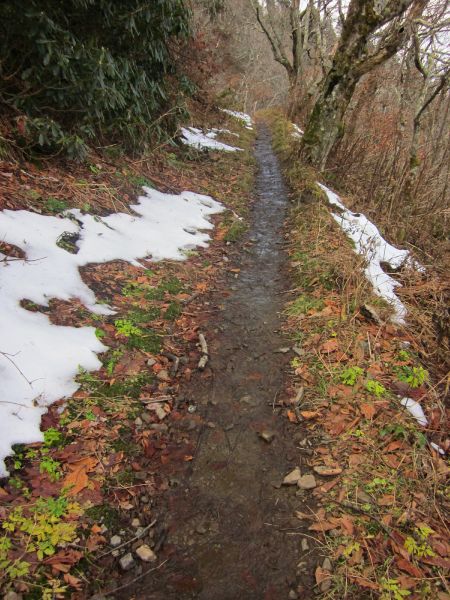
The trail was crunchy and snow-covered, but it was drier snow than I’d hoped, and my feet didn’t get wet in this. We were the first hikers on the new snow, though a cat of some description did beat us!
At the shelter, we met two very inept men who were attempting to be hikers and failing miserably at every social norm set down for hikers. They were friendly enough though, and even better – they left. I was quite pleased to have the shelter to ourselves yet again.
November 18, 2010
Silers Bald Shelter to Russell Field Shelter, 14.7 miles
I love the Smokies. Today when I took off my boots, they literally steamed. The steam oozed out of my boots and made me feel much more hardcore than I actually am.
November 19, 2010
Russell Field Shelter to Fontana Hilton, 14 miles
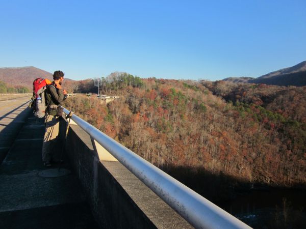
Today was a day of adventures: crossing the Benton MacKaye Trail, almost climbing Shuckstack Mountain (it looked a wee too decrepit for this weenie, but Karma made it up), gummi worms for dessert, and one of the most famous spots on the trail: Fontana Dam and the Fontana Hilton (actually a shelter, just a nice one).
It was a really fun day of hiking. As usual, northbounders got a big welcome sign for when they entered something, but I wouldn’t trade all the signs and welcomes in the worlds for the blissful solitude that Karma and I were lucky enough to experience in the Smokies.
Total trip mileage: 71.7
Total mileage in the Smokies: 71.7
Total new mileage: 71.7
Shelters: Davenport Gap, Tri Corner Knob, Silers Bald, Russell Field
