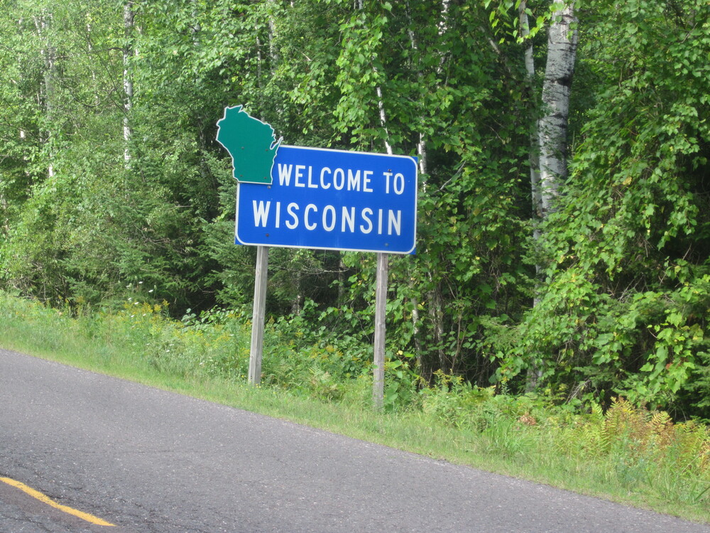
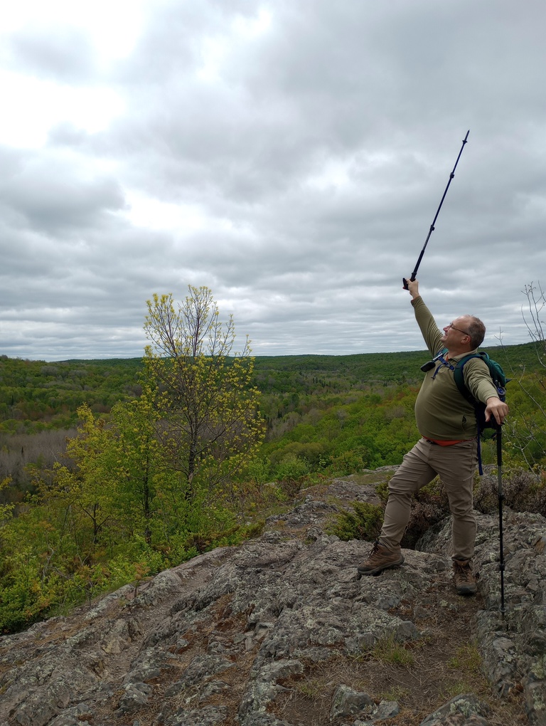
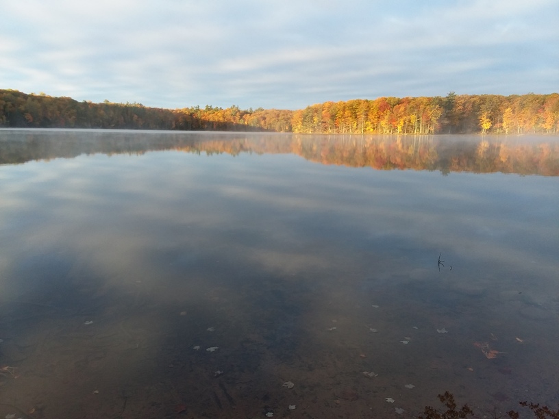
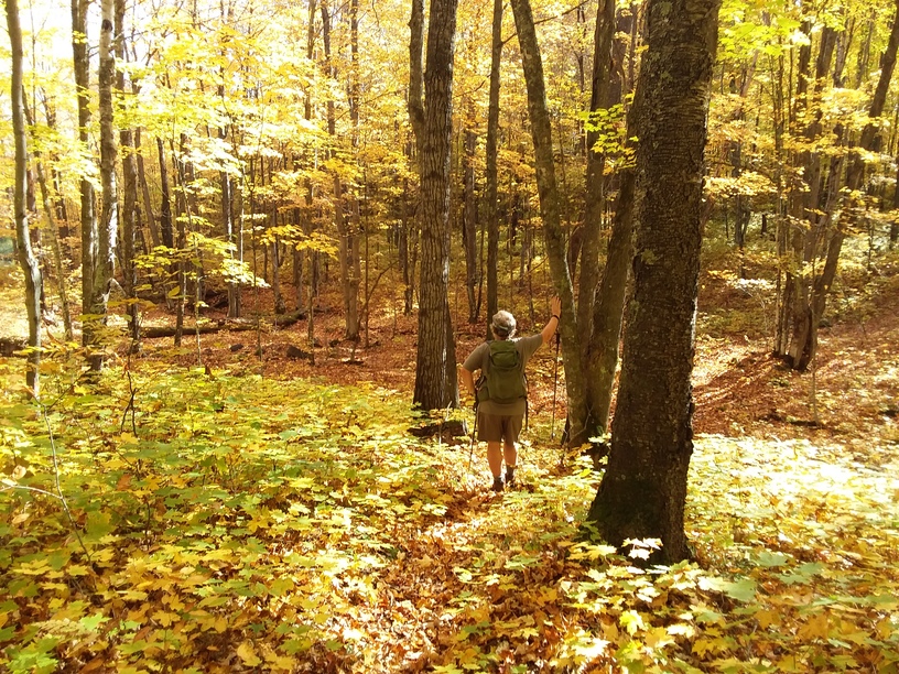
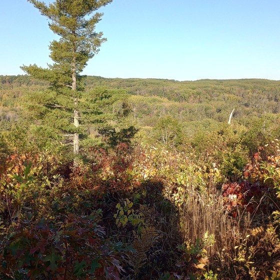
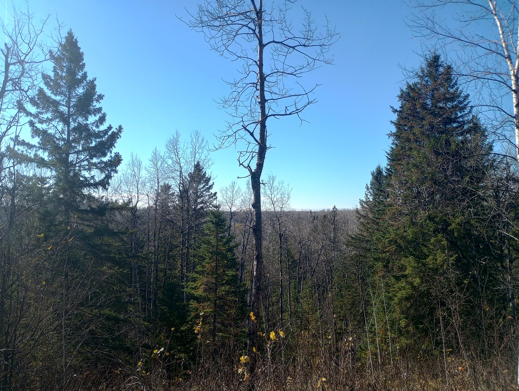
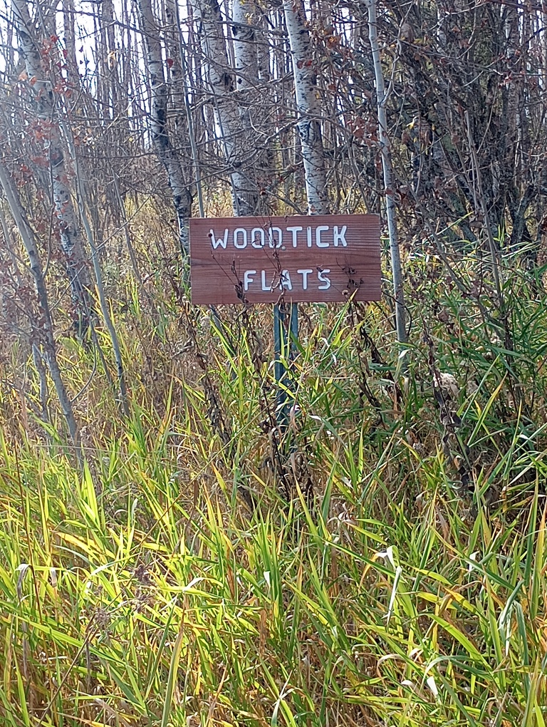
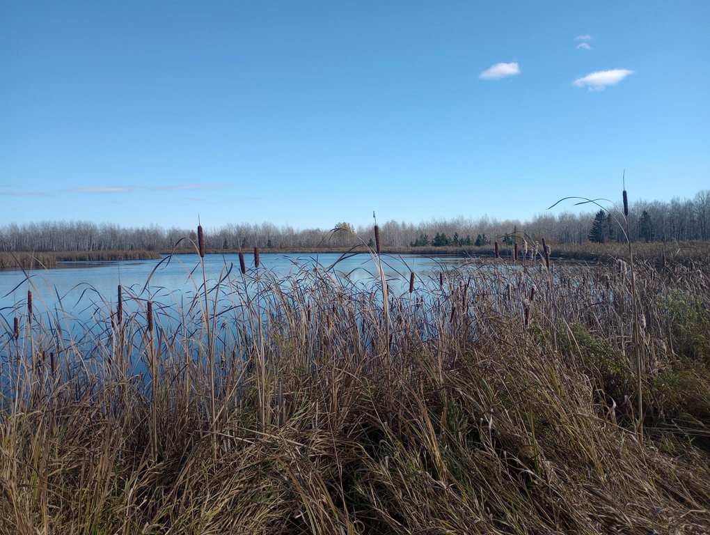
In 2021, I set off to thru-hike the state of Wisconsin on the North Country Trail. At just over 200 miles, this section of the incomprehensibly-long NCT is a really achievable section and would make for a great two-week jaunt. However, life had other plans for me and I ended up section-hiking it in a mix of backpacking and dayhiking in 2021, 2022, 2024, and 2025.
There is no easy way to write about a trail when you’ve skipped around and hiked in every direction over the course of four seasons. I’ll write this from east to west, with a note about the dates on each section, as there have been major updates since I hiked some of these areas.
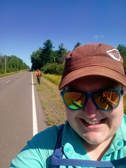
Aug. 21, 2021 – 14.4 miles
Michigan Border to Iron County Forest Stealth Site
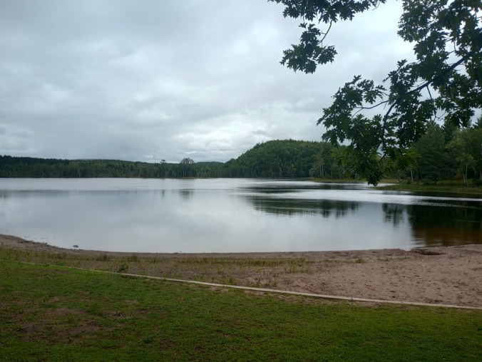
My long-suffering parents dropped me off at the border, which is pretty certifiably in the middle of nowhere. The trail began with little-traveled roads and I took a break at Saxon Harbor to get water and use the bathroom. From there, the dirt Harbor Drive was a bit harder, as I kept getting rocks in my shoes. When I reached Highway 2, a small store/bar offered water from a spigot and the chance to buy an ice-cold Gatorade.
On Highway 169, there was little traffic, but my favorite roadwalk interaction of the entire trip happened there. A car pulled over and I expected it to be a NCT volunteer or someone who knew why a woman might be walking along the road with a big backpack. But no, a man rather frantically shouted at me, “Hey! Do you know where the nearest bar is?!” Remarkably, I actually did. But also… it’s rural Wisconsin. If you can’t find a bar, you’re not trying very hard.
I flopped down in the “town” of Gurney to rest from intense heat. Luckily it was at least windy. I was excited to get onto forest roads, and even more excited when the small stream on my map had water. There was no guarantee.
Aug. 22, 2021 – 11.7 miles
Iron County Forest Stealth Site to Porcupine Hill Campsite
Due to private lands, my choices for today were to do either 11 or 20 miles, and I happily chose the smaller. Given the heat, and some invading smoke from the Greenwood Fire, I was happy to dream small. Also, it felt like a very long 11.7 miles, likely because I had to take several half-hour breaks to cool down.
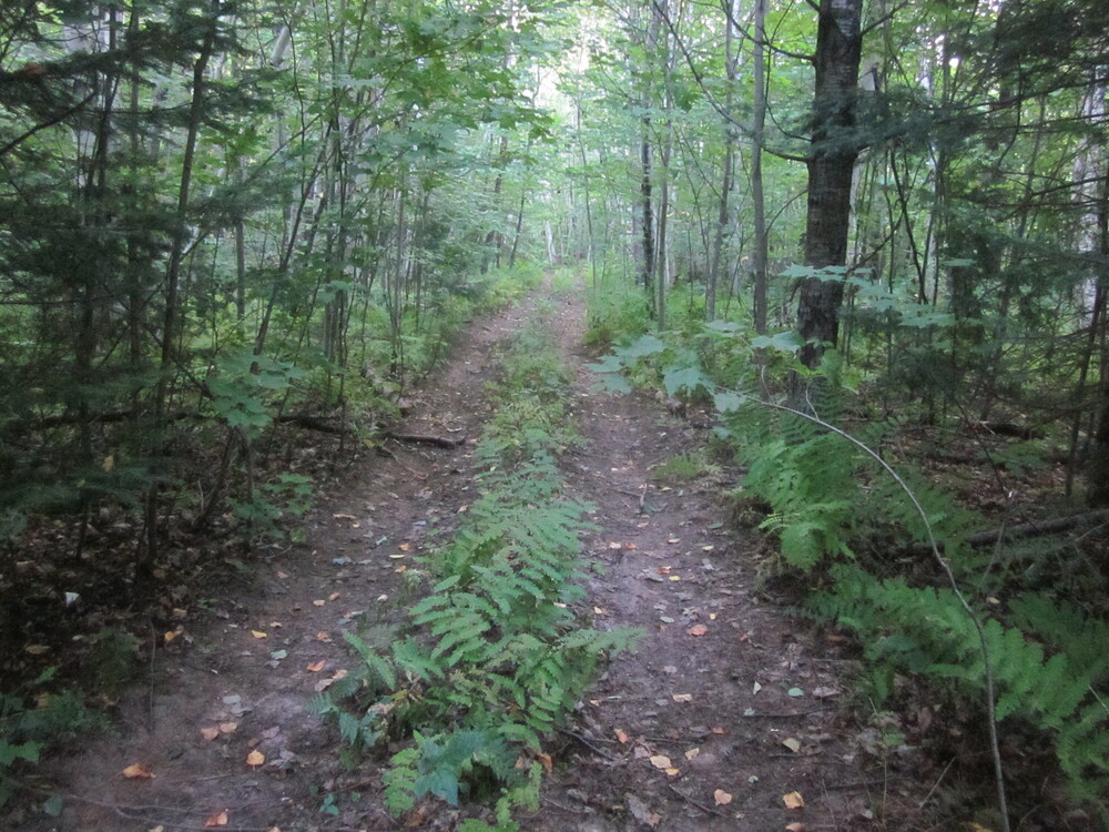
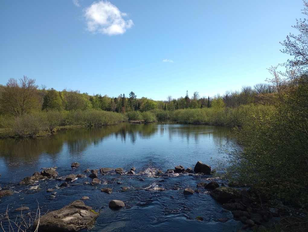
Today began with more forest roads that feel more like trails, then finally reaching singletrack and actual NCT signs. I really enjoyed hiking along the Potato River, mostly due to how scarce water has been. The air smelled like fire and pine tar, and the ground was hot every time I took a break.
At Wren Falls I gathered water, not trusting that it would be flowing at Porcupine Hill. It was a good decision, even though there ended up being a dribble at the campsite. The trail in this area is new, and the campsite feels new too.
Aug. 23, 2021 – 10.3 miles
Porcupine Hill Campsite to Rest Area
I was on trail at 6:30 this morning and finished around noon in an attempt to beat the heat. I would have loved to go farther, but there was no availability at the state park and I couldn’t go past it, so I was just kind of stuck. It was frustrating to feel excited to knock out more miles and just hit a massive wall that I couldn’t go past.
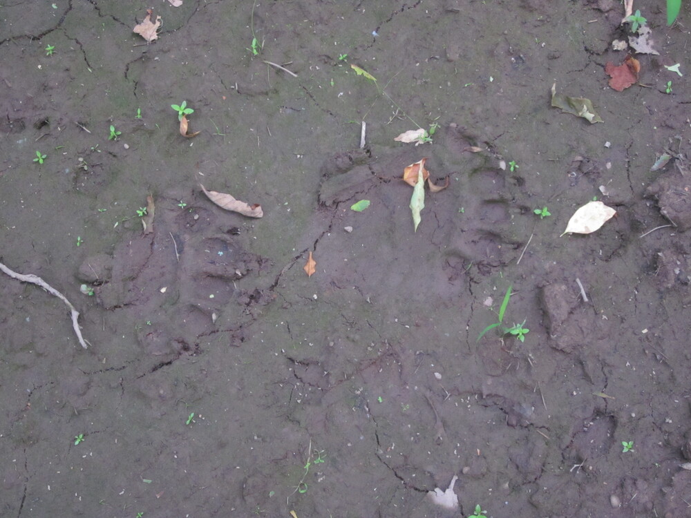
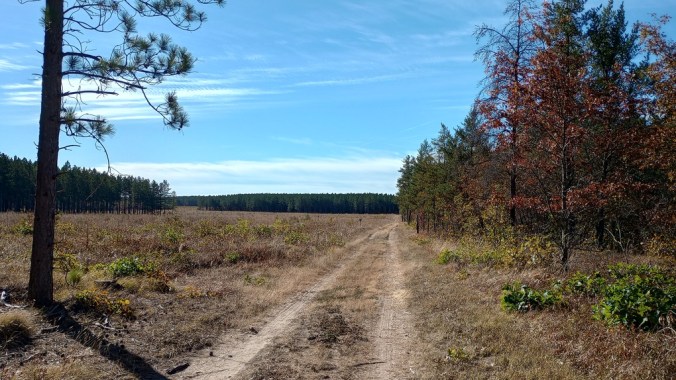
The morning started with a nice climb that reminded me just a little of some the smaller New England hills in Connecticut or Massachusetts. Then it dropped down to a forest road where I saw a giant bear print cemented into the dry clay. I followed this forest road out of Iron County Forest (and out of Iron County!) back to Highway 169. I walked north to a small parking area and began several miles of private land walking where the trails rarely deviates from a perfect straight line.
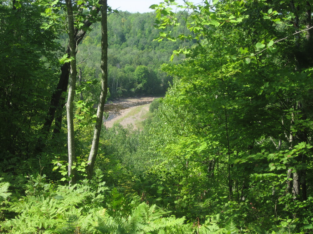
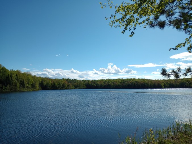
Entering public land again, the trail once more had more freedom to move around a bit and take contours into account. There was a nice overlook of the Bad River and the trail bopped around before reaching a rest area – a conveniently-placed location which is not an official designated campsite.
It was 86 degrees today and smoke from the Greenwood Fire was thick. Water was a major concern the entire day. At one point I was trying to filter water from a mud puddle where a dead frog was floating belly-up. It was at this moment when I knew that I was not going to thru-hike Wisconsin.
Aug. 24, 2021 – 8.0 miles
Rest Area to Copper Falls State Park Pavilion
I had a very miserable night due to heat and stress of the oncoming storm. I was able to get packed up before the rain hit, but before I’d gone too far, it was pouring. The trail became slick and I had to move slowly.
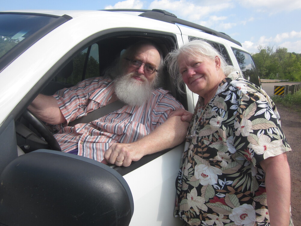
Although I knew the rain would help the immensely dry conditions I’d been fretting about, the decision was an easy one. I was able to hitch a ride out of Copper Falls with Mom who was prepping for a trip to Indiana, which I ultimately ended up going on. It was one of my last visits with my wonderful Aunt Sharon, and I’ve never regretted trading the Wisconsin NCT thru-hike for more time with her.
Even though I wasn’t going to thru-hike, I do believe this is one of the most perfect thru-hikeable sections of the North Country Trail. Over the next few years, I came back and hiked the rest of it: sometimes dayhiking, sometimes backpacking. I’m glad I saw it all.
Aug. 24, 2025 – 4.1 miles/2.05 miles
Copper Falls State Park Pavilion to Copper Falls Entry Station
Absolutely wild how these dates align, four years later. I arrived at Beaver Lake Campground the night before and so did a very sick gistrailblazer. Great. In an attempt to keep me healthy, today we divided and conquered – he had a section farther east to do, and I needed to finish Copper Falls.
I bought an overpriced state park pass and parked at the beach. I followed wide, perhaps newly-overly-developed trail to the Copper Falls Campground, which I walked through, then down a flight of stairs to reach the parking area and pavilion where I called it quits four years ago today.
I bought a sticker and turned around to get back to my car. I thought the map had shown it was only 1.5 miles between those two, but my tracking gave me a total of 4.1 round-trip. I guess I did go a little further south, past the entry station, to where actual trail picks up again.
I had planned to swim, but it was 53 degrees and drizzly. Think about the difference from 2021 to 2025 – same date, vastly different weather patterns!
May 25, 2025 – 6.4 miles
Copper Falls Entry Station to Penokee Mountain Parking Lot (with gistrailblazer)
This was the final day of a big push to finish the Chequamegon National Forest and align us so that on a future trip we could easily finish the little that remained in Ashland County.
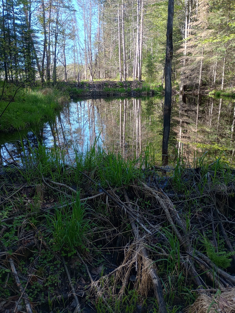
Because we had two cars and we could, we split the day up into three legs. First, we left a car at Penokee Mountain, then drove to Kornstead Road’s rather mushy trailhead to hike mostly downhill on mostly pleasant trail, even passing a four-layer beaver dam. When we arrived back at the parking area, we had finished the Chequamegon, but for people hiking east to west, they would have just begun it.
We then left a car at Mellen Park and returned to Kornstead Road to walk downhill into Mellen. We saw only one car and there was some decent shade.
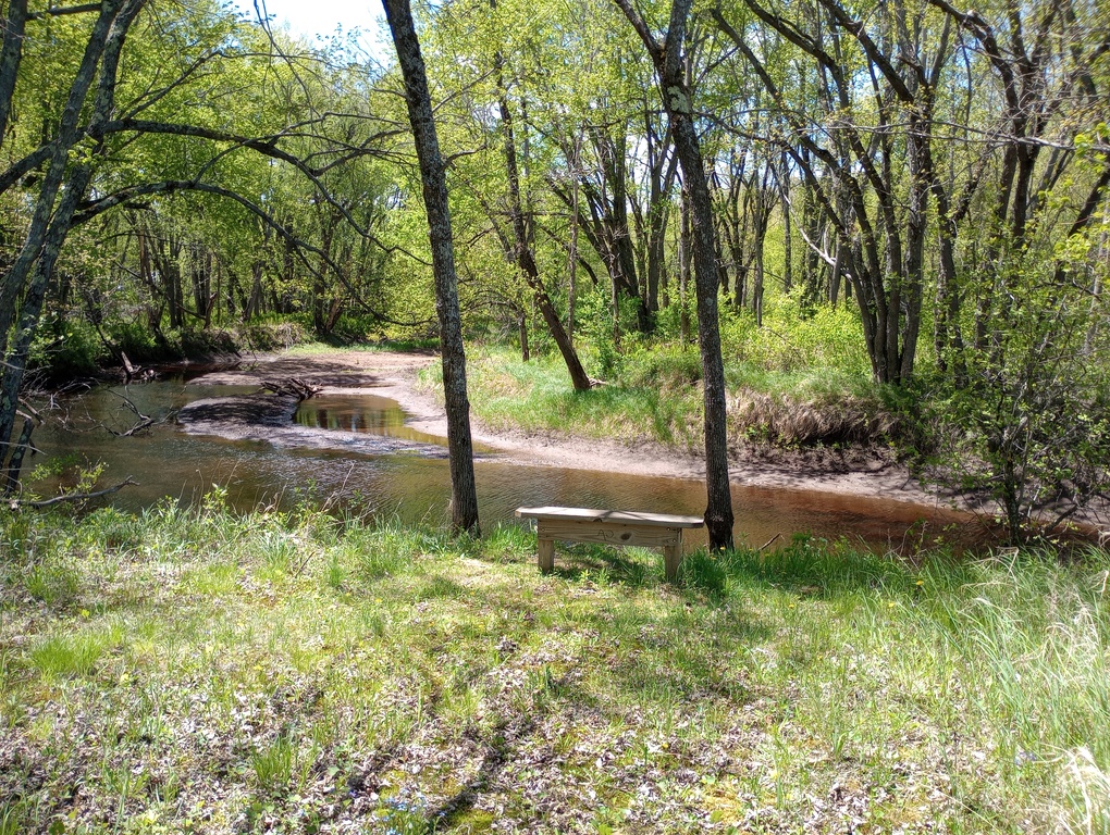
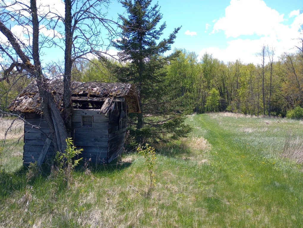
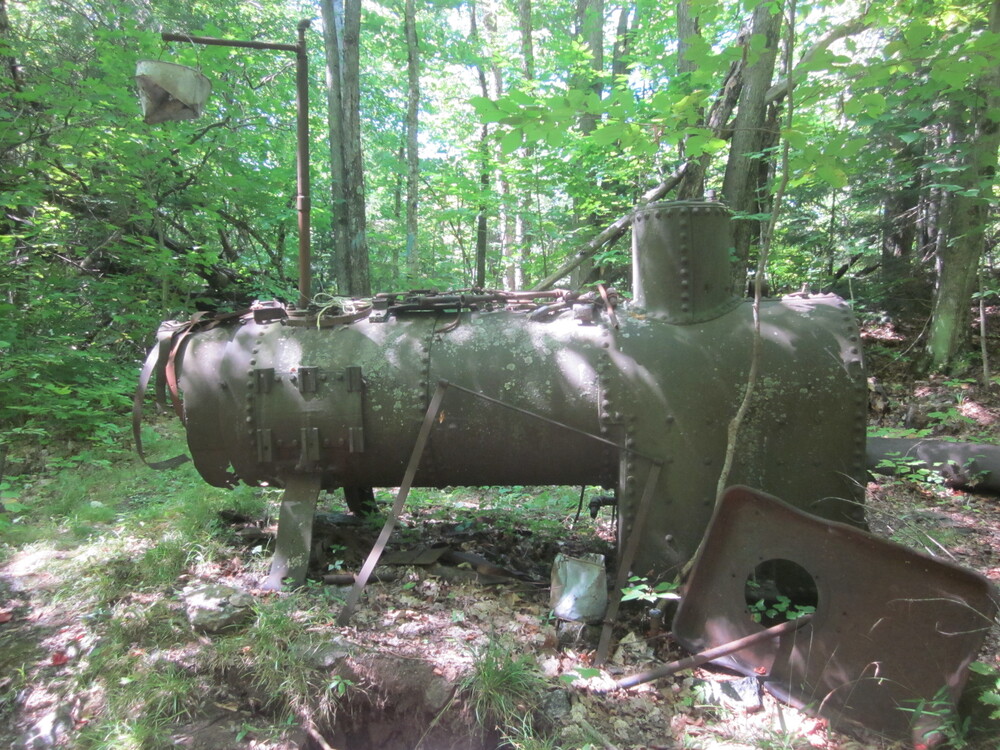
In town we decided we had more energy, so we left a car at Mellen Park again and pulled off Highway 169 near Loon Lake. We hiked out and back to the Copper Falls State Park Entry Station, then one-way to Mellen Park. We really enjoyed the grassy, open area with some old ruins and equipment in the field, and a beloved AO bench overlooking the Bad River. I imagine this would be hell in peak tick season, however.
May 24, 2025 – 9.8 miles
Penokee Mountain Parking Lot to Lake Three Trailhead (with gistrailblazer)
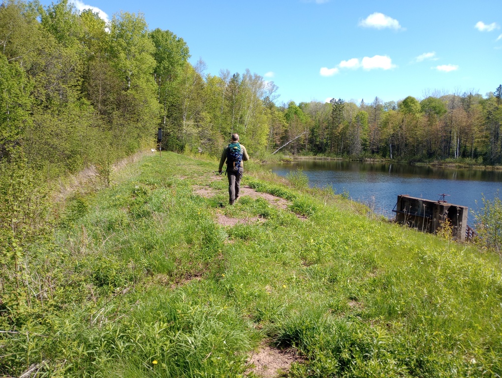
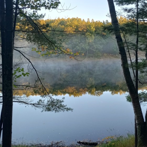
We split this day up into two legs. First we left a car at Lake Three Trailhead and drove to Hanson Road where we hiked west back to Lake Three. What a nice four miles to begin the day with. The Brunsweiler River was definitely the highlight of this section, but the earthen dam and abandoned campground on Lake Three was also incredibly cool. Given its proximity to the road, I don’t think I would feel safe camping there, but it was a great place for a break.
It was a long shuttle from Lake Three Trailhead to stage our cars where we wanted them, but soon we were leaving Hanson Road again, this time heading east. I was unreasonably tired, but we had a lot of landmarks during the day, which always helps me.
About 1.5 miles in, gistrailblazer swears he saw an elk. I heard something, and it didn’t seem like a deer, so I’m willing to believe it. Some of the prints we’ve seen in the mud have felt too large to be deer.
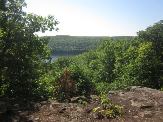
We were nearly to Sara’s Overlook when we were climbing and for a moment the forest was shrouded in mist as if we’d broken into a cloud. I blinked and exclaimed to gistrailblazer, who saw nothing abnormal. In my head, I can know that that didn’t happen, but I can’t explain it. Needless to say, we took a long break at the overlook.
I was moving pretty slowly, so at Trout Brook Campsite when gistrailblazer wanted to go explore it, I opted to continue on, knowing he would catch up. He did, but he had been super worried about me, though he caught up before the upcoming shelter, which was our designated stopping area. It had been a low, swampy area with some old forest road intersections which could be mistaken for a trail, but I thought it was well-marked and had no concerns.
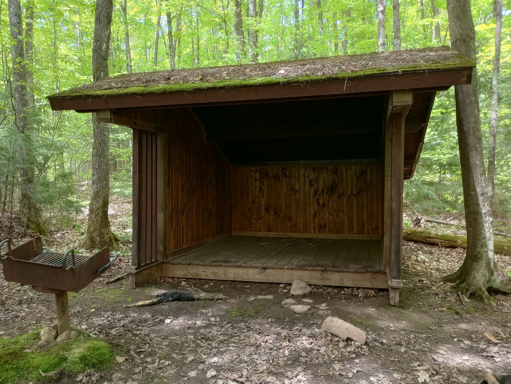
The shelter itself was in good shape, though there’s no convenient water. From there, the trail joined more ski trails, which were loopy, wet, and slow. Our assessment was that we’re glad we don’t have to hike that again. Maybe in a less wet season it would be pleasant.
May 23, 2025 – 11.6 miles
Wisco Road Parking Area to Lake Three Trailhead (with gistrailblazer)
We split this day into two chunks since we were camping at Beaver Lake Campground, which is conveniently located in this section. First we left a car at Wisco Road, then we returned to our campsite and left on foot heading westbound.
The first real point of interest was Whiskey Creek Campsite. We took a break even though we’d only gone a mile or so. From there we encountered a decent amount of storm damage, but nothing we couldn’t get under, over, or around. We rested again at Forest Road 383, a road shown on a map that no longer fully exists.
We ascended to Marengo Valley Overlook and soon Sallygirl Overlook before descending to the Swedish Settlement where we ate lunch. It was a cool area to poke around, and a place I’d love to return. From there it wasn’t long until our next rest at Marengo Shelter. I would have loved to have camped here, but admittedly it’s quite a plummet to water.
We climbed to Juniper Rock, one of the most-advertised locations on the Wisconsin NCT, and for good reason. It was a cruise back to Wisco Road from there – easy terrain and fast miles.
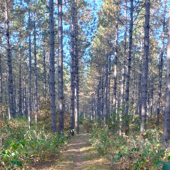
After a rest back at camp, we drove to Lake Three Trailhead and hiked westbound back to Beaver Lake Campground. The trail mostly followed an old railroad (?) grade and was very easy to hike.
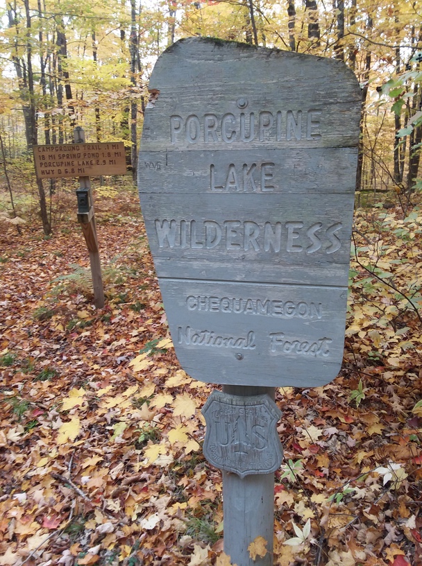
May 22, 2025 – 4.3 miles
Wisco Road Parking Area to County Highway D at Porcupine Lake Wilderness (with gistrailblazer)
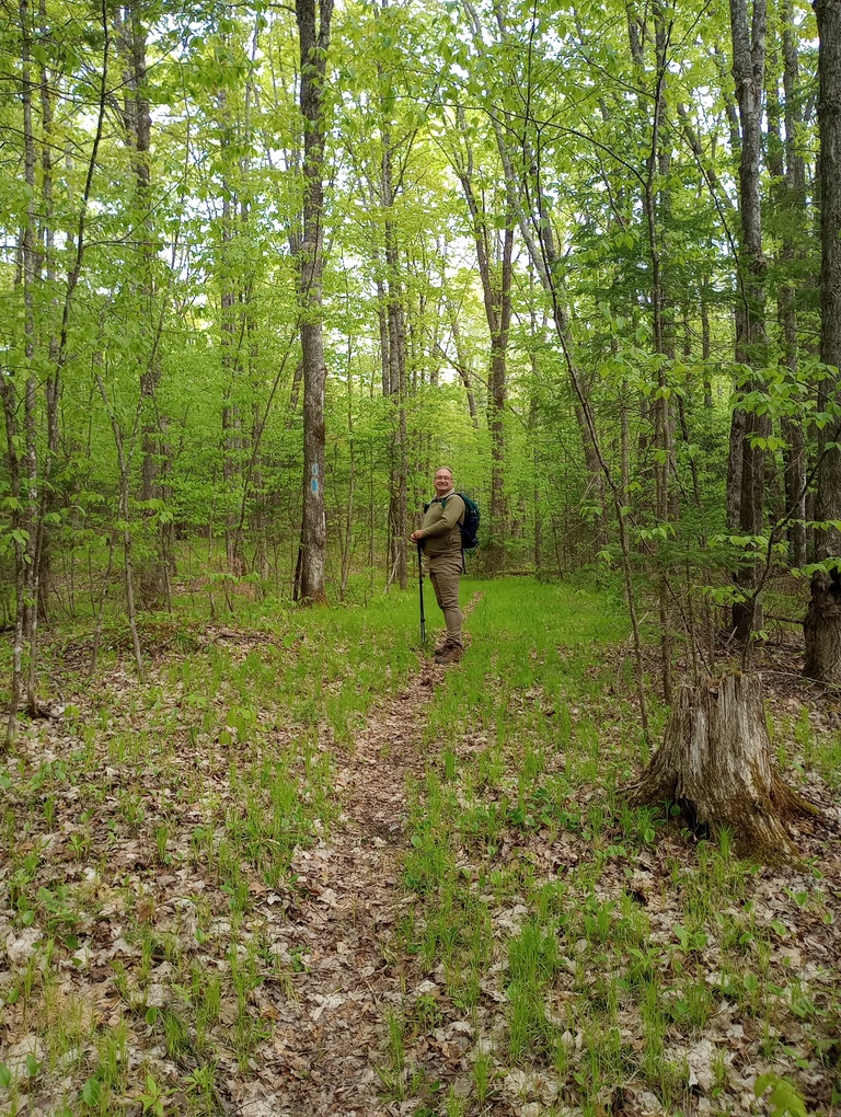
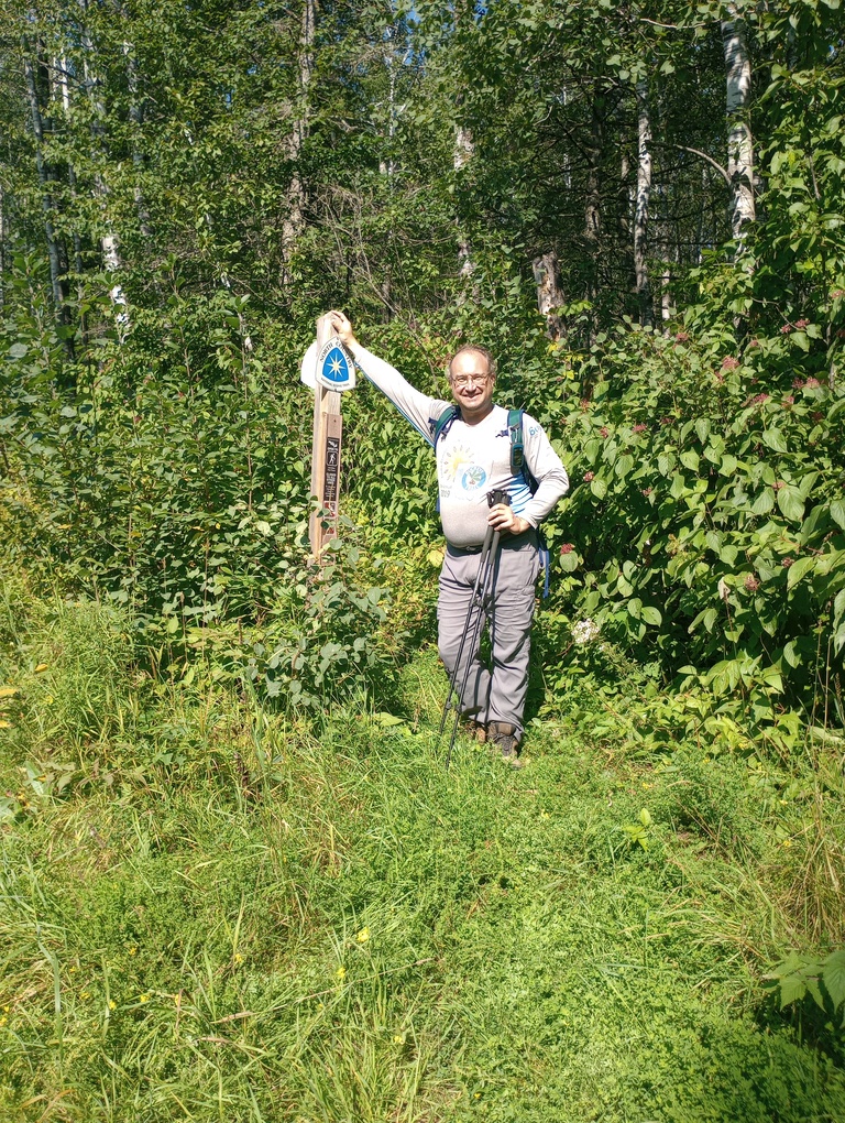
We hiked this eastbound, beginning at the wilderness. On this day, gistrailblazer had hiked through Porcupine Lake Wilderness and I shuttled him back to his car. It was early enough in the day that we felt we could do a few miles, and it was a great section.
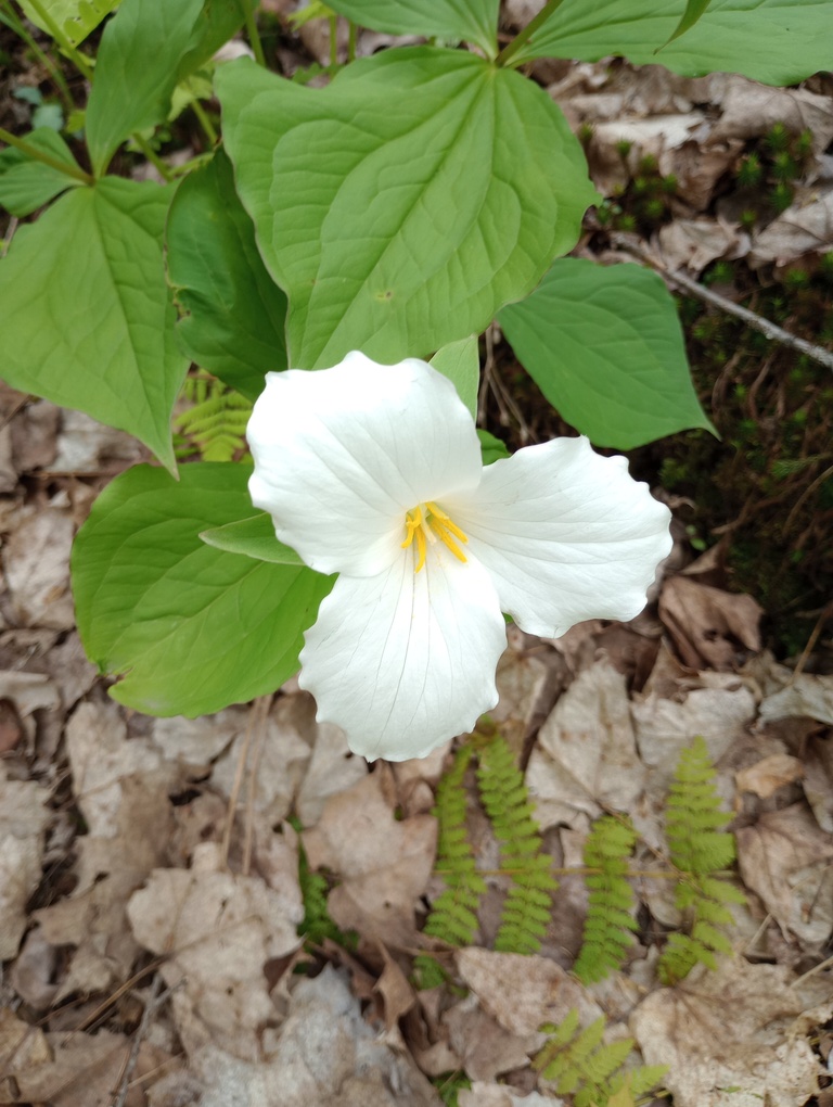
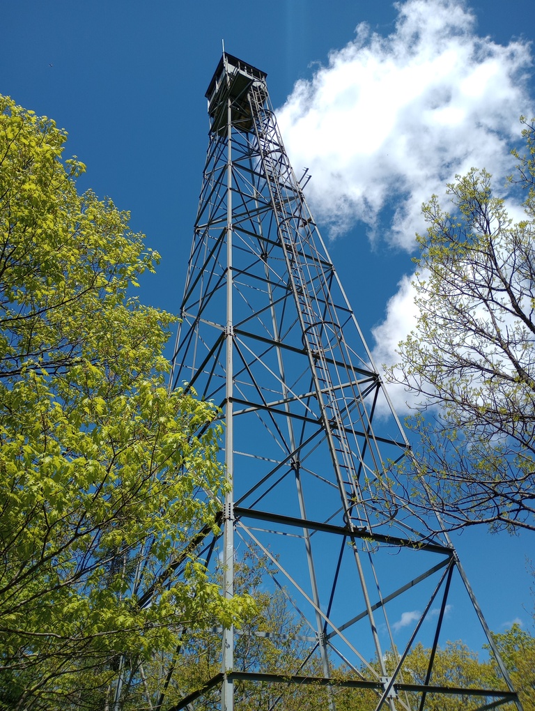
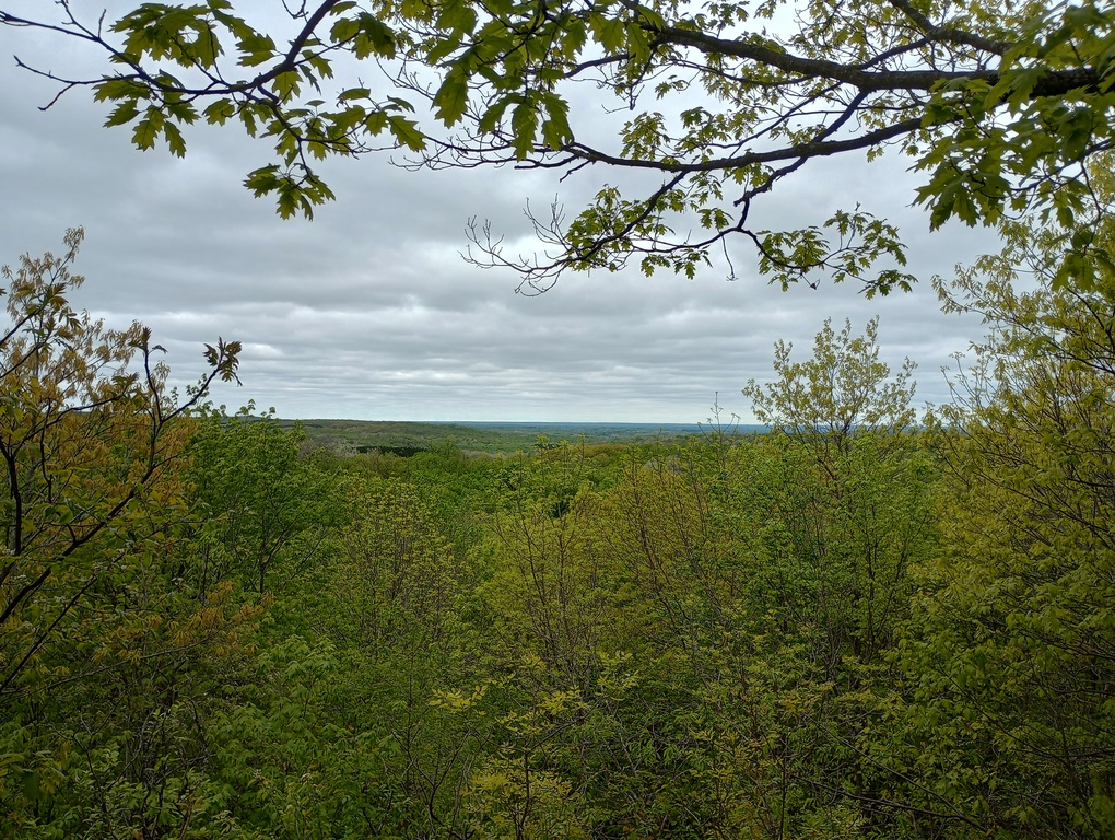
The trilliums were popping and truly blanketing the forest floor like snow. We passed a campsite – both a legitimate one and illegitimate, and began a climb to Long Mile Lookout. In May, at least, there are no more views from up there, but the tower itself is cool. From the tower, it was all downhill to Wisco Road. A nice dayhike.
October 9, 2022 – 8.0 miles
County Highway D at Porcupine Lake Wilderness to Two Lakes Campground (with Hot Beef and Spags)
It was a perfect day to traipse through the entire wilderness. It was such an easy trail until we arrived at Porcupine Lake itself, then it felt like things got substantially harder.
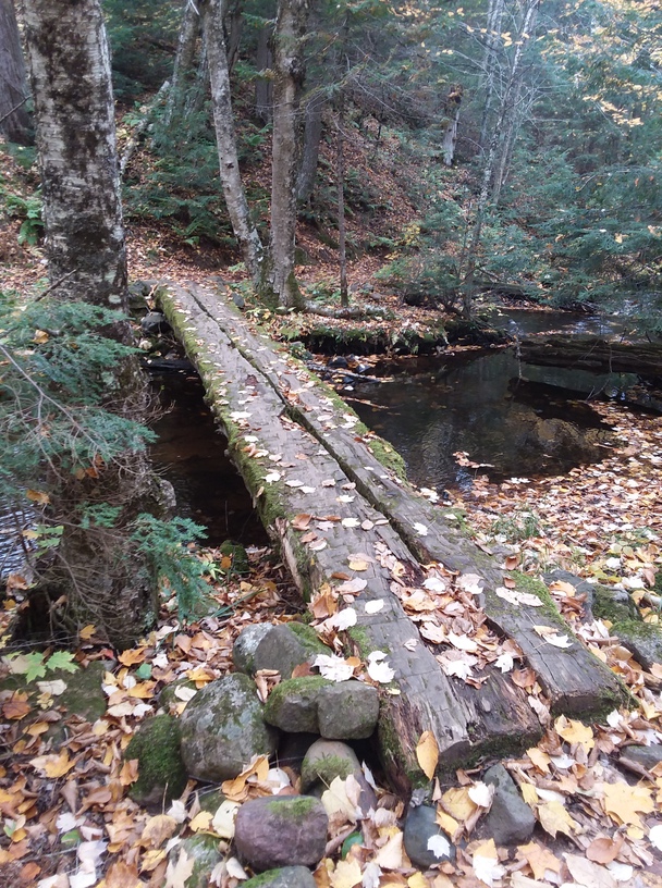
There was nothing to really note about this section except its genuine pleasantness.
October 7, 2022 – 8.0 miles
Two Lakes Campground to US 63 Trailhead (with Hot Beef and Spags)
We hiked this southbound (eastbound) from US 63 back to camp.
There was a cold, hard rain all night and it was still sleeping in the morning so we amended our planned 12-mile day into an 8-miler and it was a great choice. The trail was beautiful, though bitter cold. The yellow of leaf fall was practically fluorescent.
We ate lunch at Lake Owen where there were buoys in the girls restroom.
What a perfect day for the first snowfall of the year.
October 8, 2022 – 6.3 miles
US 63 Trailhead to Reynard Road Trailhead (with Hot Beef and Spags)
We had very important business at the Delta Diner before starting our hike this morning – gave the world a chance to warm up, which was much-needed.
We hiked this section southbound (eastbound), starting at Reynard Road. There were so many pretty lakes, with a nice bench at Mirror Lake for a longer break, and Esox Lake practically glowed blue. We saw many nice structures throughout the miles and enjoyed good trail conditions. Some of the tread was old railroad grade (presumably).
October 10, 2022 – 6.7 miles
Reynard Road Trailhead to Forest Road 228 Trailhead (with Hot Beef)
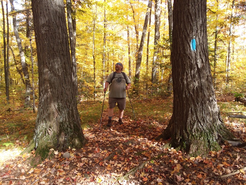
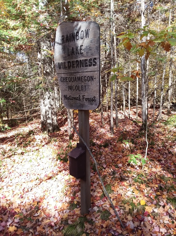
Spags shuttled us this morning and we hiked this section southbound (eastbound). It was a perfect day traipsing through the Rainbow Lakes Wilderness. The trail was immaculately maintained. A highlight was seeing where trees had eaten old NCT markers. It appeared as if the trees had tattooed themselves.
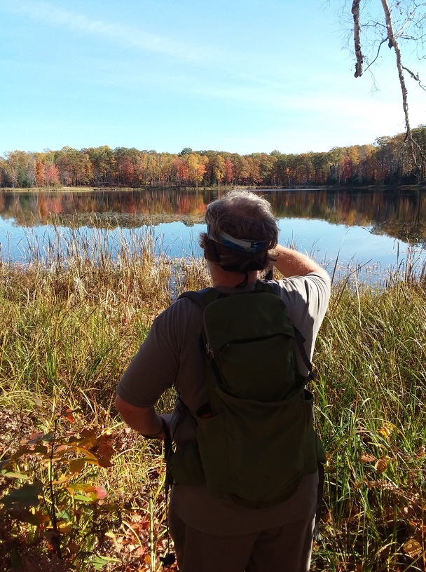
There were several lakes and the weather was one of the better days we’d enjoyed.
September 29, 2024 – 11.3 miles
Forest Road 228 Trailhead to Erick Lake Campsite (with gistrailblazer)
This was the last day of a 2-night backpacking trip where gistrailblazer and I hiked from “The Portal” to Forest Road 228 (eastbound).
We were on the trail by 7:30 to the tune of distant, then not-so-distant hunting dogs, which was a little disconcerting. We practically ran through some hilly logged areas and took our first break at Lake Ruth Trailhead. We were both tired after the last couple of days, but from Lake Ruth Trailhead we encountered a true gift: a wide, smooth old railroad grade. The hiking came really easily, and even in the last mile which got hillier, it was still pretty pleasant.
September 28, 2024 – 12.4 miles
Erick Lake Campsite to Paul Schoch Campsite (with gistrailblazer)
This was the second night and first full day of a backpacking trip with gistrailblazer where we hiked eastbound. It was a mega hot day; even a start at 7:45AM wasn’t enough to beat the heat. There were lovely overlooks in a cool oak savanna forest. We took a break at Winneboujou Campsite and arrived at our Samples Road water cache around 10:45. I am incredibly grateful that we cached water; it’s a long, dry stretch with the only water down a steep, very long spur trail. We drank everything we could and waddled down the trail with far too much liquid.
We took a break at Morris Pond and nearly stayed, but pushed on another mile or so. There was no water the entire day except a terrible pond. Gistrailblazer managed to get some water from Erick Lake when we arrived, but it was very difficult.
We had a good time exploring the campsite, enjoying the company of a couple of swans, and visiting with someone running across the state to set the Fastest Known Time for the Wisconsin NCT. We all agreed he picked the worst timing in terms of weather. It was 82 degrees when we arrived at the site.
September 27, 2024 – 2.0 miles
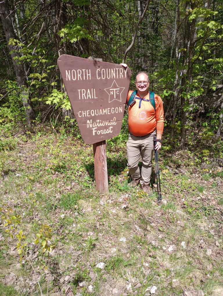
Paul Schoch Campsite to Gaylord Portal (with gistrailblazer)
This was the first night of a backpacking trip with gistrailblazer where we hiked eastbound. We arrived at the Portal pretty later in the day after shuttling our vehicles to leave one at Forest Road 228. Once on trail, we had a sandy, pleasant hike to the small campsite. We filled it up with our two small tents. There was a trickle of water near the campsite, but I wouldn’t be surprised if it had dried up within a few days of when we got there.
October 7, 2024 – 12.3 miles
Gaylord Portal to St. Croix Lake Trailhead (with gistrailblazer)
This was the first day of a multi-day hike. We wanted to backpack, but the math wasn’t mathing with how far we wanted to go, so we dayhiked this section and then backpacked into the Highland Campsite for a night. Was that a legitimate solution? I’m not entirely sure, but it worked so well.
Our hike began with a lovely hike through forest and field and to Mott’s Ravine – a pretty stretch of trail that was definitely named by someone who dreamed of seeing a ravine but who never actually saw one. It was still very dry, so we ate lunch at Highland Town Hall where we could get water.
After we rehydrated we continued on through a lovely, piny woods to a section with a fair amount of elevation change as the trail undulated to Jersett Creek Campsite. We took a nice break and enjoyed reading the trail register. We did some math and realized that the water running at Jersett Creek was the first running water we’d seen on the trail for 30 miles.
From there, the trail soon turned into a fairly wide and easy path. We veered off the main trail to the Zosel viewing platform (behold… swamp). By this point in the day, I was super exhausted and ready to be done, but I was about to reach a portion of the trail I’d been looking forward to 15 years, so I gritted my teeth and continued on.
The reason I was excited for this stretch of trail is because it hosts a series of stones of early European explorers. On the map, several of these stones are shown with little information about what else was there. Well, it turns out… nothing. They’re stones with names and dates, and no other information.
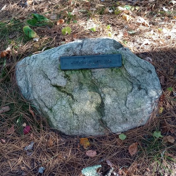
I was kind of disappointed. I thought there would be a little bit of interpretation, but there was nothing else, so gistrailblazer and I made up stories about each of these explorers. To add insult to injury, the trail paralleled a forest road which looked like substantially easier walking than we had.
Eventually the final two miles came to an end and we arrived at a car we left at St. Croix Lake Trailhead. We shuttled back to Highland Town Hall and backpacked into the nearby campsite. It meant retracing maybe a tenth of a mile, but it was such a great solution – one that kept us safe, allowed us to do the number of miles we felt ready for, and stay hydrated.
October 8, 2024 – 9.0 miles
St. Croix Lake Trailhead to Highway 53 Trailhead (with gistrailblazer)
We woke up pretty early and left Highland Campsite, leaving a car at Highway 53 Trailhead and driving back to St. Croix Lake where we left off the day before.
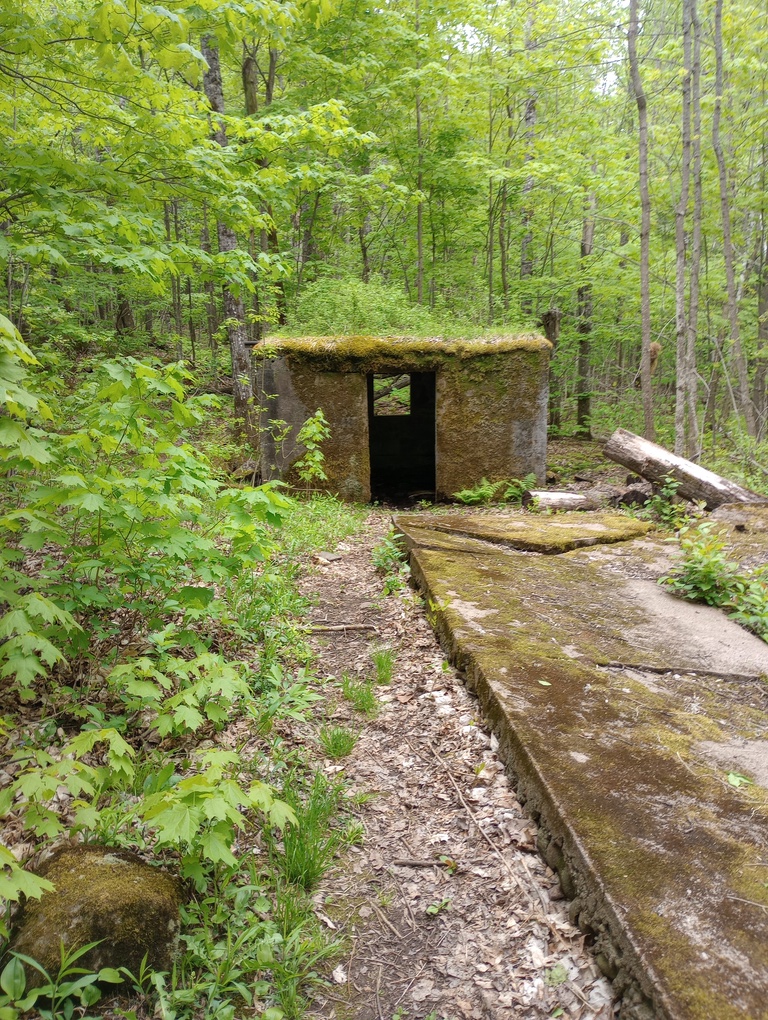
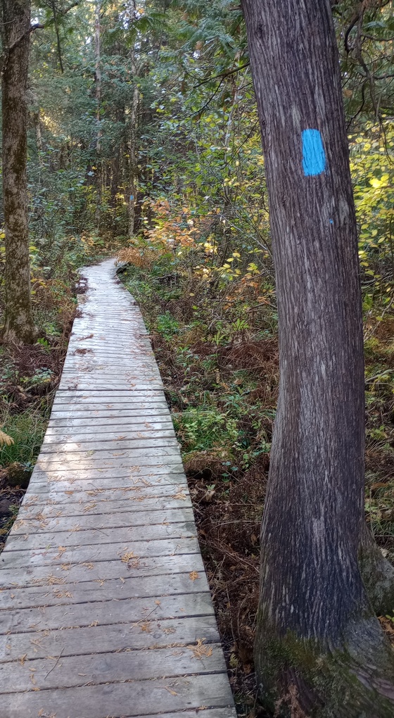
The highlight of the day, no doubt, was hiking the long boardwalk that I helped to construct circa 2007-2008. It was my first time volunteering on a non-Superior Hiking Trail project, and the boardwalk will always have a special place in my heart.
Inexplicably, near the boardwalk was a bucket that was part of a rubber duck giveaway. Alas, there were no rubber ducks. We took a break at Catlin Creek Campsite, and there in the register box was a duck! I made gistrailblazer take it.
The roadwalk linking two sections of trails wasn’t bad until we hit County Road AA. Even that wouldn’t have been terrible, but gistrailblazer began running up the long hill and there was no possible way to keep up. To say that I got grumpy at him is an understatement. Luckily, the trail soon turned off into the woods again and we took another break at Aden Creek Campsite. We then paralleled a train track and walked into the nearly-ideal trail town of Solon Springs. We got a snack at the grocery store and sat outside eating it.
From there, the trail squirreled around Lucius Woods, practically making a U-turn, and then followed a very exposed road in the blistering hot day. When we did rejoin trail, we got a scenic overlook of the settling ponds near the trailhead, and that’s about where my mood was.
October 19, 2024 – 3.3 miles
Highway 53 Trailhead to Bird Sanctuary Road (with gistrailblazer)
The rain wouldn’t stop. We arrived at the trailhead and sat in the car for waiting for it to get better. It didn’t, so we went to get BBQ in Solon Springs instead of hiking. Once we’d eaten, we returned to the trailhead and waited for it to get better. This time it actually did. Though it rained intermittently, we didn’t have far to go and the trail was extra fast.
October 20, 2024 – 9.5 miles
Bird Sanctuary Road to Moose River Trailhead (with gistrailblazer)
After a great night camping at Gordon Dam, we staged cars and took off into the bird sanctuary. This was a section I’d been looking forward to forever. The grassy, prairie-like terrain was unique and many geese kept us company. We took a break at Rovers Lake Campsite, which surprised me, as I expected it to be the place I’d camped long ago with the Rovers, but that was elsewhere.
Leaving the sanctuary was sad, but we found a giant ancestor pine to eat lunch near. We sat on a boardwalk in the autumn sun and it was a lovely moment. As we neared Gordon Dam, the trail got very rocky, and I was wearing the wrong shoes for that, but I had fun anyway. The highlight of the day was finding a long boardwalk. In 2011 or 2012, I volunteered several days hauling lumber to a canoe barge which floated to this spot to be constructed. I’d touched so much of that boardwalk, but never seen the actual final product. It was possibly my favorite moment of the entire trek across Wisconsin.
At Gibson Cabin, we took a break before the final distance to Moose River Trailhead. This stretch of trail features the baby St. Croix River, my most favorite river in the world.
October 26, 2024 – 11.9 miles
Moose River Trailhead to random place to park on Jackson Box Road (with gistrailblazer)
We hiked this section eastbound. It was a decent roadwalk, with great weather. We got on trail before 11 and were off before 4; not bad for the sidequests and two breaks we took.
Two noteworthy highlights of the day: seeing bear tracks on the gravel Jackson Box Road and a final long, last mile spent hiking with Marigold Stevenson, an alter-ego from Georgia with a baffling social life.
October 27, 2024 – 7.7 miles
Jackson Box Road to John S Road (with gistrailblazer)
We left a car at a pull-off area on John S Road. It looked like logging had taken place in this area, and a little gravel pull-off area had enough room for a car or two. We then drove to the random place we ditched a car yesterday and did the same. On this hike we were almost exclusively on pavement, but the traffic wasn’t bad.
Arriving at the car was bittersweet; the season, on October, was undeniably coming to an end. For four weeks in a row, gistrailblazer and I made our way on tiny dirt roads and put probably a thousand miles on our cars, for a handful of trail miles. And it was awesome, and totally worth it.
August 25, 2025 – 8.4 miles
John S Road to Summit Town Hall (with gistrailblazer)
Earlier in the week, gistrailblazer shared his sickness with me despite enormous efforts to avoid it, so I spent this day suffering, and allow me to assure you: I did not suffer in silence. Because we were going to come in contact with no one but ourselves, we carried on hiking. In case one of us could not go the whole distance, we broke the day up into two shuttles: first, we left a car at the Tri Lakes Community Center (which has a lovely picnic area and a Little Free Library) and drove to where we’d left off in October 2024, John S Road.
In the less than a year since we’d last parked there, the John S Road area was completely reworked and giant boulders placed in the location where we’d left a car. It does lead one to wonder why the public land and hunter access in these areas even exist if there is nowhere to park. It’s not like this road has a large population. We parked on the opposite side of the road, taking up over half a lane of a lane-and-a-half dirt road. What are you going to do?
When we survived that portion of the hike, we shuttled once more, this time driving to Summit Town Hall in order to walk back on Milchesky Road. It would have been a lovely roadwalk, except I was miserable. The only redeeming quality was that we found out that Taylor Swift was engaged. Also, there was a road crew on Milchesky Road and we inconvenienced them three times by cars and once on foot. They probably thought we were messing with them.
Mostly, I complained today. Don’t let a smile fool you; my heart was filled with despair and death. Except when gistrailblazer delivered pizza to my tent. We camped at The Backyard at Lake Amnicon, not far from the Tri Lakes Community Center. It would be a bit far to walk from the current route of the NCT, but for us it was perfect.
August 27, 2025 – 6.0 miles
Summit Town Hall to Pattison State Park (with gistrailblazer)
We hiked this section eastbound, which was mostly southbound. I awoke very ill, but determined to make progress. The trail through Pattison State Park was completely deserted. I expected crowds, even in the early morning. It was fun to hike through Pattison, as I’d never explored it before.
After some pleasant trail through the park, the NCT dumps out onto a busy, paved road walk. We had several miles in order to reach a car at the Summit Town Hall.
After about a mile on the roadwalk, I started not doing so well. I had strong words for the route, being very sick, and each truck that didn’t move over. I was a pure ray of sunshine.
When we arrived at the road leading to Summit Town Hall, I laid down on the ground and didn’t move.
A large parcel of land was later acquired by NCTA and this route will someday be off the road. Cheers.
August 29, 2025 – 8.1 miles
Pattison State Park to County C (with gistrailblazer)
No roadwalk was talked about more than the dreaded County Road B. We drove it several times in our commute to Wisconsin, and we analyzed which direction presented the most danger. With curves and fast traffic, we were nervous.
The day before, I hadn’t been able to leave my tent. So I had no confidence that I could possibly hike the 8 miles to County Road W. So, we cut up the day by leaving a car on a bit of public land along the roadwalk and walking towards it from Pattison. To our surprise, the roadwalk on B wasn’t bad, in part because we planned to be hiking at an earlier, less-busy time in the day. Later, there was a view of Cloquet to Duluth, which was a little surreal.
The first leg of the hike, which entailed all of County Road B and less than a mile of Dedham Road, was 4.5 miles, and I felt somewhat okay. I was worried that hills would drain my energy, and Dedham Road is incredibly hilly, with two large water crossings. So we compromised by continuing to hike, but shuttling our cars so we were always hiking downhill. It was ridiculous, but it was the most fun I’ve ever had on a roadwalk.
We drove home, and on the driveway, my car’s rear shock gave out. When I think of where it could have happened…
August 30, 2025 – 4.8 miles
County C to County W Trailhead (with gistrailblazer)
gistrailblazer finished the Wisconsin North Country Trail today! With only one car, we parked at the intersection of County C and Irondale Road, near a recreational trail.
The roadwalk was practically silent. Fog made it feel prettier than it probably is. We were soon walking through a construction zone, and the road was a mess, but easy to walk. We headed downhill past two friendly dogs, and when Richard arrived at the County Road W Trailhead, he had finished the trail.
Then, to his everlasting credit, he let me hang out in the ditch while he walked back nearly five miles to go grab his car. I was exhausted from pushing myself through my illness, so I was relieved to not have to walk farther than necessary.
I looked at the trailhead with a little sadness; I knew I only had one day of hiking left to finish, but I just didn’t have it in me.
October 25, 2025 – 8.4 miles
County W Trailhead to Red River Campsite (MN)
Done.
It should have been months ago, if I hadn’t gotten so sick, but better late than never. Just as I began the Wisconsin North Country Trail being dropped off by my parents, Dad drove me to the trailhead and waved as I headed up the hill. My car was parked in Minnesota. I could have done the hike in a day, but I decided I wanted one last night camping out on this adventure.
The trail started with a short but steep climb. The leaves had nearly all fallen. The sun was bright as summer. Half a mile after Spruce Point Campsite, the trail went slightly uphill and suddenly I was in the MacQuarrie Wetlands. It was a fast transition. Once in the wetlands, signage was sparse but there weren’t a lot of options. Once I had to get out Avenza to make sure I was making the right choice. I imagine it’s a very challenging area to install signs in!
At a viewing platform, I enjoyed a memorial to AO, the famous AO of all the simple benches I always appreciated. I loved being out there, loved the sun and the memory of AO and thinking back to all the moments I enjoyed while on one of his benches. What a legacy to leave behind.
I was so happy that I somehow took a wrong turn. I still can’t figure out how it happened, and I absolutely saw a sign that led me to believe I was on the trail, but I was not on the trail. I know this because I crossed paths with the actual trail, so one of the routes was wrong, and I am sure it was the one I took.
From there, my speed picked up, and I was racing down the trail, going a mile an hour over my usual pace. The footing was good, I was feeling great, and pretty soon my leg began screaming. Shin splints? I’m not sure, but I slowed down, down to a pace of one mile an hour and still it hurt.
But it was worth it. Soon I arrived at State Line Trailhead and began the hike to the Minnesota border. This area is from a previous chapter of my life. A dozen names of folks I rarely see now floated through my head and so many memories. I know exactly who installed the logbook at the border, remember the day I found out about the arch at the border, remember the nearby bridge installation, how the money was raised, and what it took to get the materials into the site. This area is from arguably the best chapter of my life.
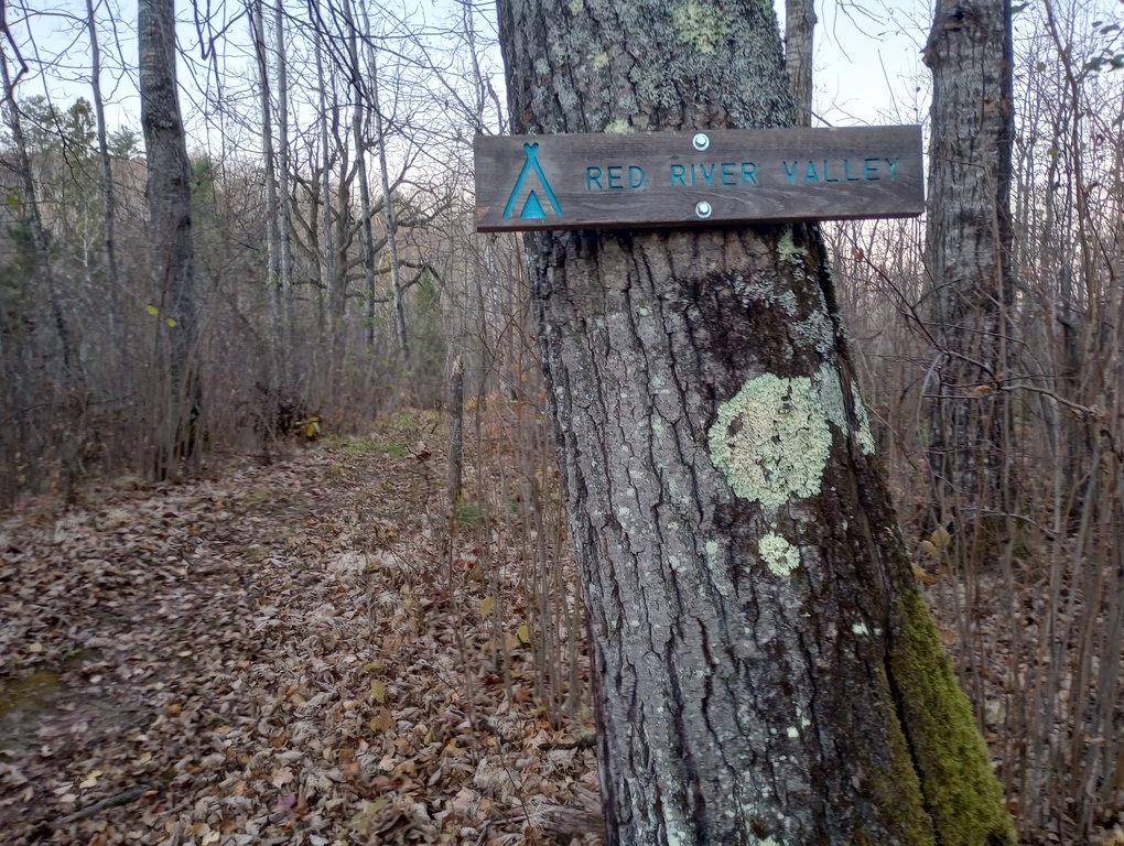
It felt right to end my Wisconsin NCT journey in Minnesota, at the Red River Valley Campsite. In the morning, I had an easy mile and a half back to my car.
Thank you: I’m forever grateful to the North Country Trail Association, the fine folks who attended some of those WI-NCT volunteer events nearly 20 years ago, my parents for their shuttling help and patience, Hot Beef and Spags for the most delightful late-season hiking I can imagine, the US Forest Service for maintaining Beaver Lake Campground where I lived for about a week, and gistrailblazer for making it possible for me to actually finish this.
Data:
2021 Total: 44.4 miles
2022 Total: 21.0 miles
2024 Total: 79.4 miles
2025 Total: 73.4 miles
Total: 218.2
The trail has changed in several areas since I hiked, particularly on the east side of the state.
Miles hiked alone: 58.4
Miles hiked with friends: 159.8
2021 Days on Trail: 4
2022 Days on Trail: 4
2024 Days on Trail: 9
2025 Days on Trail: 10
Includes mini-days of under 3 miles.
Longest day: 14.4 miles
Shortest day:2 miles
# of nights dispersed camping: 1
# of nights in WI-NCT campsites: 5
# of nights at Beaver Lake Campground: 7
# of nights at Gordon Dam Campground: 3
# of nights at private campgrounds: 3
Lowest temperature: 28 degrees
Highest temperature: 86 degrees (but likely higher)
Best side quest: St. Peters Dome and Morgan Falls in the Chequamegon-Nicolet National Forest. Worth it. If you have a car. Definitely not worth it if you’re on foot!
Best trail town: Mellen. Hiker-friendly restaurant, great little store, good parking options.
Advice for future hikers: If you intend to thru-hike, I suggest hiking westbound. This gives you the longer, more logistically-challenging roadwalk when you are moving at your fastest. Resupply locations (may mean a maildrop) include Mellen, Drummond, and Solon Springs.